CRATER LAKE NATIONAL PARK
CRATER LAKE NATIONAL PARKP.O. Box 7
Crater Lake, Oregon 97604
Email:

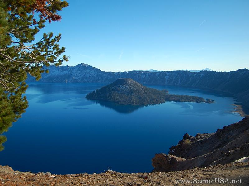
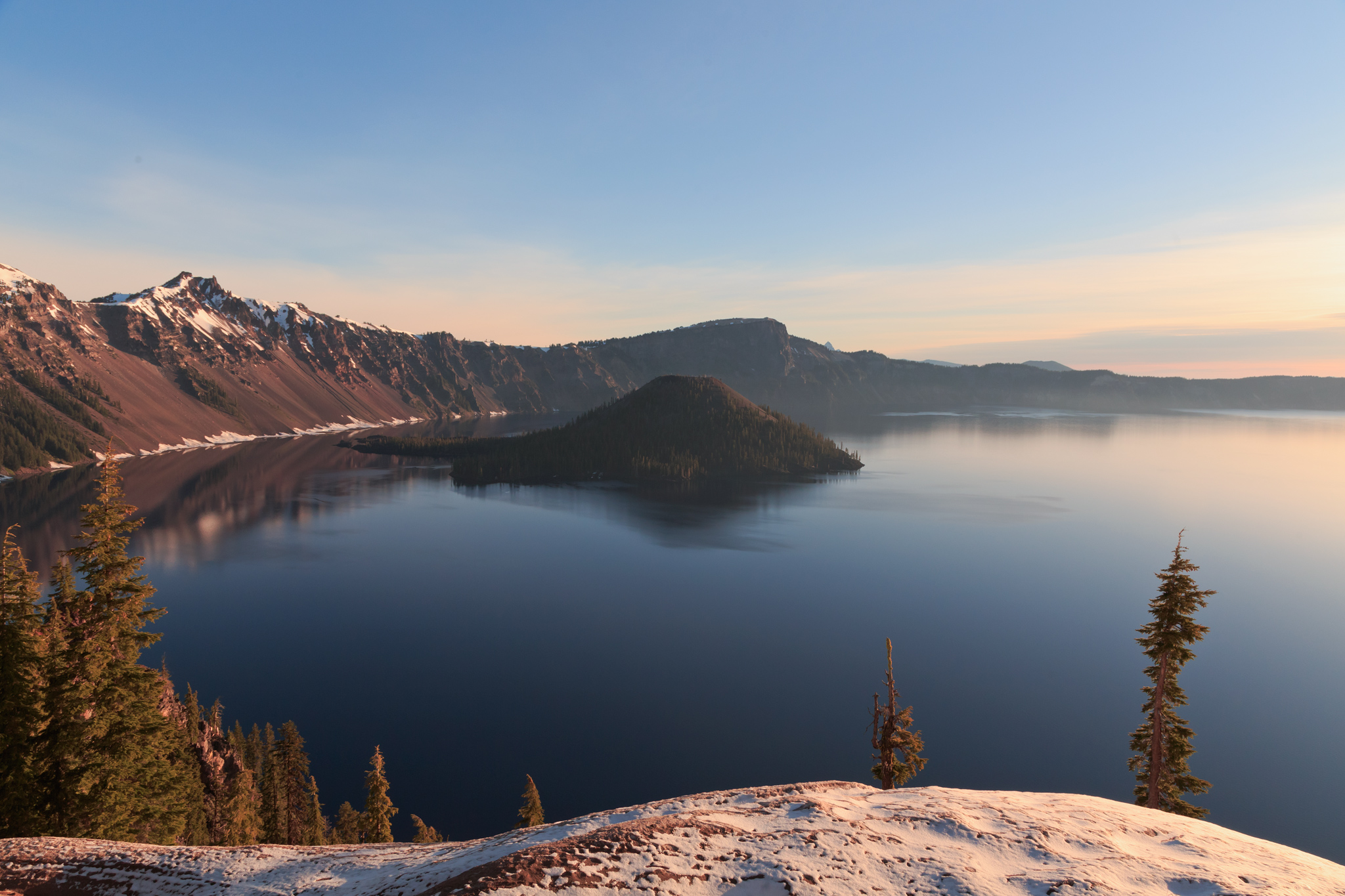
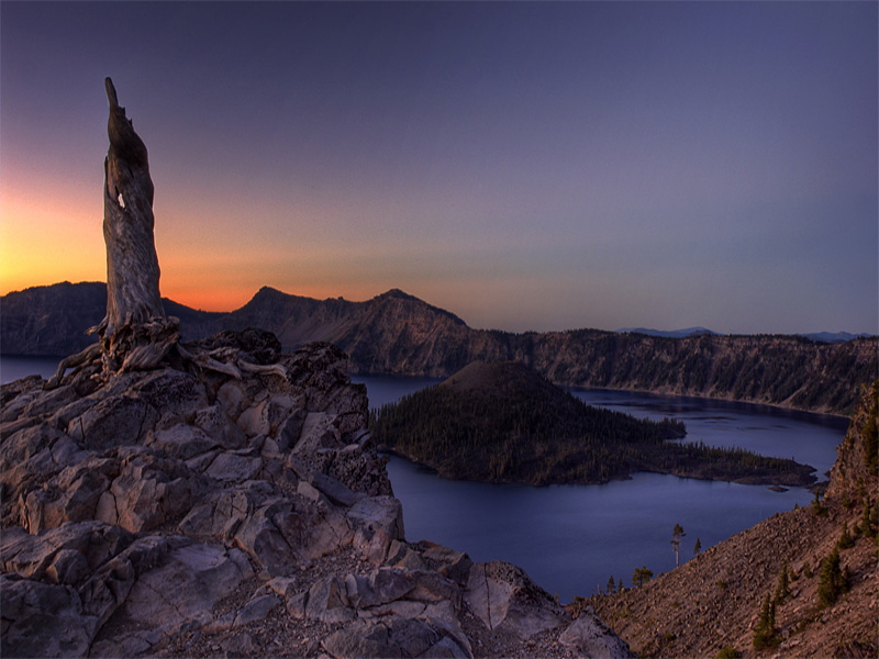
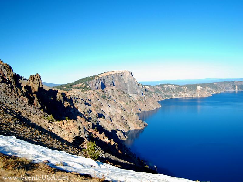
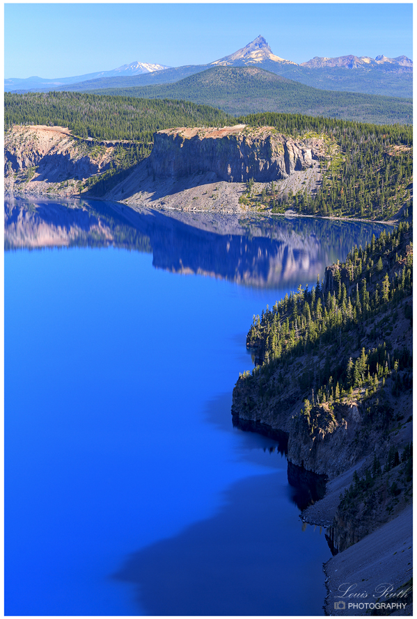
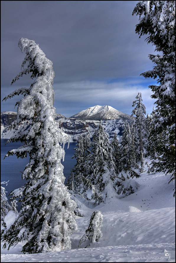
Crater Lake is widely known for its intense blue color and spectacular views. During summer, visitors may navigate the Rim Drive around the lake, enjoy boat tours on the lake surface, stay in the historic Crater Lake Lodge, camp at Mazama Village, or hike some of the park's various trails including Mt. Scott at 8,929 ft. Diverse interpretive programs enhance visitors' knowledge and appreciation of this national park, 90% of which is managed as wilderness. The winter brings some of the heaviest snowfall in the country, averaging 533 inches per year. Although park facilities mostly close for this snowy season, visitors may view the lake during fair weather, enjoy cross-country skiing, and participate in weekend snowshoe hikes.
Crater Lake National Park is an area of 249 square miles dedicated to the preservation of its natural resources. For many years, park managers have looked at this task as a job to be accomplished only for the enjoyment of its human visitors. As important as this goal remains to be, park personnel now take a more comprehensive view of the ecosystems and interactions within the environment we call Crater Lake National Park.
Enabling legislation for Crater Lake National Park, set forth in 1902, mandates that this area be "dedicated and set apart forever as a public (park) or pleasure ground for the benefit of the people of the United States." (32 Stat. 202) This important law allows for the unfettered access to this unique area. In subsequent legislation, including the Organic Act which established the National Park Service, emphasis was placed on the management of natural areas in order to provide for preservation and protection. This law allows park resources to be managed so that they may remain unimpaired and in a natural state for future generations.
While Crater Lake is considered the primary scenic wonder at Crater Lake National Park, management of all the natural resources of the park is given equal weight. As no forest is independent from the streams that run through it or the geologic history which has given rise to its different kinds of soil, ecosystems are dynamic parts of the whole which function according to their inputs and outputs. For example, if down wood is removed from park streams, a major source of habitat for insects has been taken away. In turn, fish will suffer from the loss of a significant food source. In the end, it is not only the fisherman who will ache for their catch of yesteryear, but the bear, eagle, and other fish-catching animals will suffer even more.
As such, Crater Lake National Park manages its ecosystems for the sustainability of all resources which are found in the park. Objectives of the park's Resource Management Plan include: securing adequate resource information through scientific research, conserving natural resources, promoting understanding of the geological and biological processes found within the park and how the public may access these resources without their deterioration, and preserving the cultural resources found within the park so that they may be enjoyed and understood by future visitors.
These objectives are carried out through many programs aimed at allowing natural processes to continue. For example, in areas where natural vegetation has been adversely affected or displaced, efforts are underway to revegetate the areas with native plants. Maps can be created from Geographic Information Systems (GIS) to predict changes in the environment or in determining management actions . GIS technology is used to electronically store data on all aspects of the park's vegetation, soils, wildlife, and aquatic resources. Long-term studies have been initiated to monitor park ecosystems for changes which may occur at a snail's pace, yet which may harbor information useful to the entire globe.
Crater Lake National Park is an environment with boundaries imposed only by man. Its connections to the world are as inseperable as a tree to its roots. The resource management staff at the park is responsible for overseeing that these connections remain unimpaired for time immemorial, so that generations to come may enjoy this special place.
Local Native Americans witnessed the collapse of Mount Mazama and kept the event alive in their legends. One ancient legend of the Klamath people closely parallels the geologic story which emerges from today's scientific research. The legend tells of two Chiefs, Llao of the Below World and Skell of the Above World, pitted in a battle which ended up in the destruction of Llao's home, Mt. Mazama. The battle was witnessed in the eruption of Mt. Mazama and the creation of Crater Lake.
The Klamaths revered the lake and the surrounding area, keeping it undiscovered by white explorers until 1853. That year, on June 12, three gold prospectors, John Wesley Hillman, Henry Klippel, and Isaac Skeeters, came upon a long, sloping mountain. Upon reaching its highest point, a huge, awe-inspiring lake was visible. "This is the bluest lake we've ever seen," they reported, and named it Deep Blue Lake. But gold was more on the minds of settlers at the time and the discovery was soon forgotten.
Captain Clarence Dutton was the next man to make a discovery at Crater Lake. Dutton commanded a U.S. Geological Survey party which carried the Cleetwood, a half-ton survey boat, up the steep slopes of the mountain then lowered it to the lake. From the stern of the Cleetwood, a piece of pipe on the end of a spool of piano wire sounded the depth of the lake at 168 differnt points. Dutton's soundings of 1,996 feet were amazingly close to the sonar readings made in 1959 that established the lake's deepest point at 1,932 feet.
William Gladstone Steel devoted his life and fortune to the establishment and management of Crater Lake National Park. His preoccupation with the lake began in 1870. In his efforts to bring recognition to the park, he participated in lake surveys that provided scientific support. He named many of the lake's landmarks, including Wizard Island, Llao Rock, and Skell Head. Steel's dream was realized on May 22, 1902 when President Theodore Roosevelt signed the bill giving Crater Lake national park status. And because of Steel's involvement, Crater Lake Lodge was opened in 1915 and the Rim Drive was completed in 1918.
Crater Lake National Park is fast approaching its 100th birthday. The celebration of one of our nation's oldest parks is a testament to the courage and determination of William G. Steel and the countless others who have been involved in the preservation of this national treasure. In looking to the future appreciation and preservation of this park, knowledge of its history and origins are imperative in keeping with the tradition of Crater Lake's unique past.
Day-UseFishingyes
Hiking Trailyes
Picnickingyes
Crater Lake Lodge, Open From 05/25/2005 To 10/17/2005, Phone (541)830-8700
Details : Crater Lake Lodge has 71 rooms and is normally open mid-May through mid-October. Advance reservations are strongly recommended.
Mazama Village Motor Inn, Open From 06/03/2005 To 10/03/2005, Phone (541)830-8700
Details : Mazama Village Motor Inn has 40 units and is located in the Mazama Village complex. It is open June through early October, and reservations are recommended.
Lost Creek Campground, Open From early July to early October (weather permitting)
Details : Lost Creek Campground has 16 tent sites and is open from mid-July to early October. Please Note - Weather can impact the opening and closing dates of the campground.
Mazama Campground, Open From 06/17/2005 To 10/02/2005 (weather permitting)
Details : Mazama campground has 200 sites and is open early June through early October. Reservations are not taken, however sites are usually available. Running water, flush toilets, picnic tables, and fire rings are provided. Please Note - Weather can impact the opening and closing dates of the campground.


 Share Your Crater Lake National Park Photos (click here)