Friend of Stateparks Photo Gallery
Photographer: Gary Jordan
Copyright Notice: all photos copyright Gary Jordan
e-mail: sm1107@comcast.net
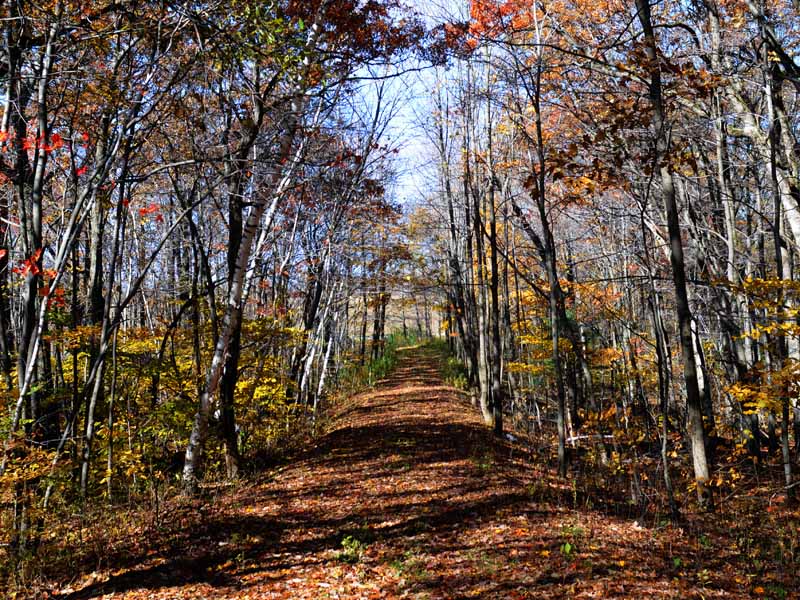
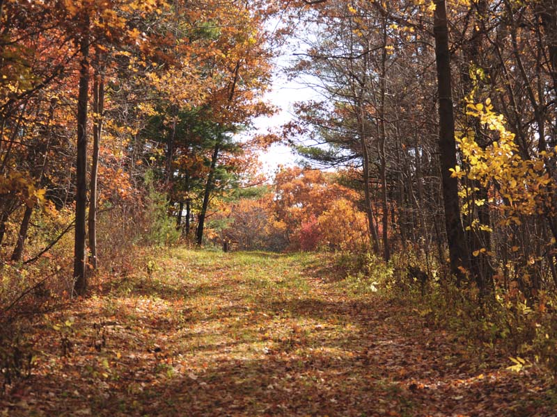
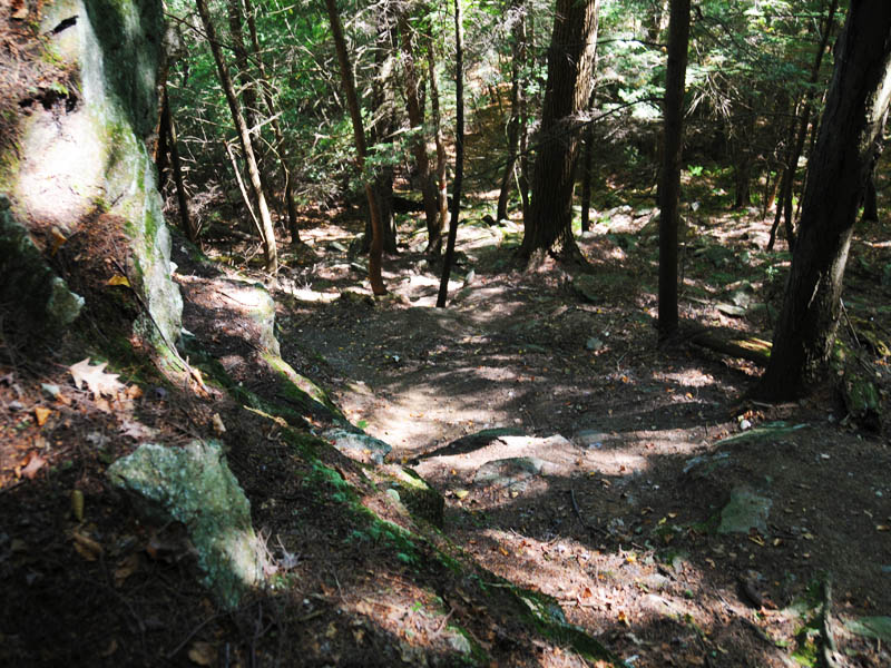
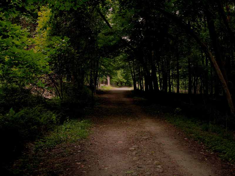
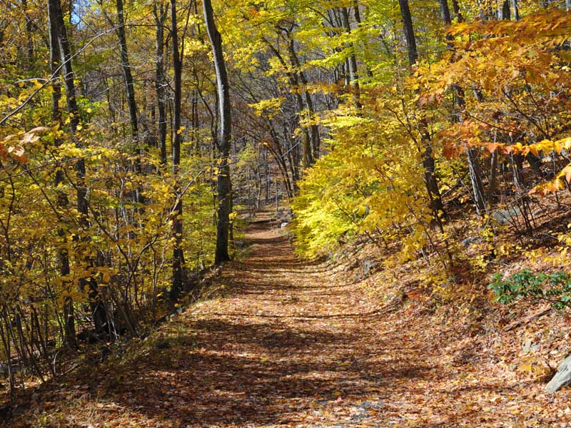
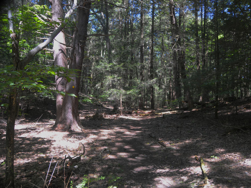
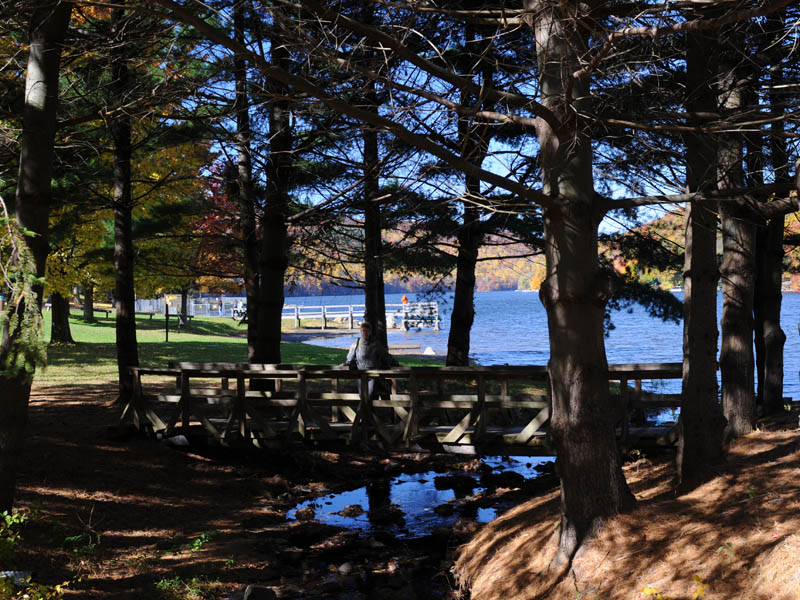
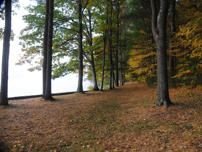
Path To Road
This path leads back to the road you leave your car by.
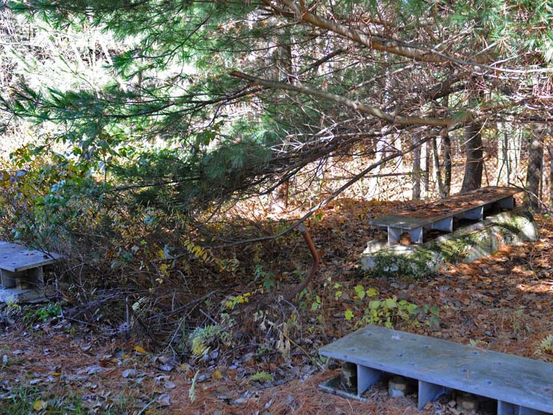
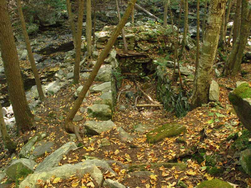
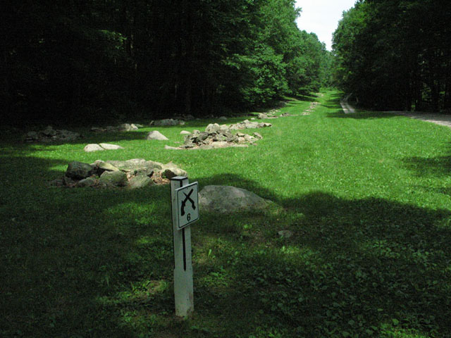
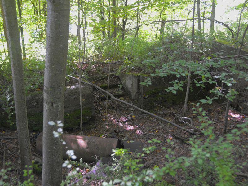
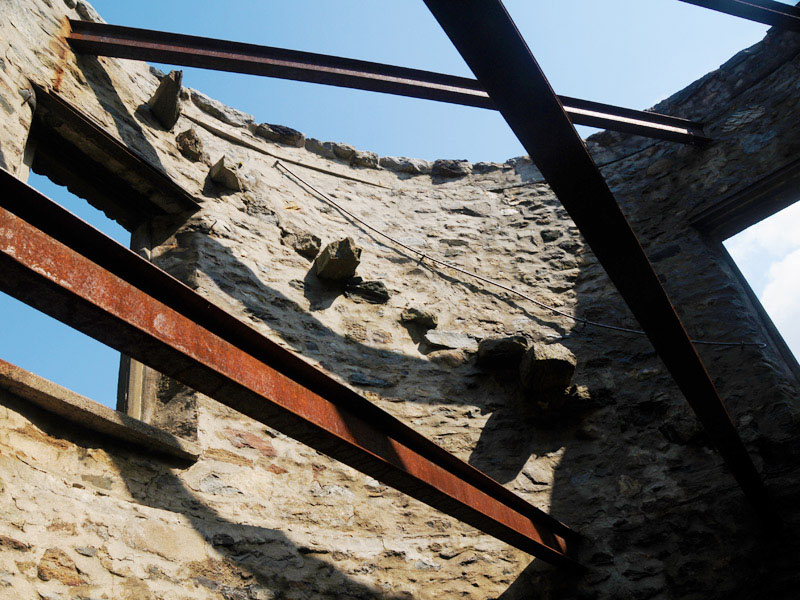
Mounting Plates
These mounting plates must have been used to anchor the radar arrays used here.
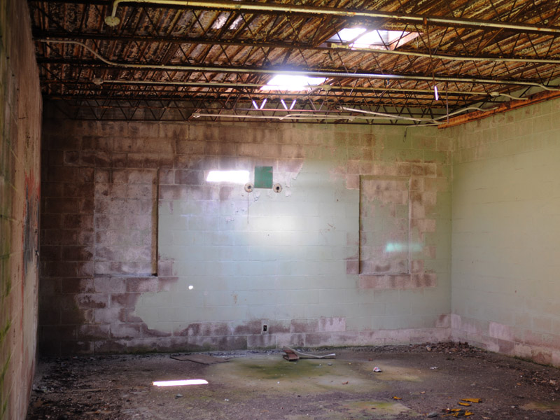
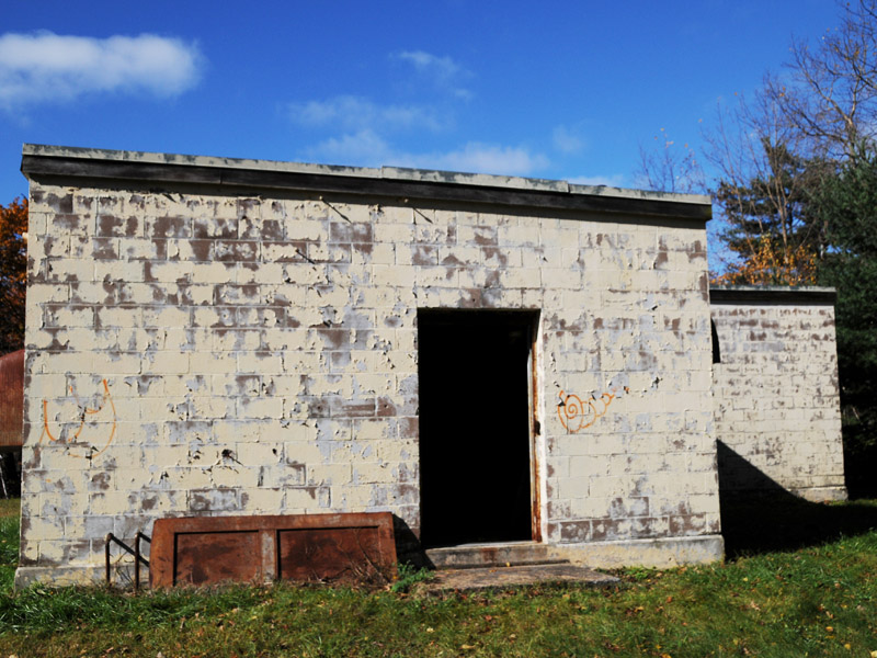
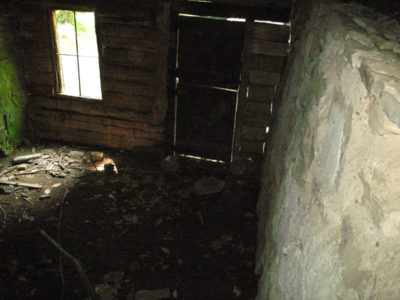
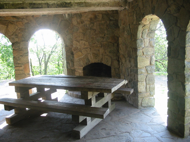
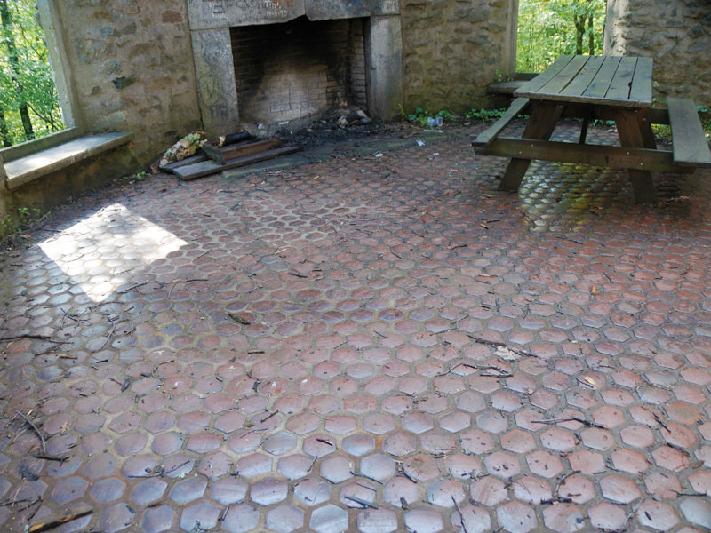
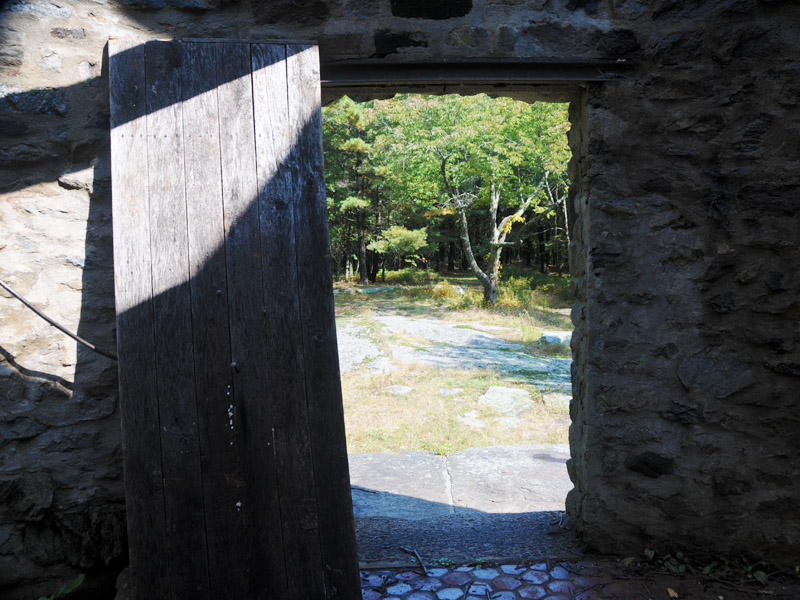
Inside Old Radar Building
This is one of the rooms inside the old radar building. All the equipment has been removed.
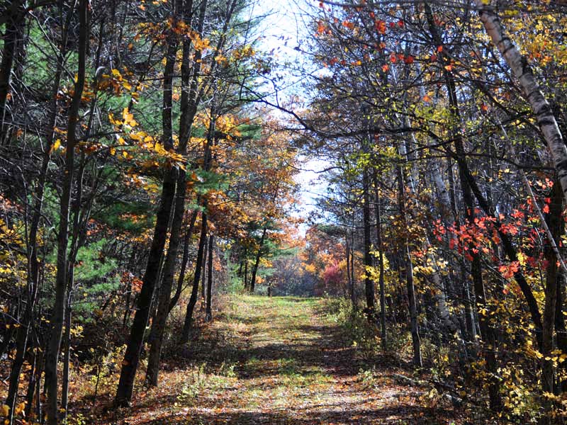
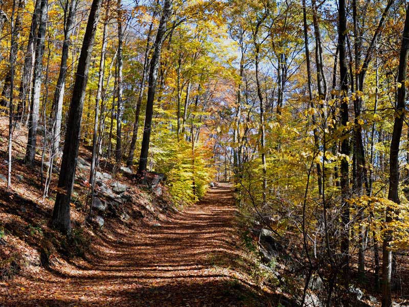
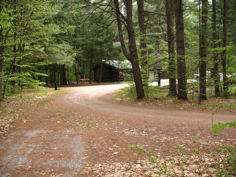
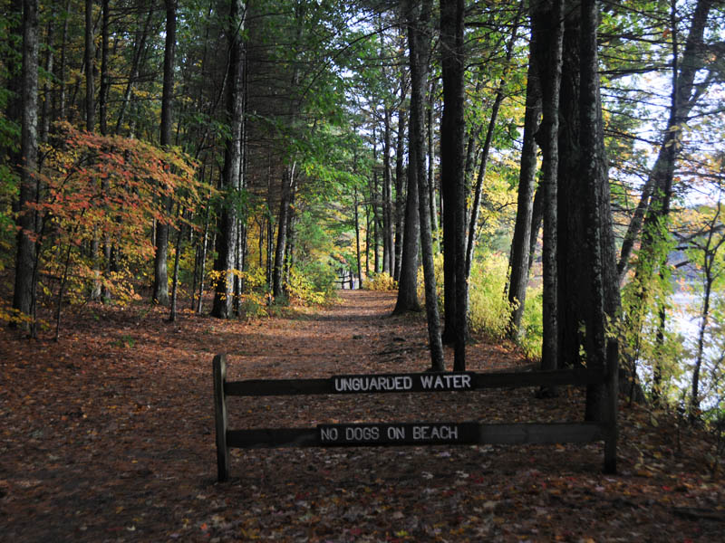
Path to Old Radar Building
This path leads back to an old radar station.
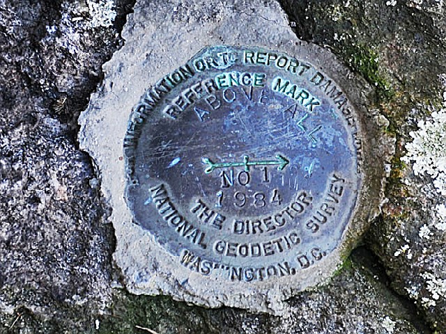
Land Marker
Marker reads FOR INFORMATION OR TO REPORT DAMAGE
THE DIRECTOR NATIONAL GEODETIC SURVEY WASHINGTON, D.C.
REFERENCE MARK
ABOVE ALL
NO.1
1984...
This is part of the Global Positioning System GPS network responsible for the common geographic framework
for America's spatial data infrastructure.
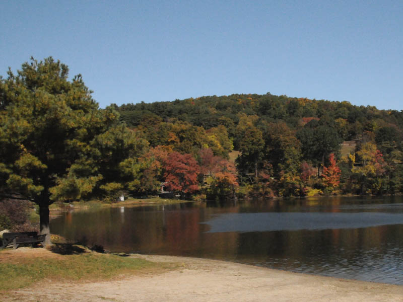
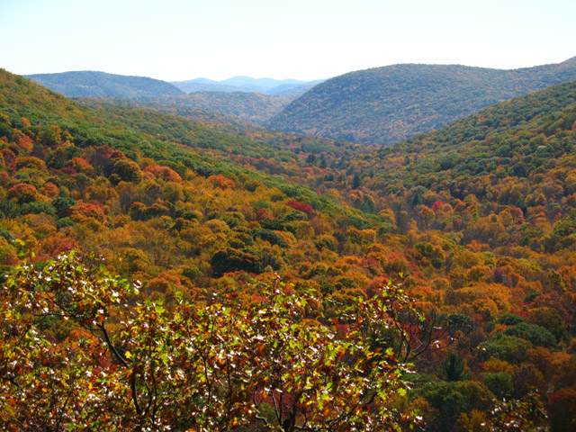
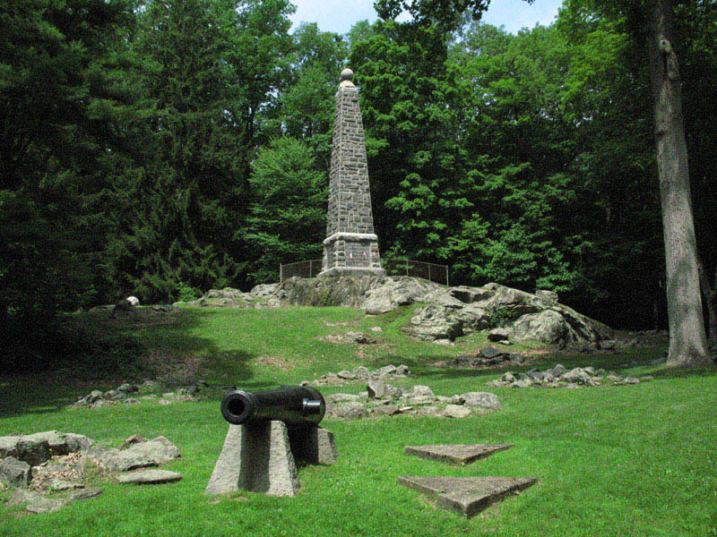
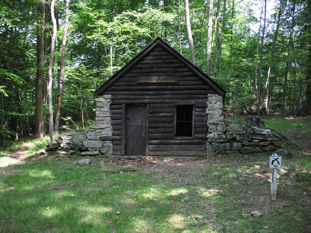
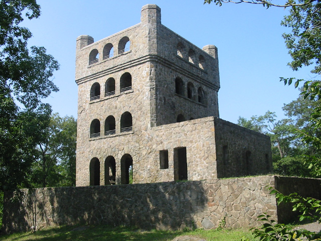
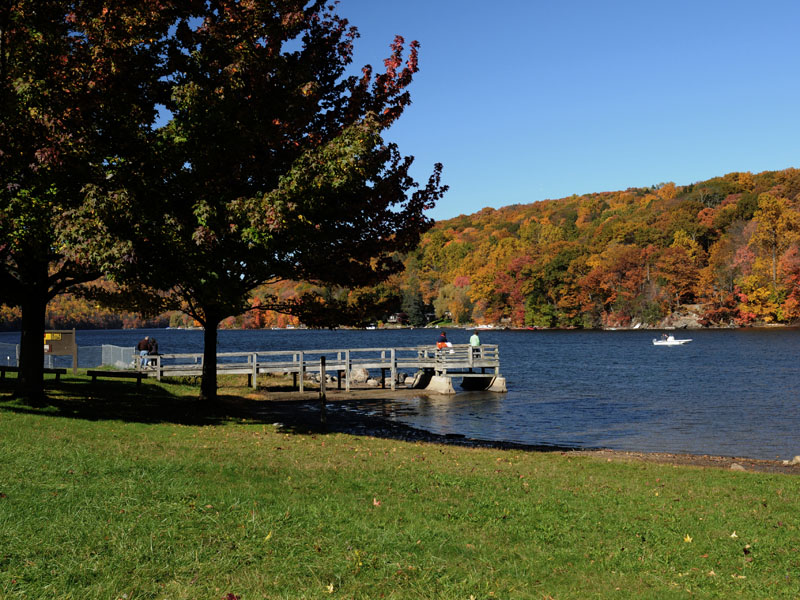
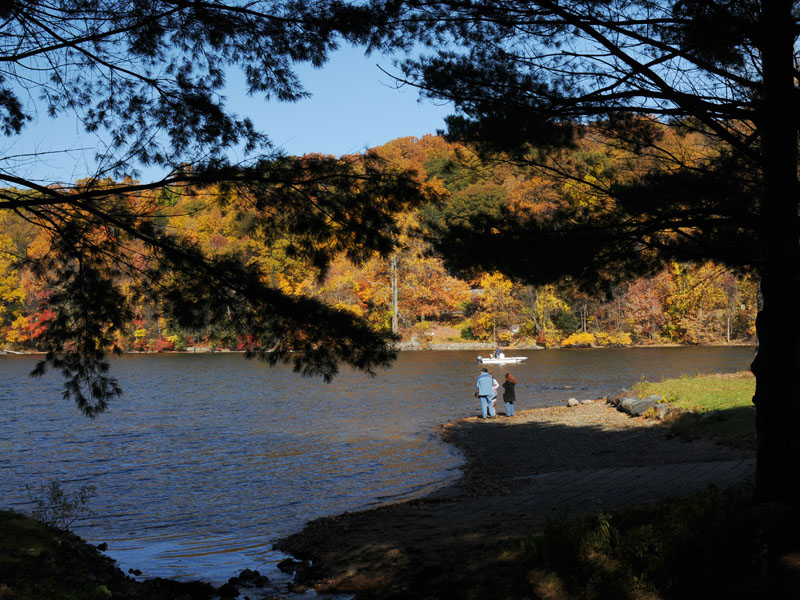
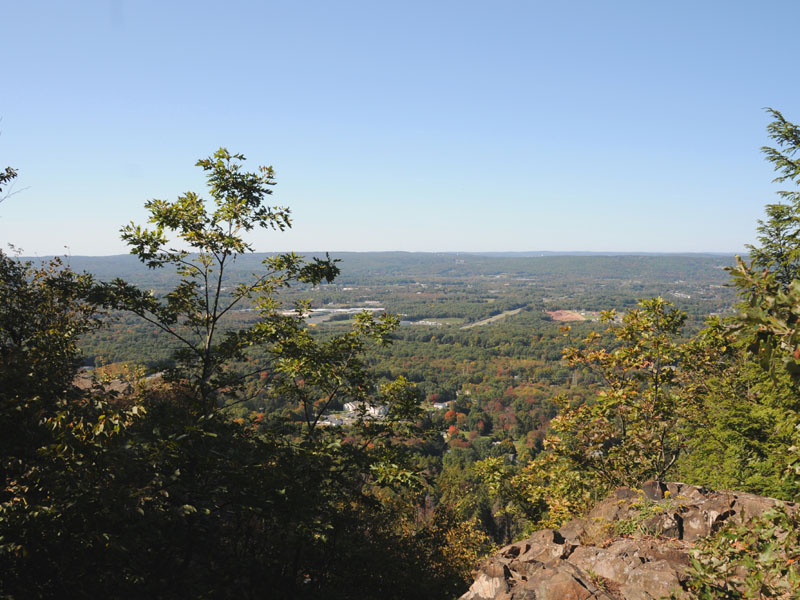
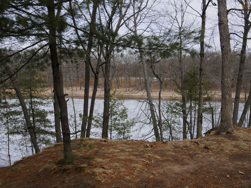
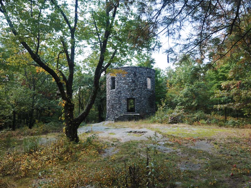
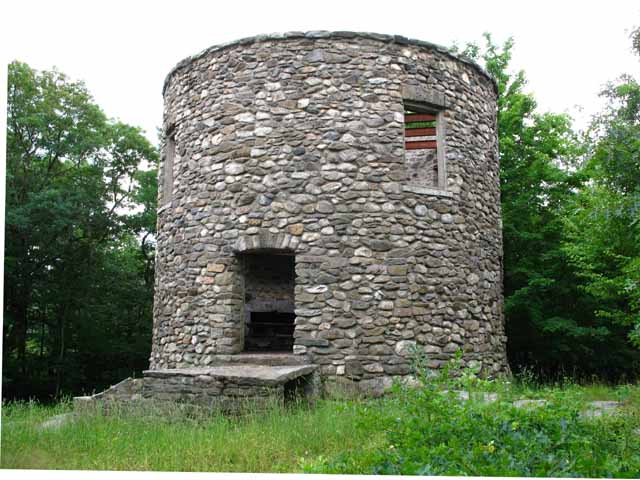
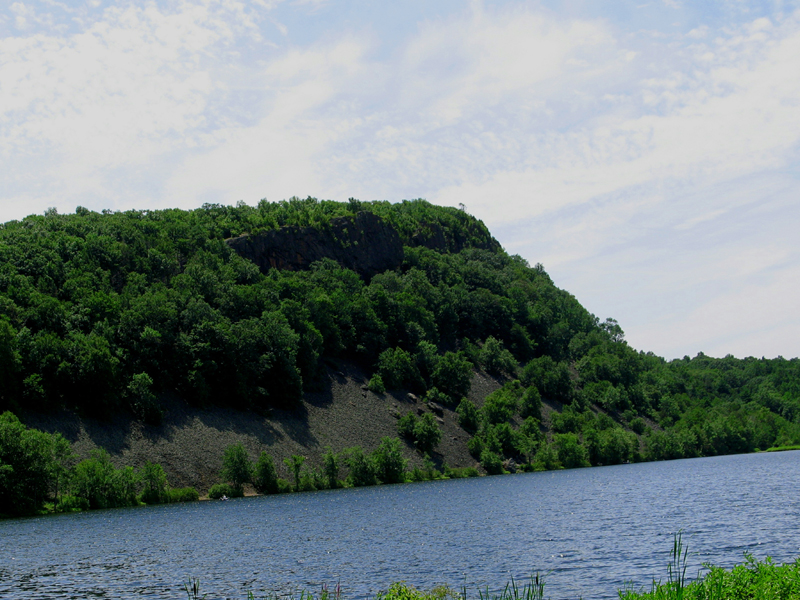
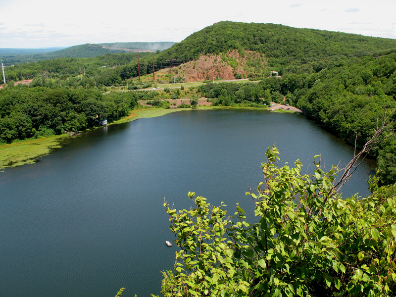
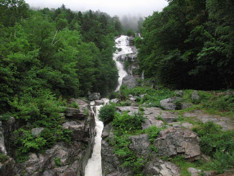
Old Radar Station
Built during the Cold War, this radar station has since been abandoned.
Above All State Park is home to the former site of SAGE Semi Automatic Ground Environment Air Defense Network. This particular site was a gap-filler providing low altitude coverage out to a range of 65 miles.
The Semi-Automatic Ground Environment SAGE was an automated control system for tracking and intercepting enemy bomber aircraft used by NORAD from the late 1950s into the 1980s. In later versions, the system could automatically direct aircraft to an interception by sending instructions directly to the aircraft's autopilot.
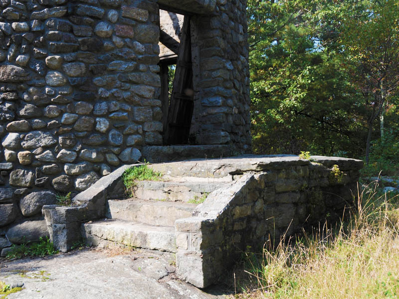
Old Radar Station
This is the south face of the old radar building.
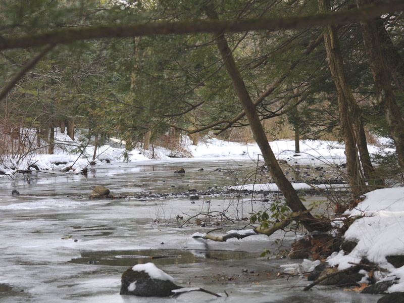
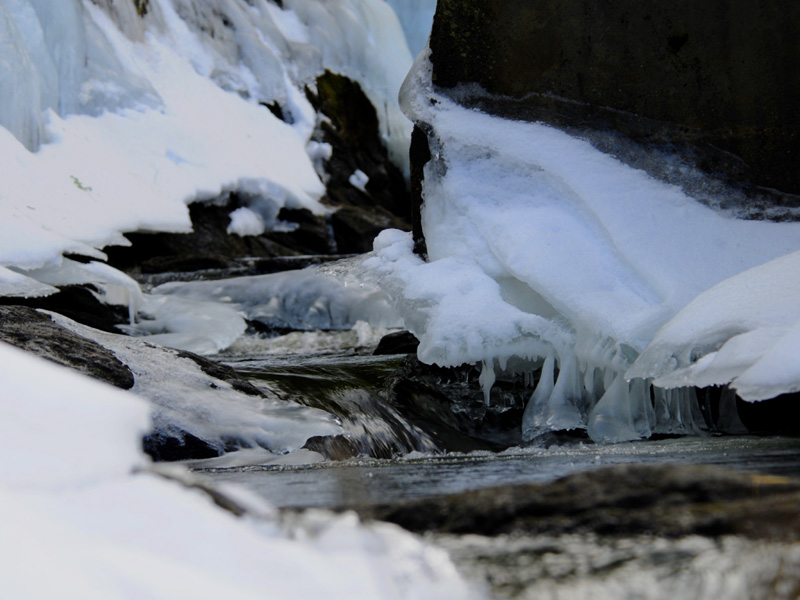
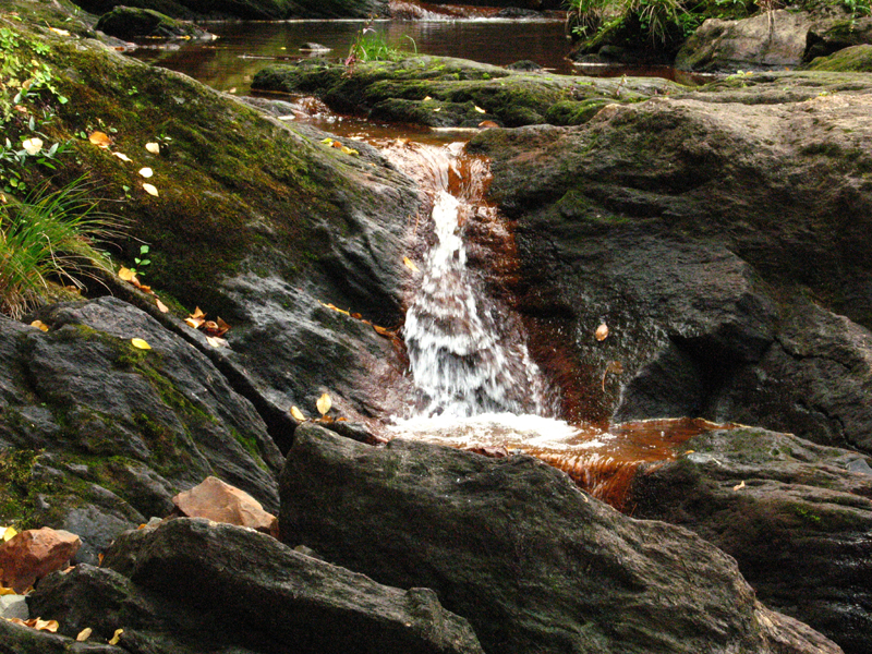
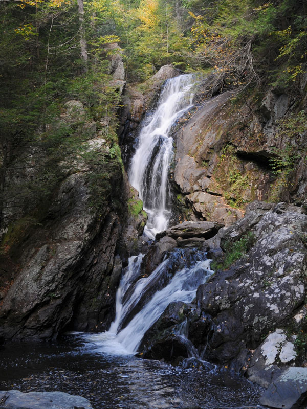
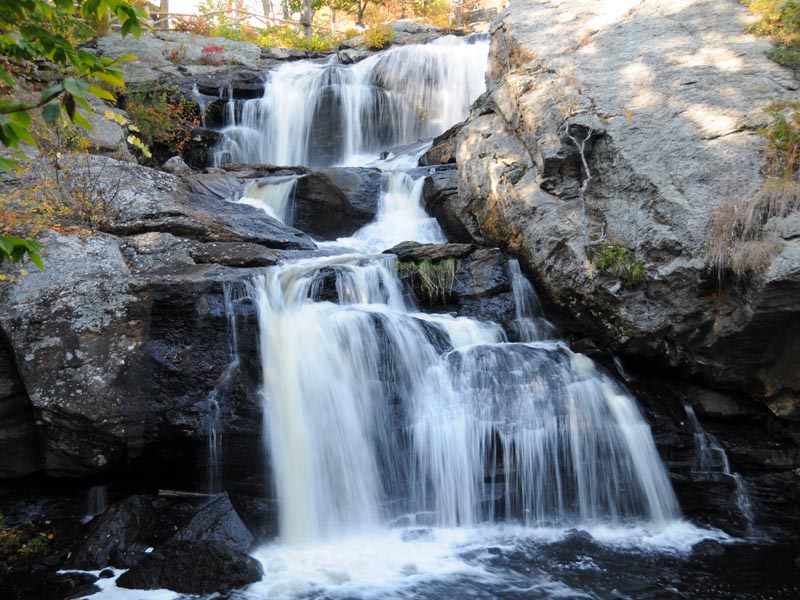
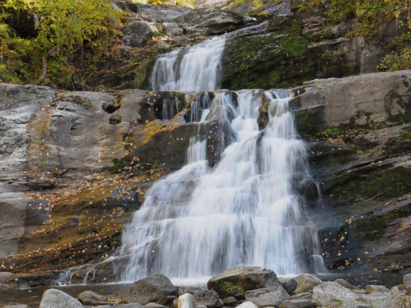
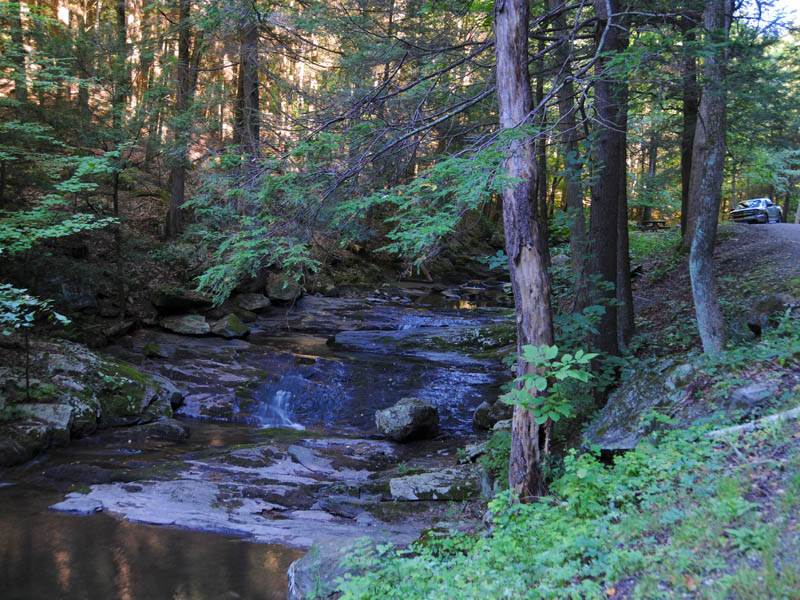
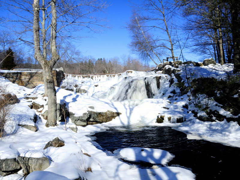
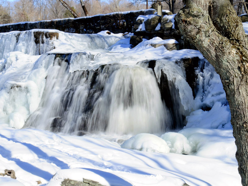
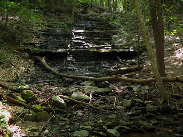
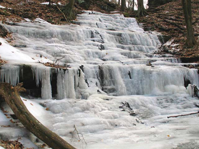
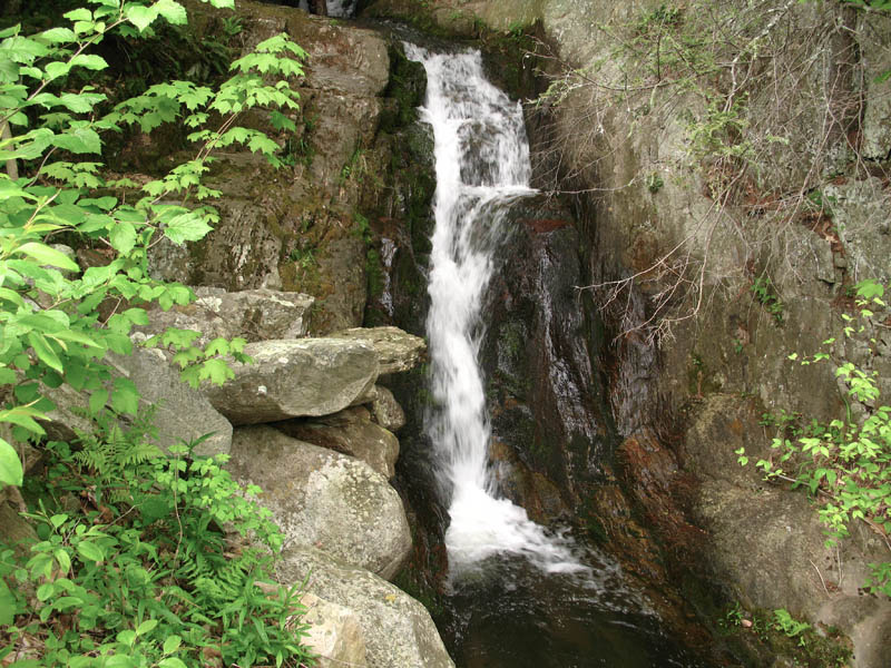
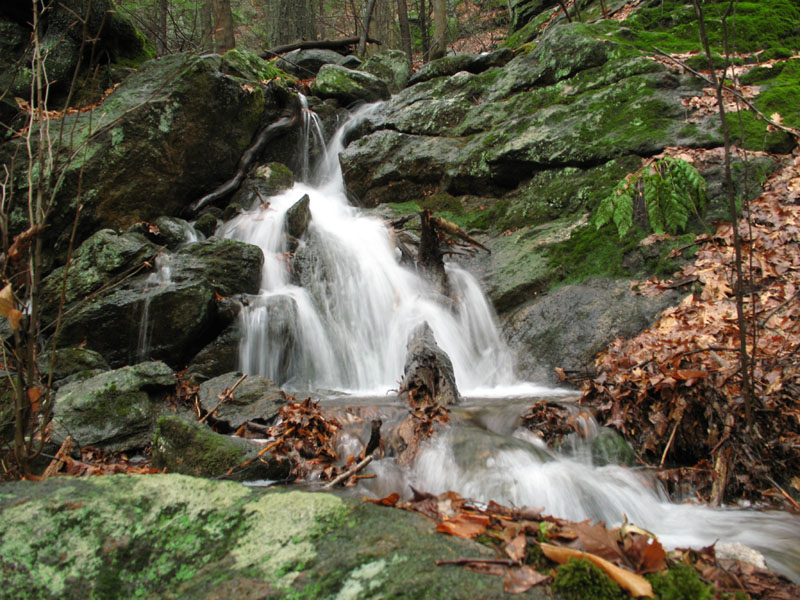
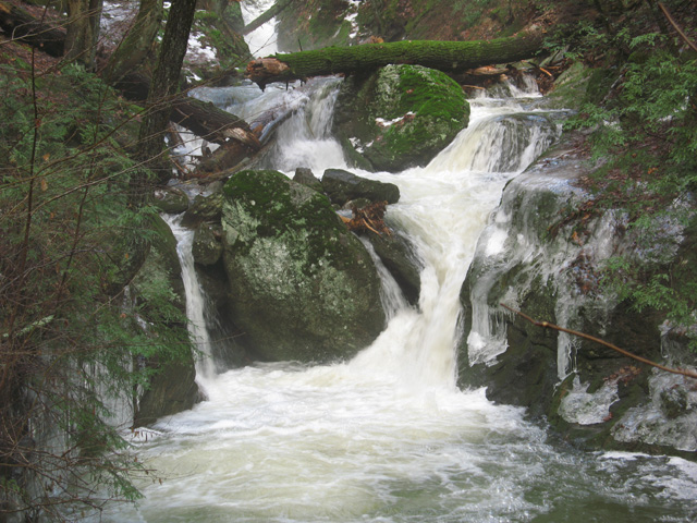
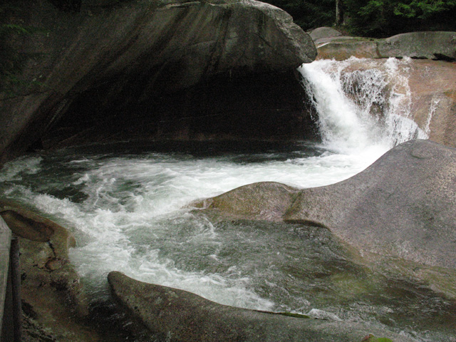
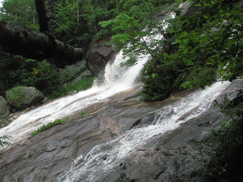
Cascade
Winter ice forms as this brook cascades over the rocks.
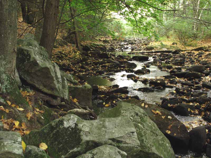
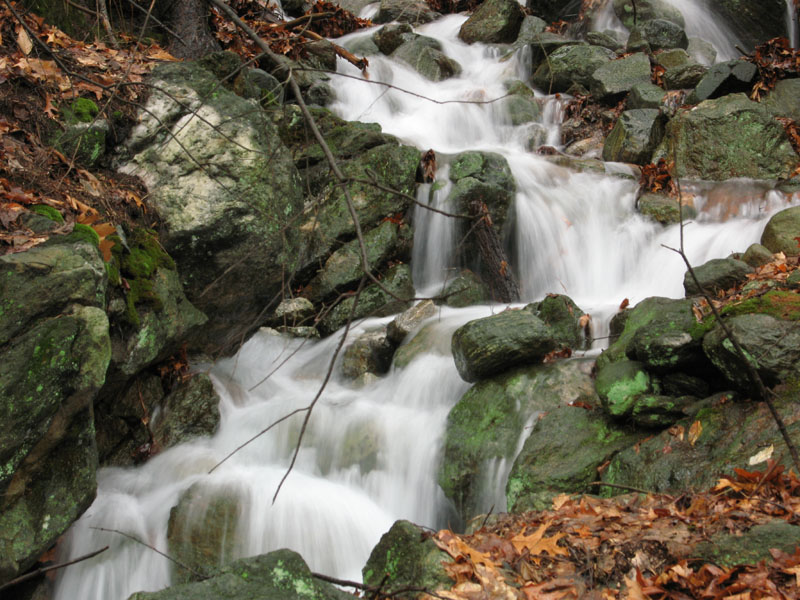
Cascade
This is a cascade right below the overflow of the nearby dam that supplies water for the brook.
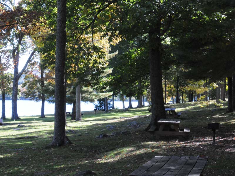
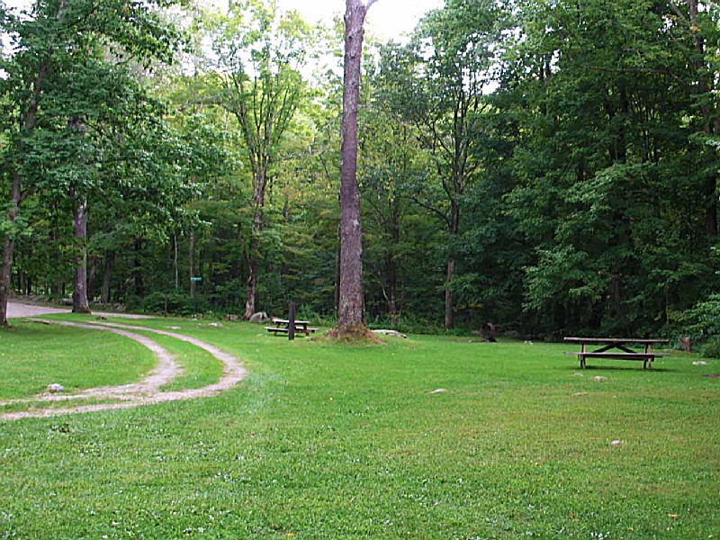
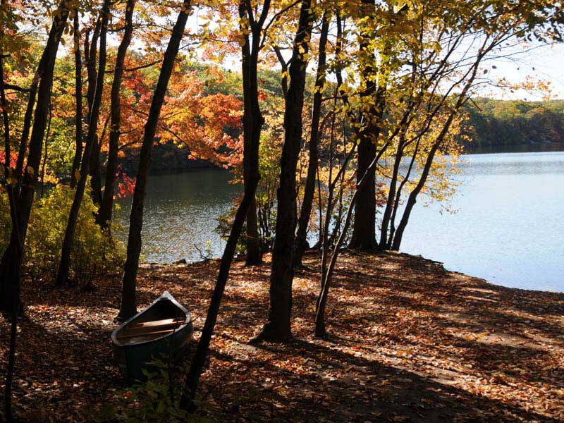
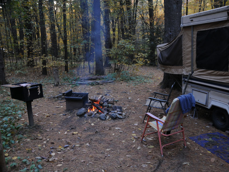
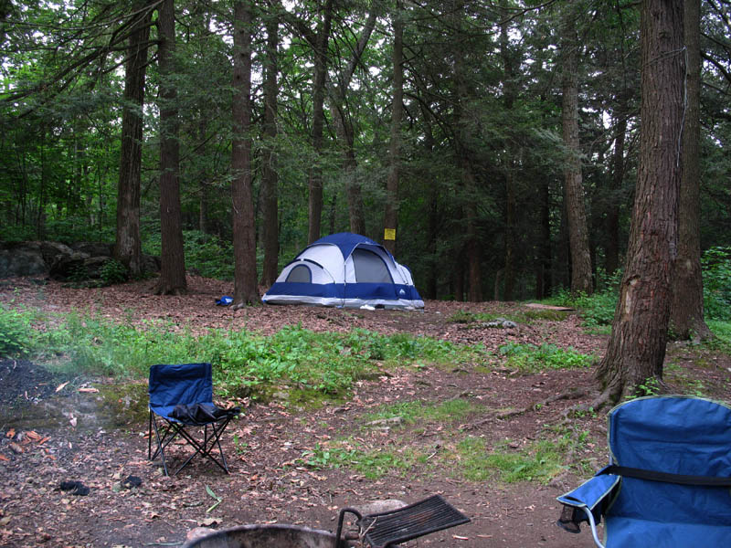
Black Rock Campgrounds
This is sites 87 88.
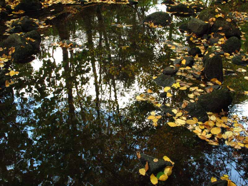
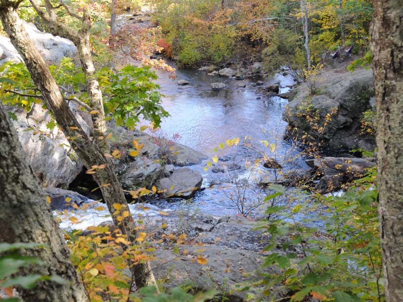
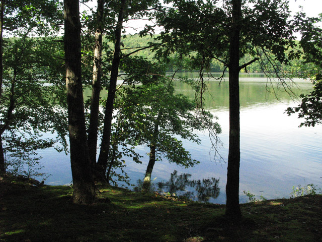
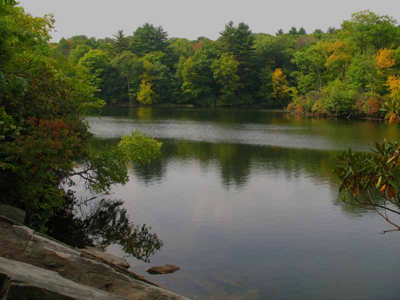
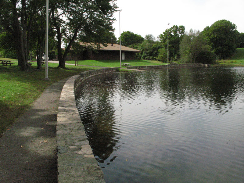
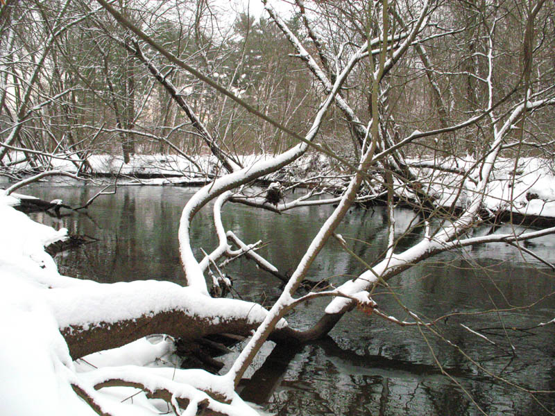
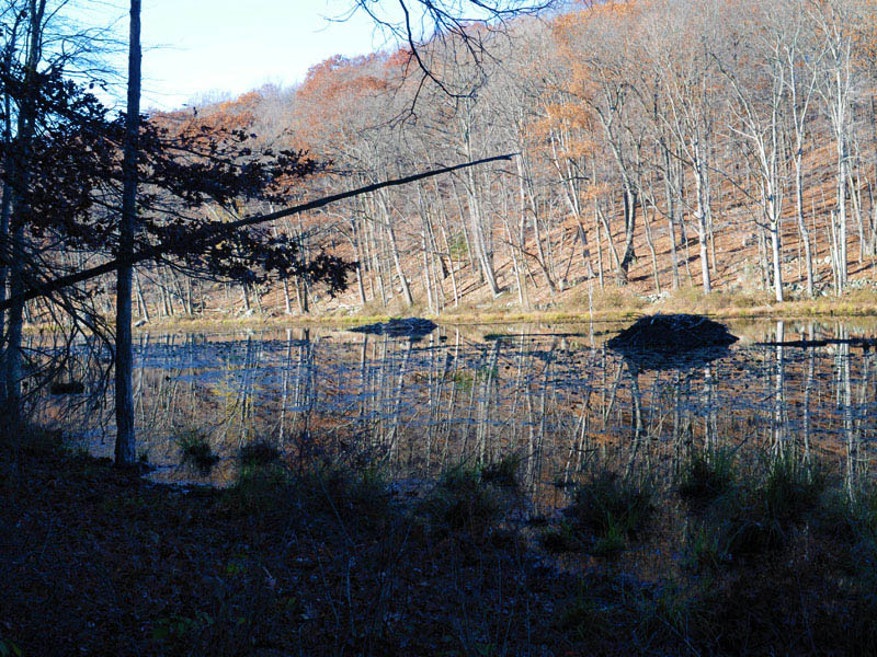
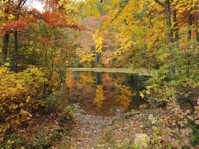
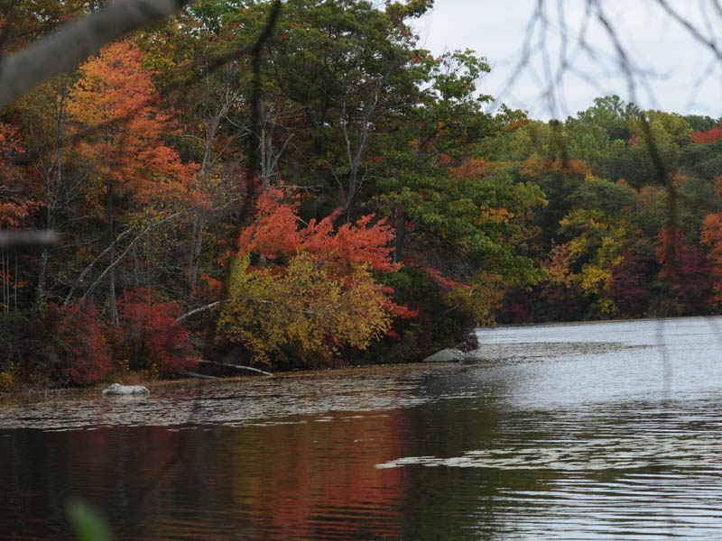
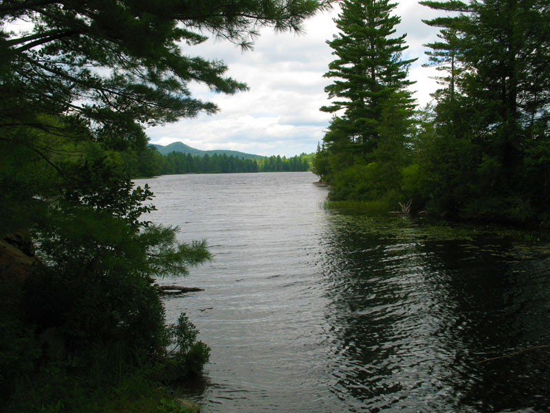
Reflection in the Water
A brook downstream from the reservior, mirrors reflections of trees in the water.
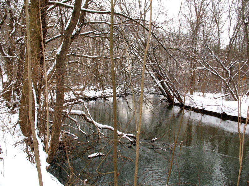
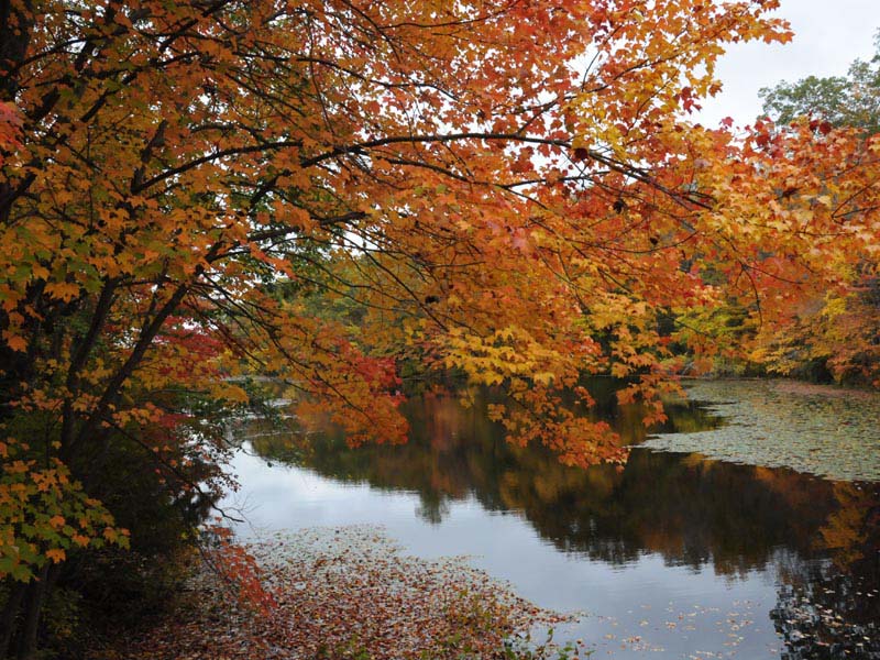
Brook in the Park
A brook downstream from the reservior in the park.
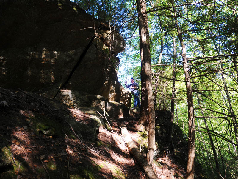
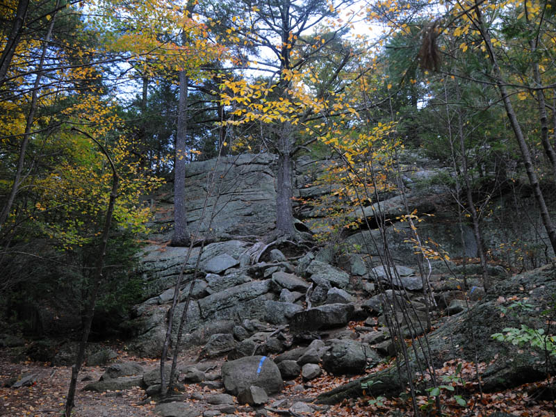
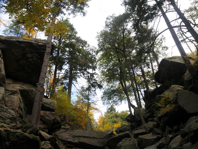
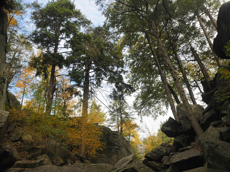
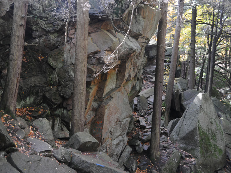
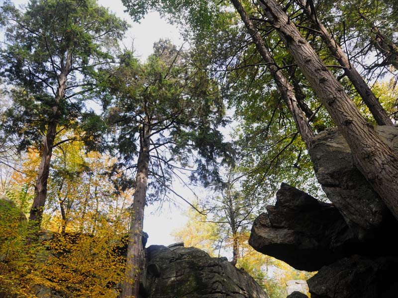
Off the Trail
A steep climb, if you wander off the blue-blazed trail.
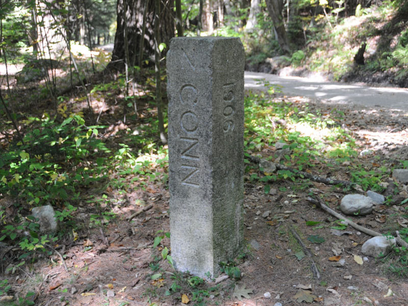
State Line Marker
This is a concrete marker which divides Connecticut and Massachusetts.
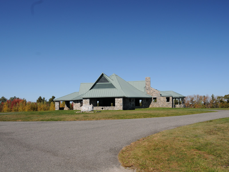
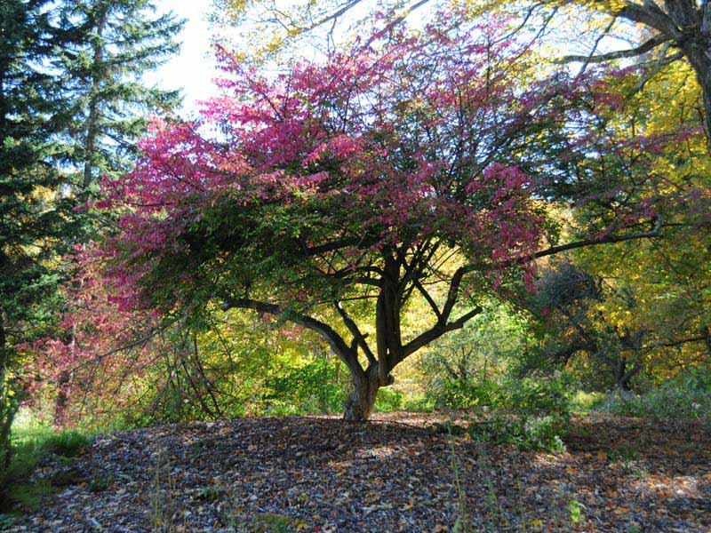
Dennis Hill Park III
A unique summit pavilion formerly a summer residence,is located at an elevation of 1627 feet. It is a popular place to picnic in the fall when on weekends the gates to the park are open.
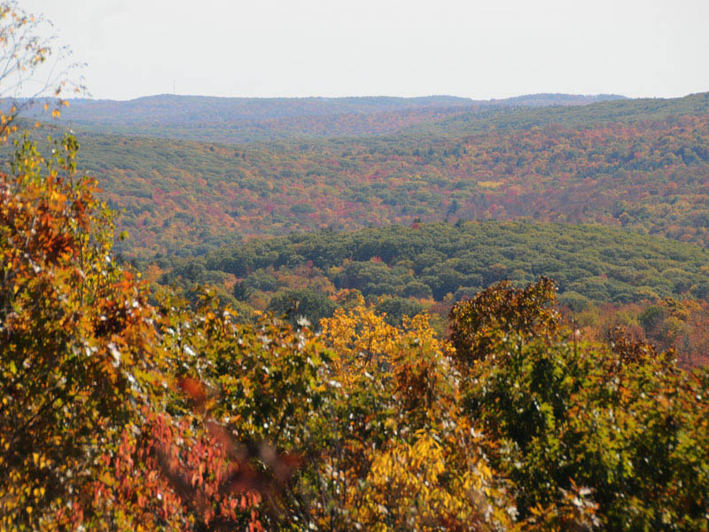
Dennis Hill Park II
Haystack Mountain, Mt. Greylock, the Green Mountains, and a portion of the State of New Hampshire can be seen from the summit in clear weather.
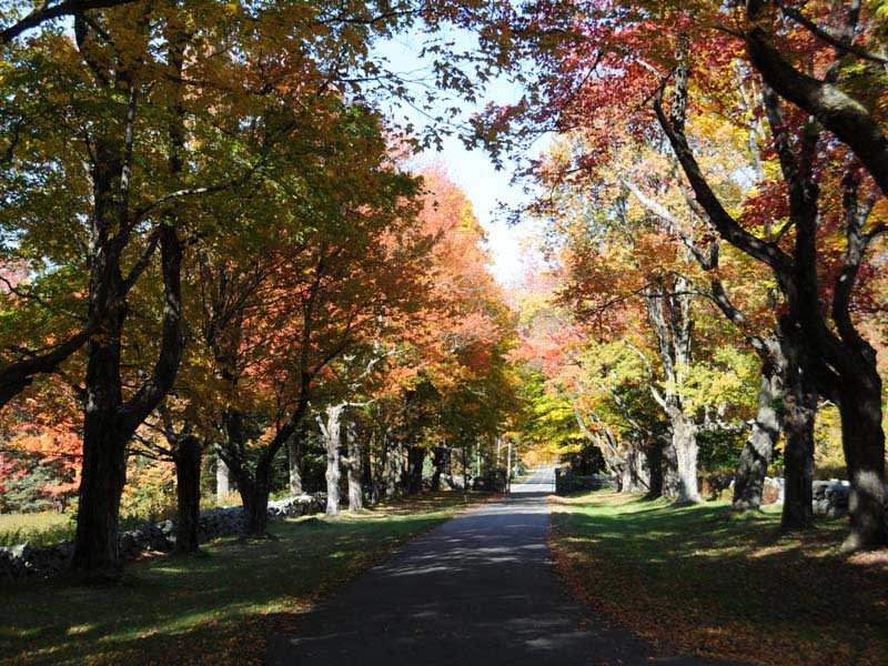
Dennis Hill Park IV
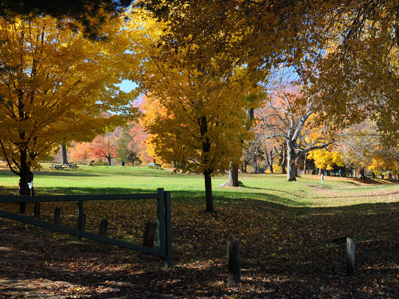
Maple trees with their colors adorn the road into the park on fall days.
Dennis Hill Park VI
Old stone gate entrance to the park
Dennis Hill Park V
This shrub and it's unique color caught my eye as I drove into the park.
Dennis Hill Park I
Remnants of an old structure is seen as you drive through the park.
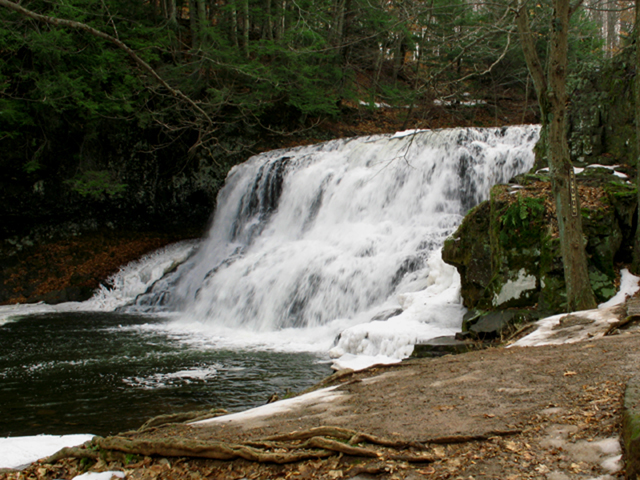
Devils Hopyard State Park
A winter view of the top of the falls. The stream runs under the bridge before cascading down.
Devils Hopyard State Park
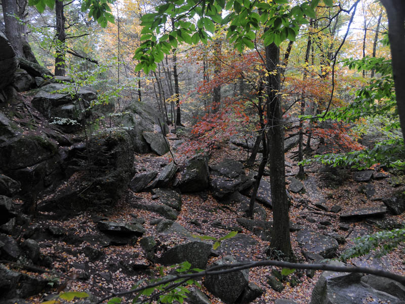
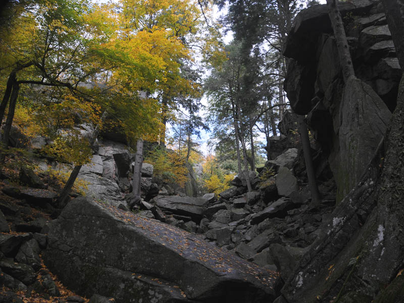
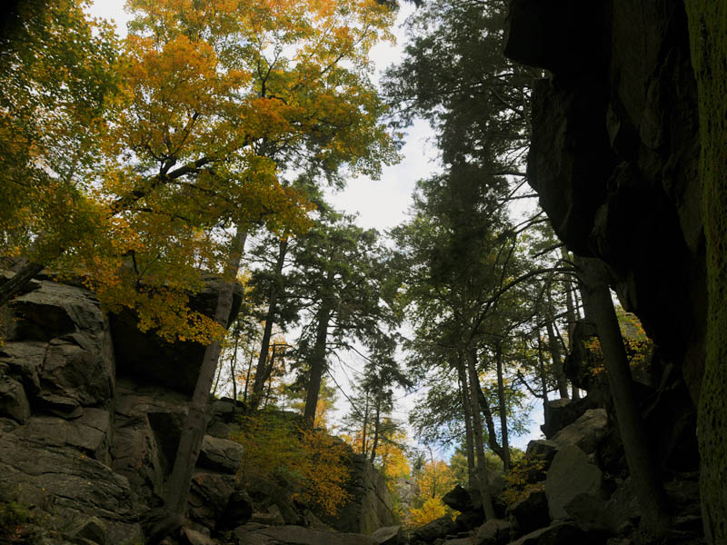
The trees in the fall give the park some great color.
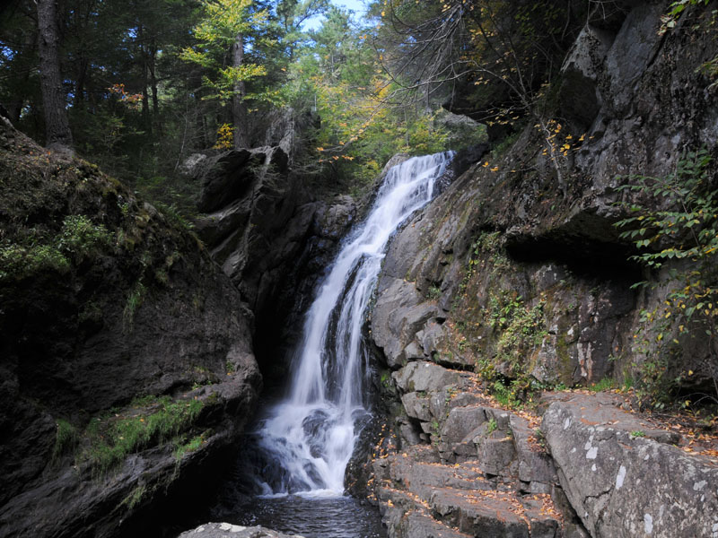
Chapman Falls
Chapman Falls is right next to a bridge over the road.
Chapman Falls
Looking at the bottom of the Chapman Falls
Chapman Falls
This view is looking down from the top of the falls.
Devils Hopyard State Park
This photo was snapped while standing on the road.
Dinosaur State Park
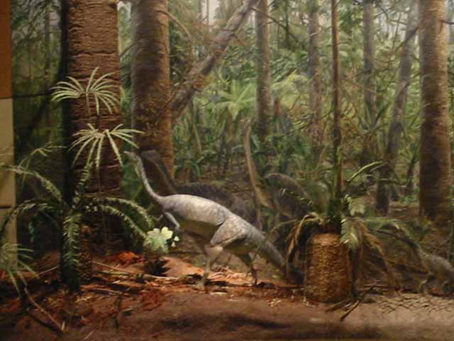
The geodesic dome houses a life size model of dilopasaurus, a dinosaur which lived about 201 to 189 million years ago, during the early Jurassic period.
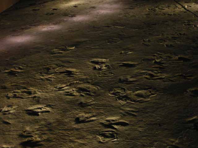
The Trackway
There is an interactive plaque with three different buttons that light up the straight trail of a single dinosaur. Here is a photograph that shows how they are lite up.
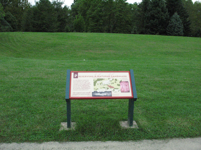
Preserving a Natural Landmark
Plaque reads In 1966 dinosaur tracks were discovered here and 1,500 of them were exposed. They were carefully covered over in 1976 to prevent damage from freezing and thawing. The trackway will be re-exposed when a protective structure can be built over it.
Four consecutive posts mark the corners of the buried trackway.
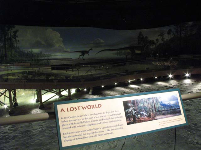
A Lost World
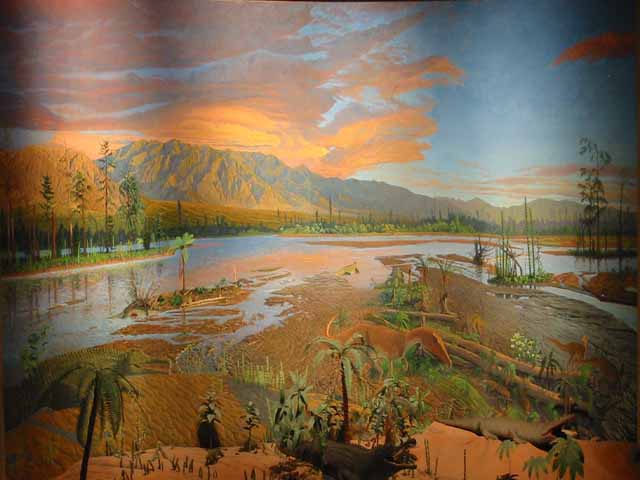
The Caption reads In Connecticut Valley, one has to only dig a few feet below the surface to discover a lost world - a sub-tropical place with beautiful lakes, forests, and remarkable animals a world with volcanic eruptions and violent earthquakes.
Each new excavation in the Valley's sandstone and shales has the potential for great discovery - like this amazing display of 200-million-year-old dinosaur tracks.
Tracks Entwined
Dinosaur tracks heading in all directions.
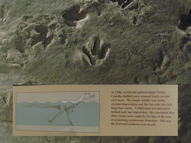
Unusual Tracks
The plaque reads
In 1980, vertebrate paleontologist Walter Coombs studied some unusual tracks on this rock layer. The longer middle toes made circular impressions and the two side toes left long claw marks. A little mud was mounded behind each toe impression. He concluded that these tracks were made by the tips of the toes of swimming carnivorous dinosaurs. This was the first such evidence ever found.
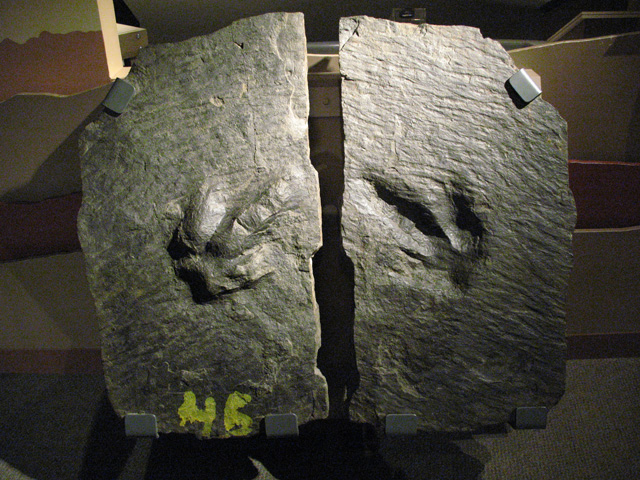
Same Rock
This is a rock that was split apart and reveals the foot that made the print.
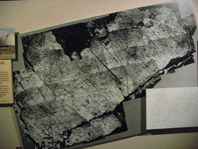
Over 1,500 Prints
This picture represents the vastness of dinosaur footprints in the area. The ones not preserved under the Dome were buried for future excavations.
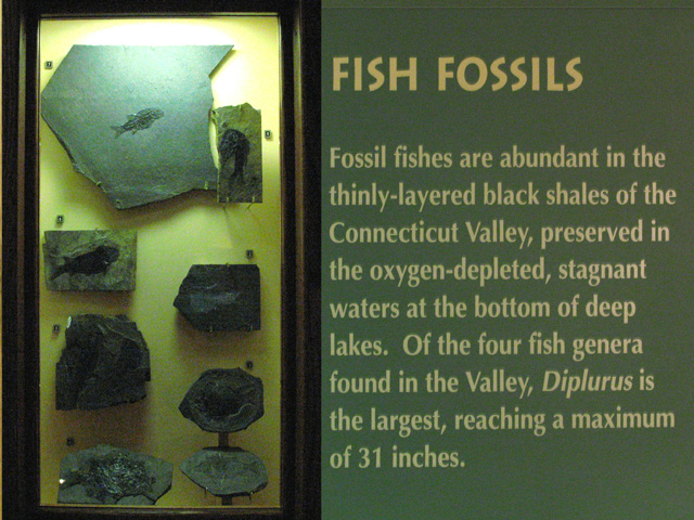
Fish Fossils
Various fish fossils with explanation.
Dinosaur Eggs
On display in the classroom are two fossilized dinosaur eggs.
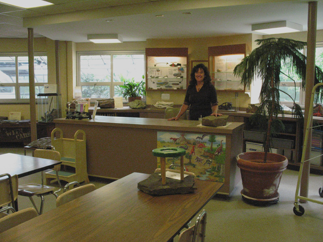
The Classroom
Pictured here is the Environmental Education Coordinator for this complex. She holds classes in this room encompassing outdoor recreation and natural resources.
Dinosaur State Park
Inside the dome is this depiction of how it looked millions of years ago.
Dinosaur State Park
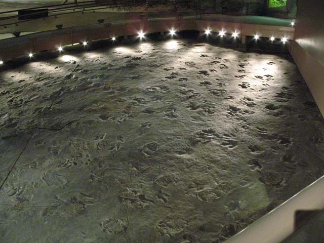
The dome houses more then 500 dinosaurs tracks made during the Jurassic Period 200 million years ago.
Dinosaur State Park
Inside the dome, artist William Sillin created this mural depicting the Triassic period.
Dinosaur State Park
Life size model of a dinosaur inside the dome.
Plaster Casting
There is an outside area where you can make your own plaster castings of real dinosaur footprints. Fun for the whole family with the benefit of taking home a print of a long extinct species.
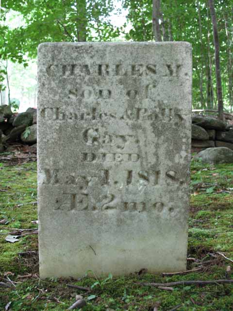
Gay City Gravestone
In the cemetary this gravestone reads
CHARLES M.
son of
Charles Polly
Gay
DIED
May 1,1818
AE.2mo.
Gay City Gravestone
In the cemetary this gravestone reads
In memory of Matilda daughter of Mr Henrey Mrs Polly S Sumner who died April 10th 1808m the 7th year of her age
Come pretty youth and see the place where you must shortly be
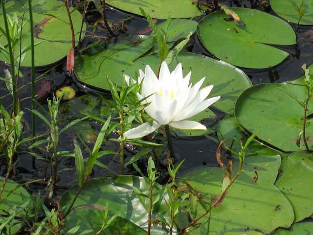
Water Lily
Summer brings water lilies to full bloom in what is called Still Pond.
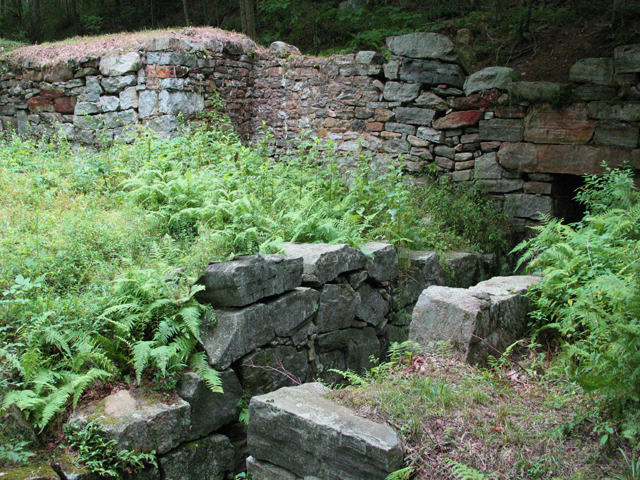
Ruins of Paper Mill
This is where a water-wheel powered a factory for the manufacture of rag paper in the mid 1800's.
Gay City Cementary
What is left of the old graveyard is located a short distance from the Parks main entrance. The gravestones are placed at opposite ends opposing one another silent testimony to the fueding families that once lived here Gays vs Sumners.
Still Pond Wildlife
Still Pond abounds with wildlife. The croaking of frogs can be heard at night as winter turns into spring.
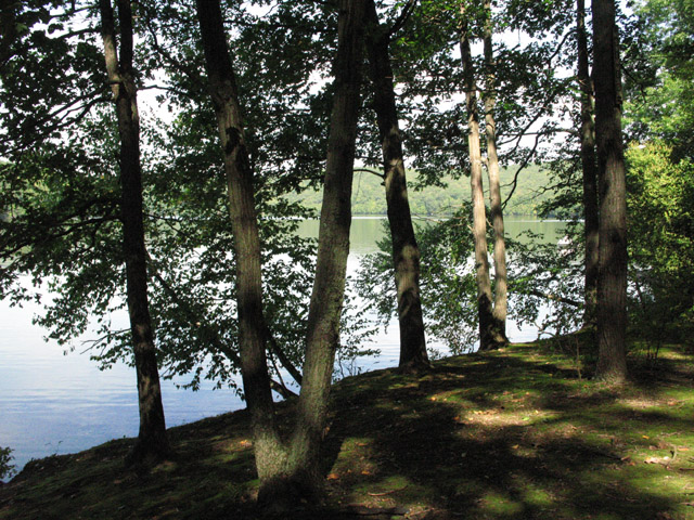
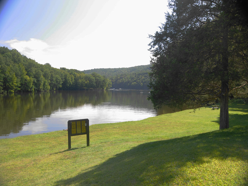
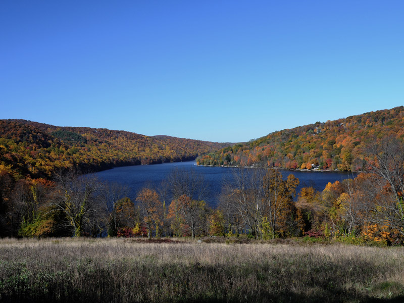
Lake Zoar
Mr. Waldo was Editor-in-chief of the Bridgeport Post now The Connecticut Post, The Telegram and Sunday Post. He was a well-known conservation-minded citizen, serving as the Chairman of the State Park and Forest Commission for many years,. Mr. Waldo served on the Commission from 1938 until his death in 1956.
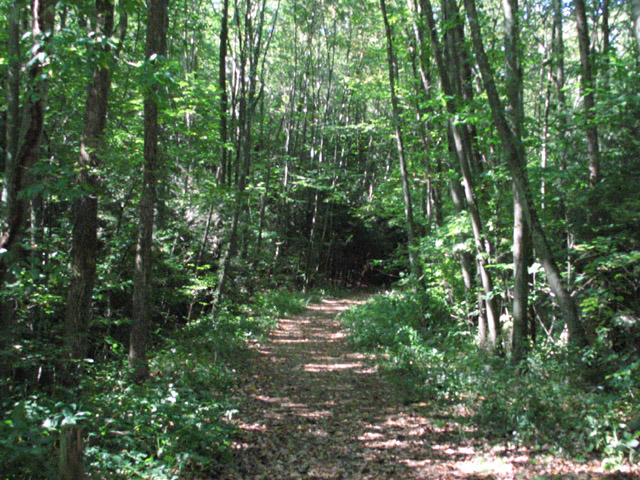
Park Entrance
This roadway takes you on a serene hike to Lake Zoar. No vehicles are allowed.
Lake Zoar
The hike ends at Zoar Lake pictured here.
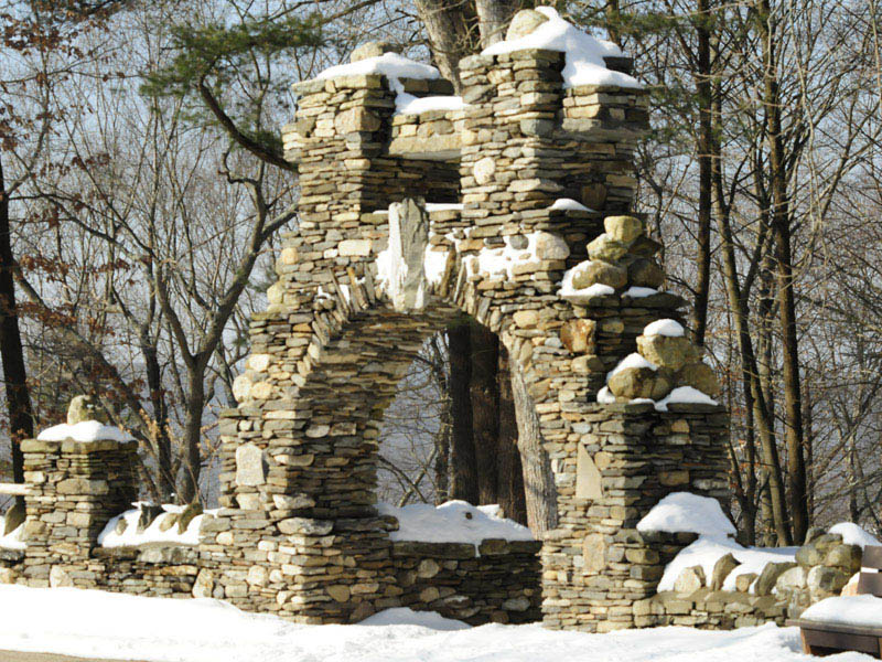
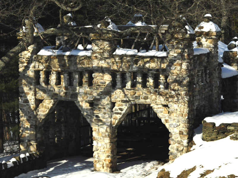
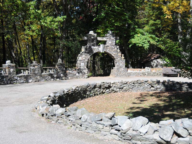
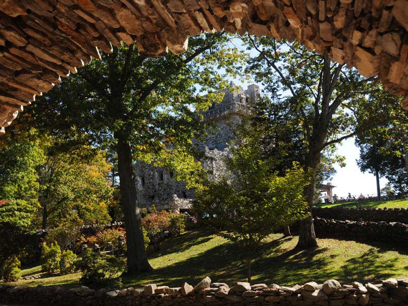
Stone Archway
This was shot 1-23-09 winter. There aren't many people that visit in the winter but the ones that do can see the castle and grounds with snow.
Old Train Station
In the summer this structure now serves as a picnic area.
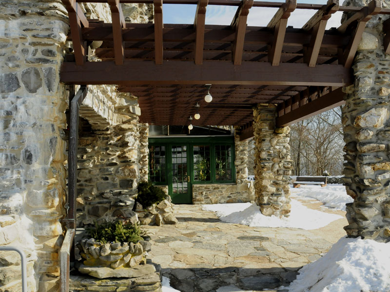
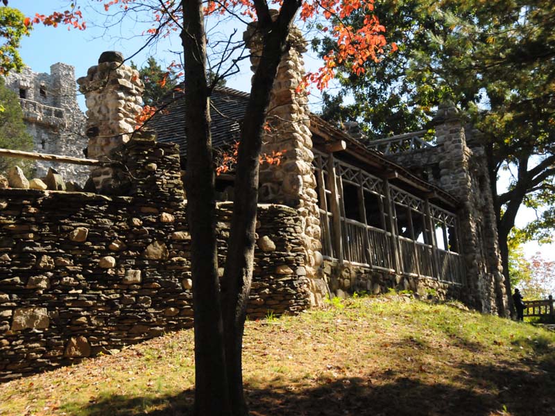
Entryway Porch
This porch leads to the central room of the castle.
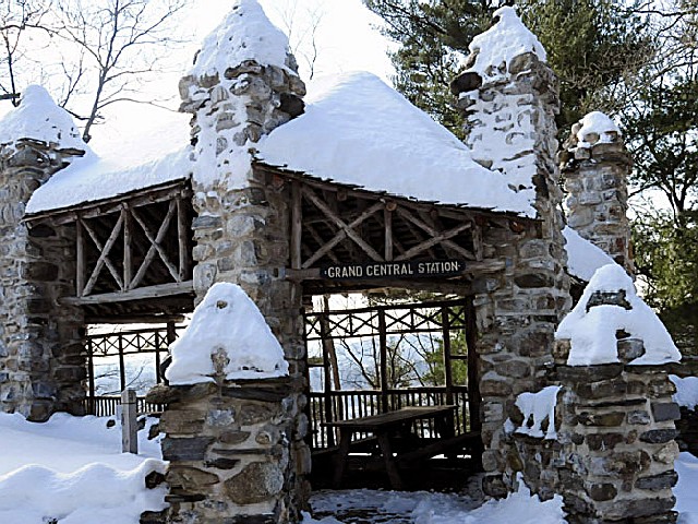
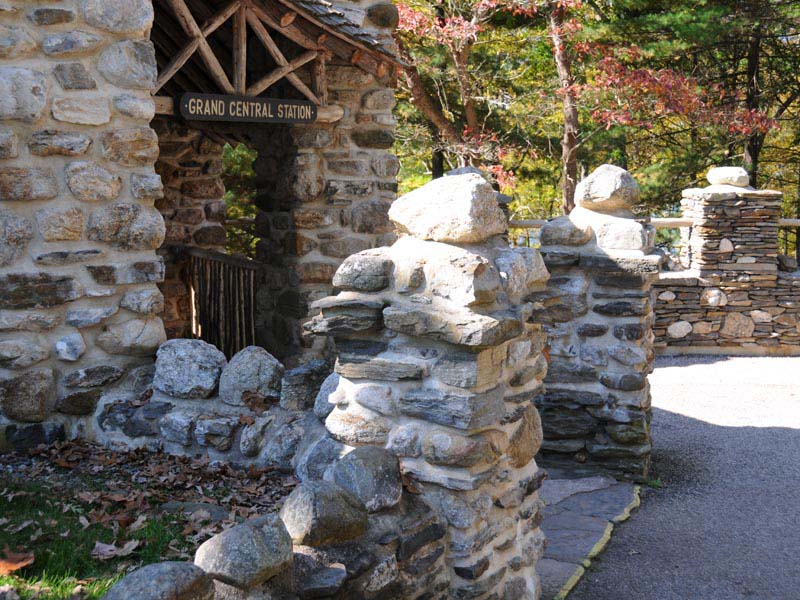
Grand Central Station
A picture of Gillette's old mini-train station. The engine is now housed in the new adjacent visitor's building.
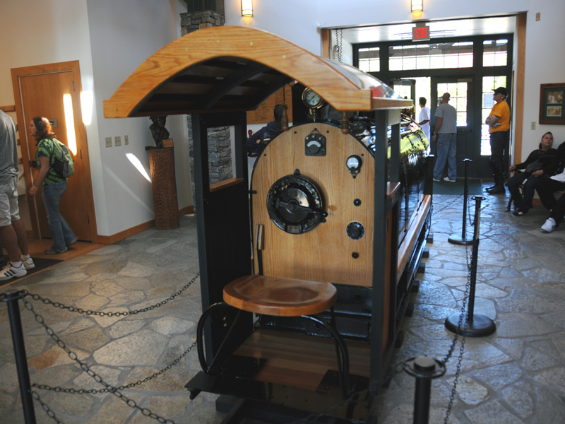
The Steam Engine
Pictured here is the original steam engine visitors could ride that ran around his property. It was designed by Gillette.
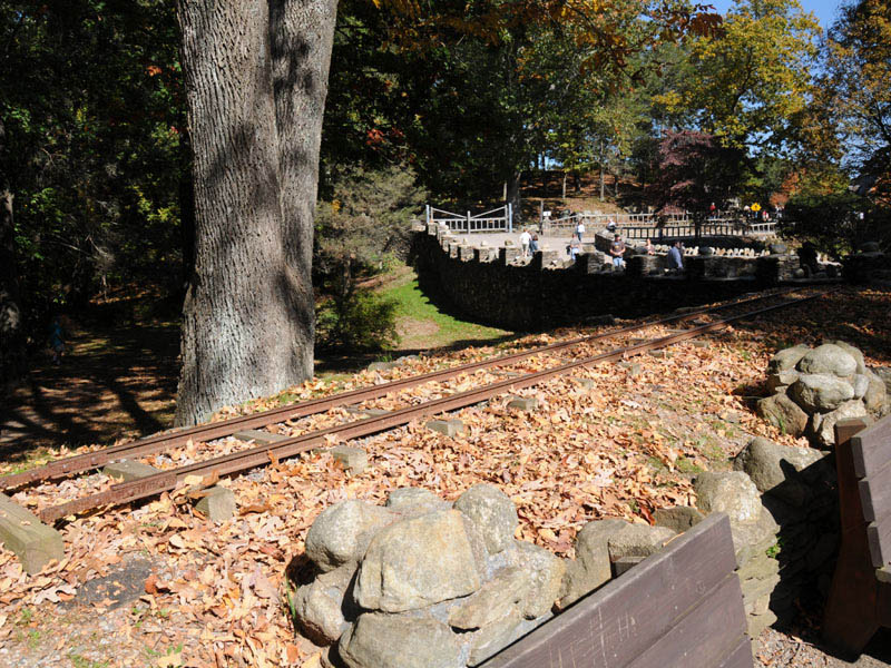
Train Rail
A section of the old railway that ran around Gillette's property.
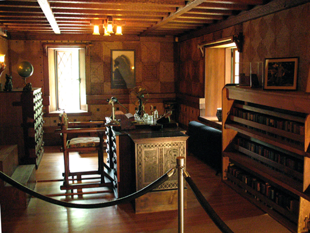
Study
This is the small study William Gillette had in his Castle.
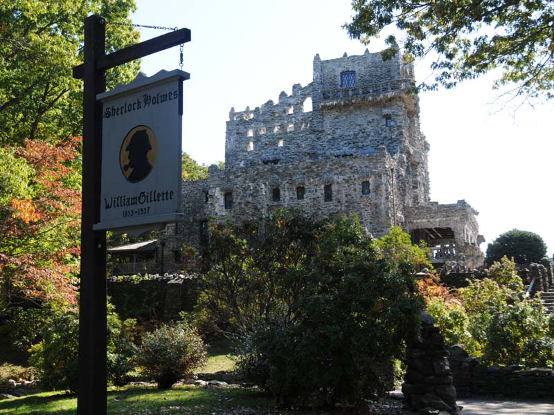
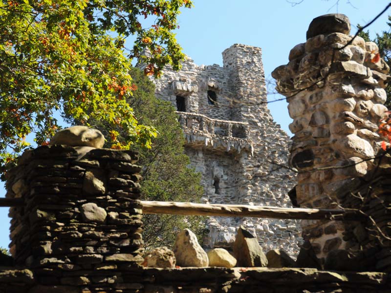
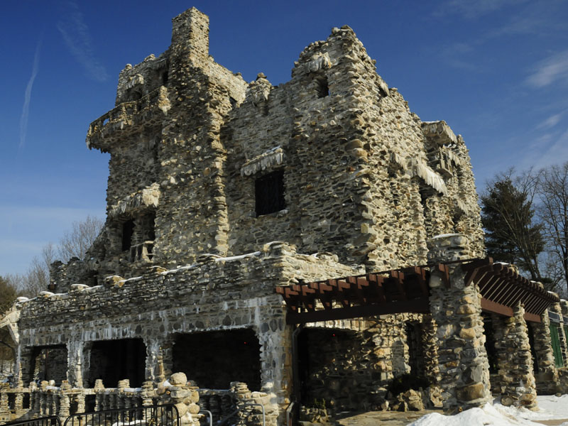
Gillette Castle
William Gillette made his fortune playing Sherlock Holmes and built this splendid castle overlooking the Connecticut River. The inside is open seasonally for all to view and enjoy. The grounds are open year round.
Driveway
Gillette's driveway is bordered on both sides by rock walls.
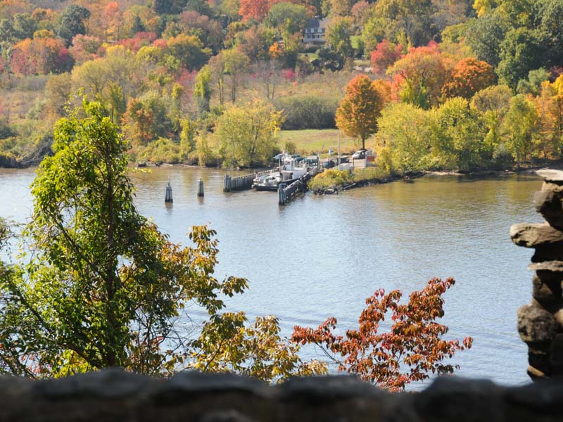
Ferry
The ferry ride that crosses the Connecticut River can be seen from the rear stone patio of the castle.
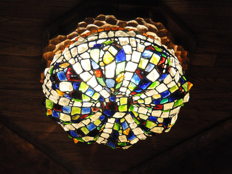
Tiffany Light Fixture
This is an original Tiffany Light Fixture rare. It is one of two in the castle. I do not believe Tiffany made many.
Overlooking Connecticut River
View of the Connecticut River looking through a window porthole in the upper part of the castle.
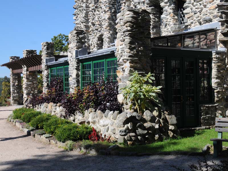
Rear of Castle
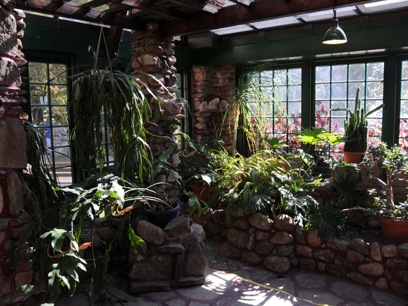
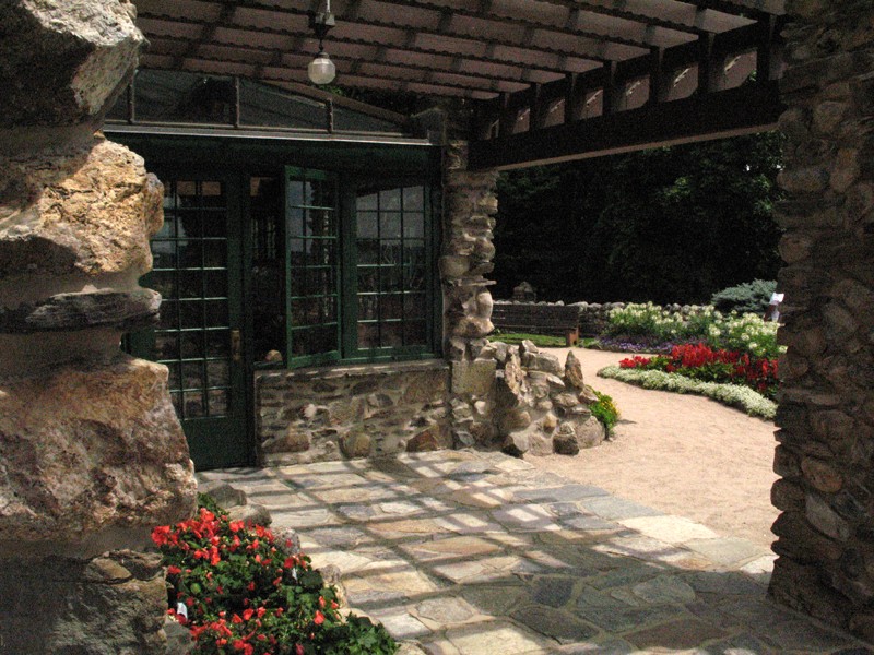
The greenhouse door comes out at ground level in the rear of the castle.
Keystone Archway
Many stone works of art can be seen as you tour the grounds.
Grand Central Station
Gillette had a miniature steam driven train that ran around his property. People he would invite over for a ride left from this building, thus the name - Grand Central Station.
Stone Works of Art
Gillette used all local workers and craftsmen to build this estate.
Grand Central Station
This is a different view of the train station.
Gillette Castle
Gillette Castle viewed from a keystone archway.
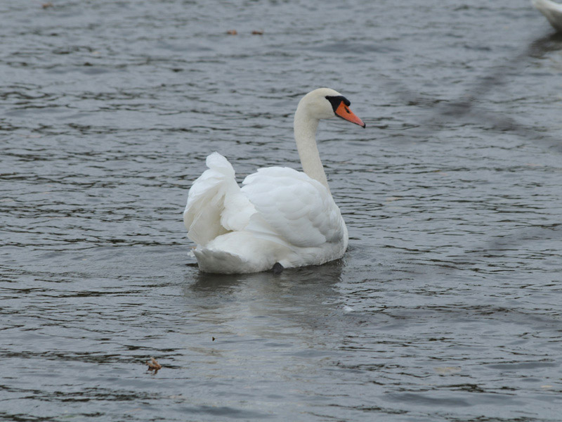
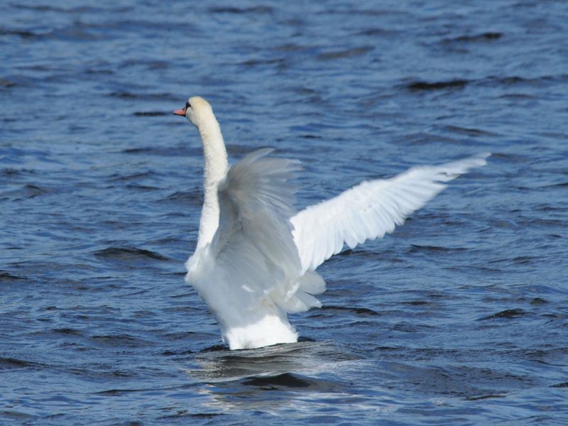
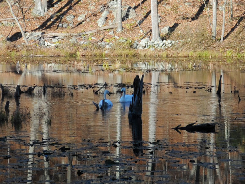
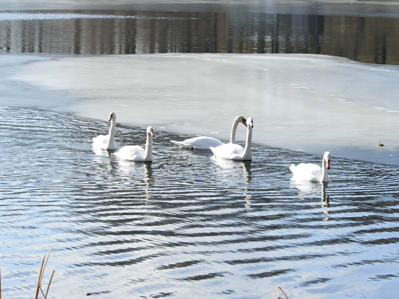
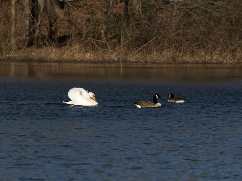
Swan Dance
One swan gave me a classic pose.
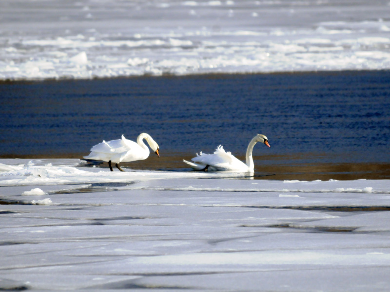
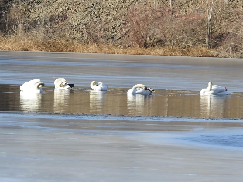
Resident Swans I
If you look close enough this is a cluster of five swans that slept together on the ice. I obesrved while one by one they woke up and hopped back in the water.
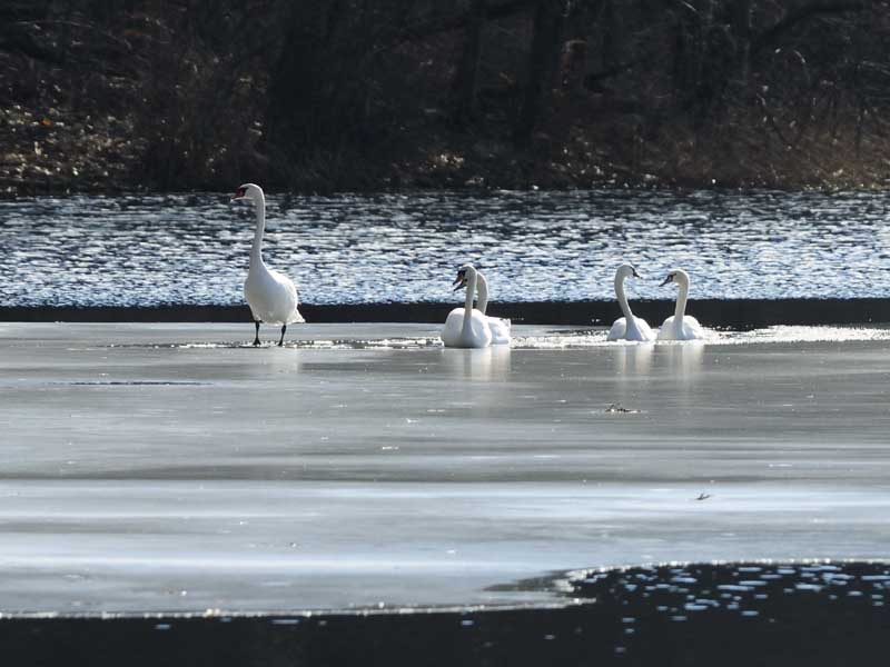
Resident Swans II
These swans were the last ones to get up and hop in the water after a nights sleep.
Spread Wings
A swan keeping it's wings cleaned and groomed.
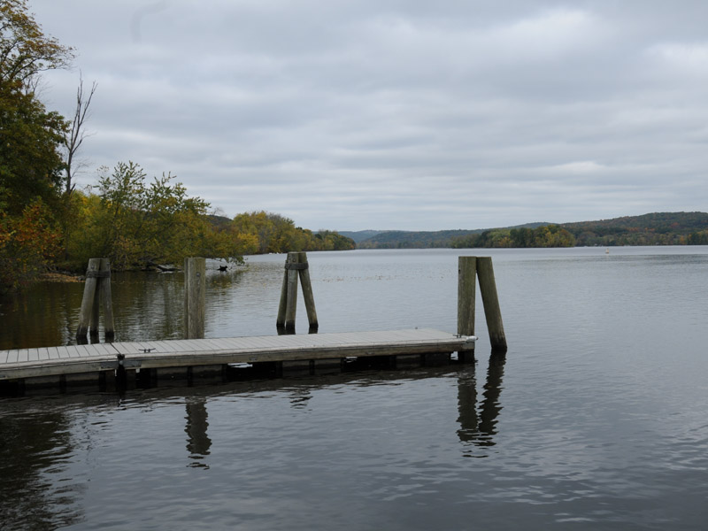
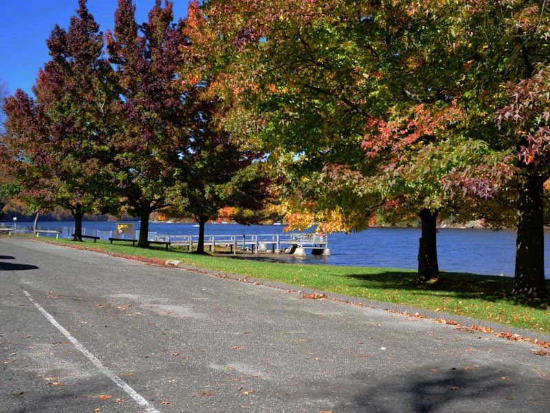
Dock on the Connecticut River
Boat launch and dock open to the public
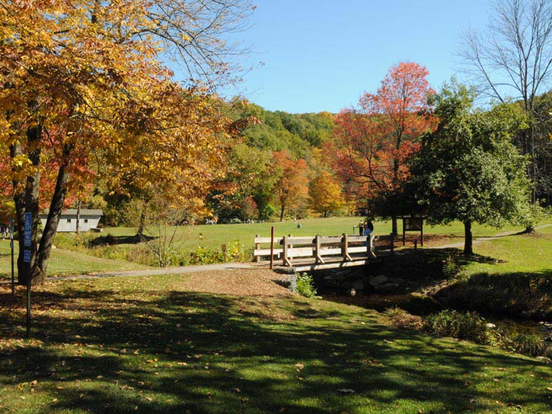
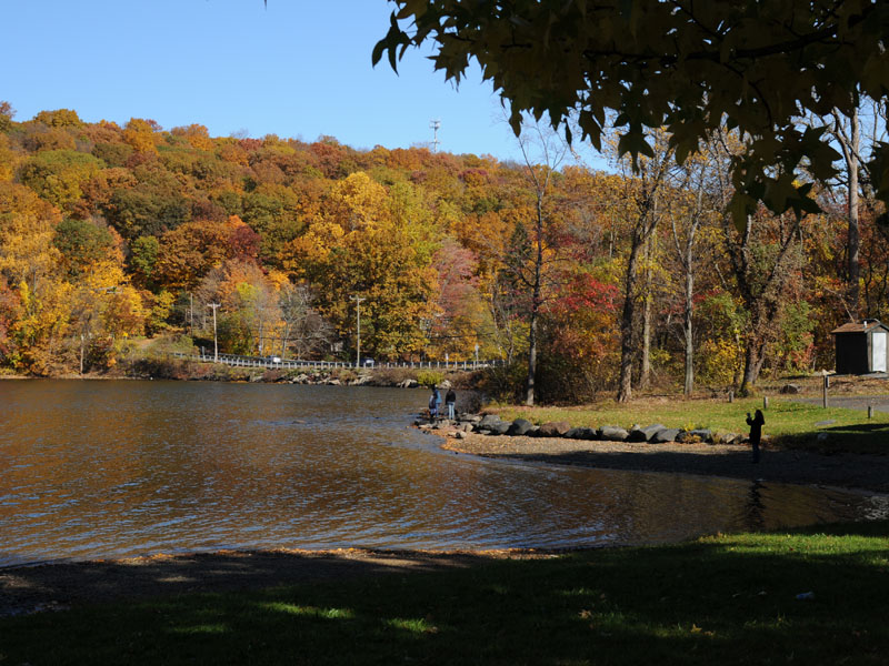
Haddam Meadows
The meadows end of the park
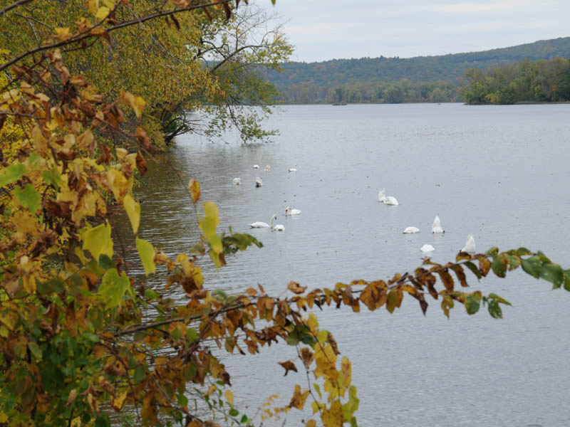
A Gaggle
Swans feeding off vegetation in the Connecticut River.
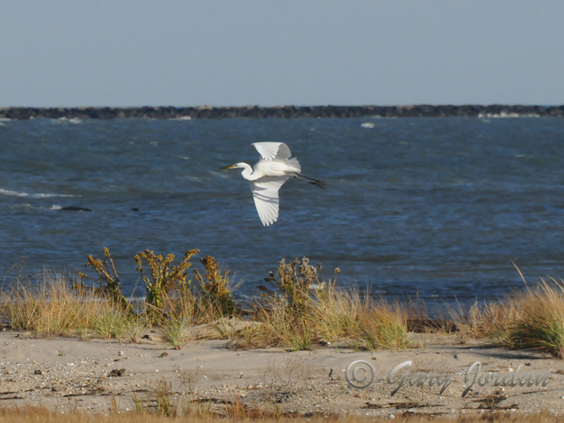
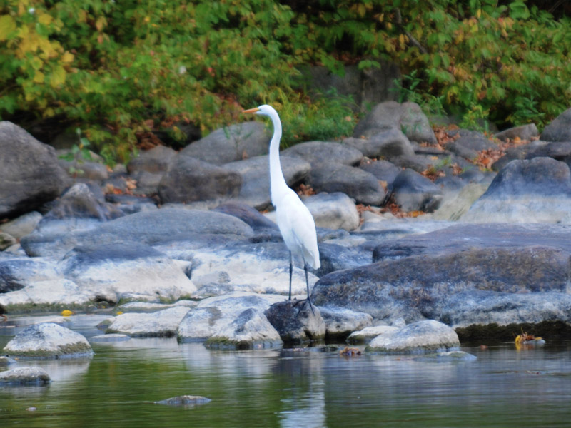
Great White Egert
At low tide, Great White Egerts hunt for food in the salt marshes.
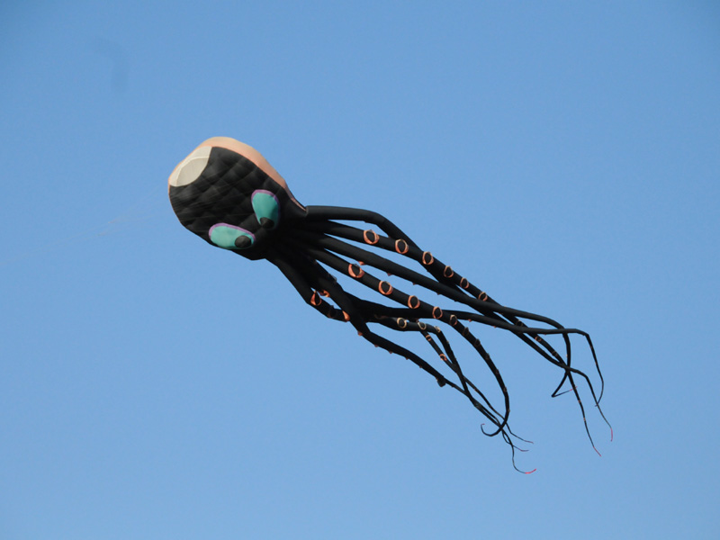
Octapus Kite
A Connecticut kite club flies their inventions at a field in the park.
Kiters
Diverse kite designs fly freely in the breeze. Quite the spectacle.
ConnectiKITERS
The Kite Club needs a steady breeze to keep their kites aloft.
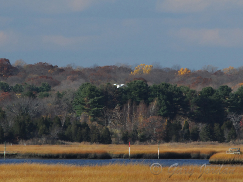
Salt Water Marsh
A Great White Egert flies above the salt water marsh.
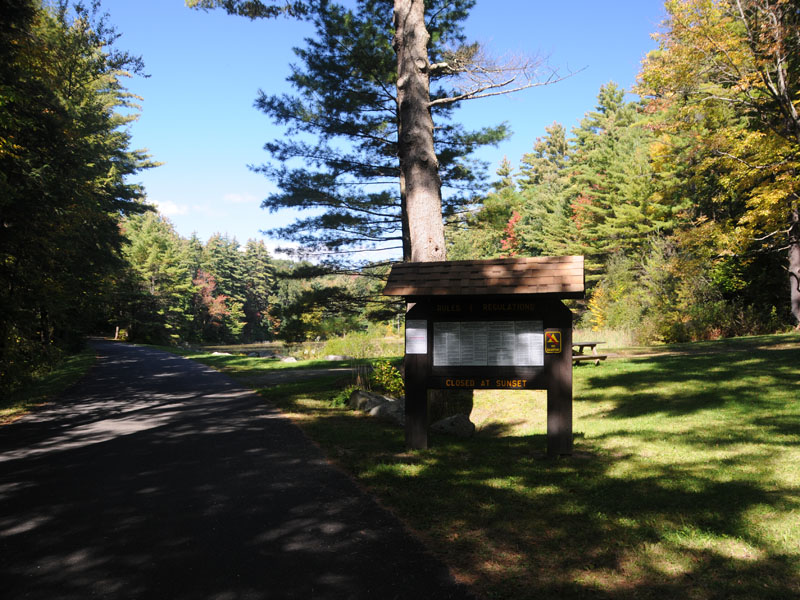
Picnic Grounds
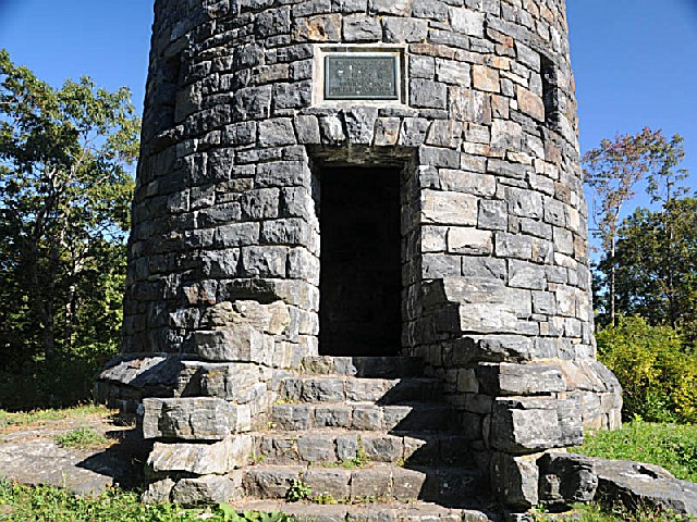
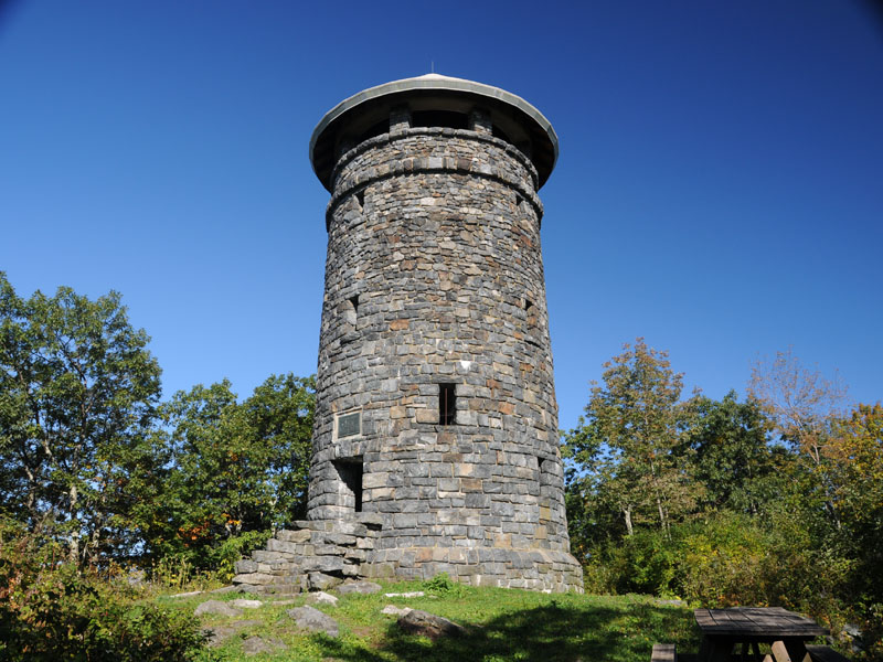
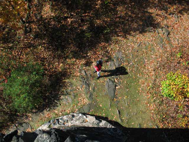
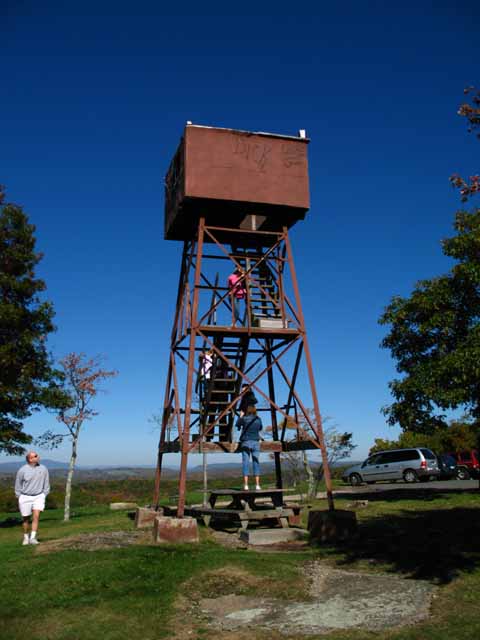
A roadway provides access halfway up the mountain. Then a half mile hike takes you up to the summit where the tower stands.
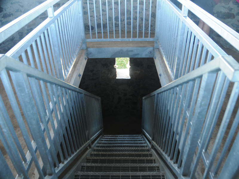
Top Stairway
This is an all galvanized steel stairway, the last flight of stairs going up the interior of the tower to the top. The work of re-furbishing this tower is the finest work I have seen done for any of the old towers I have yet visited.
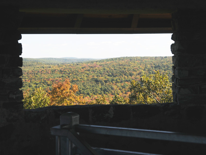
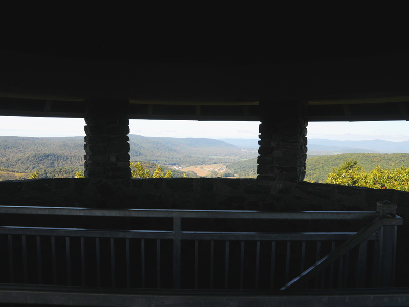
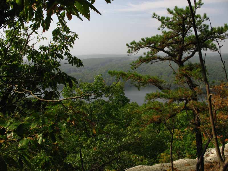
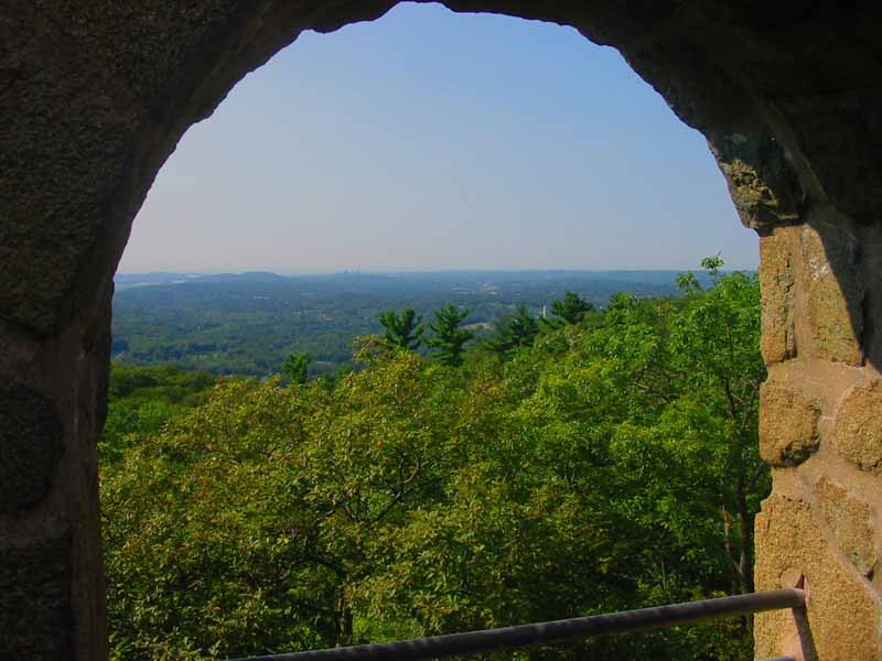
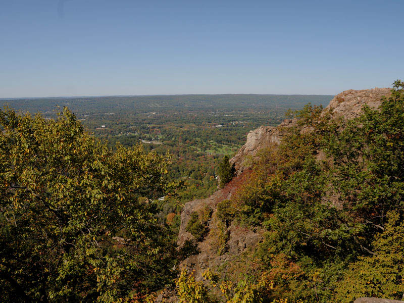
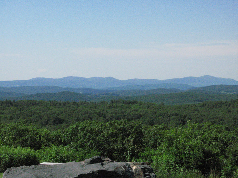
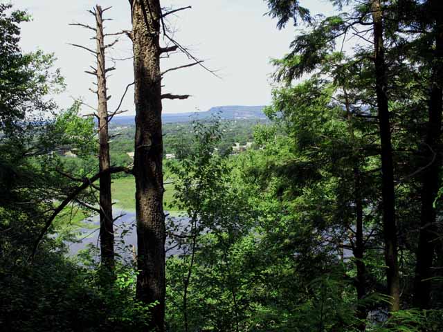
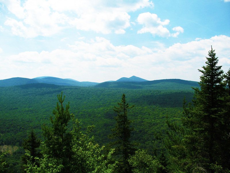
Panoramic View
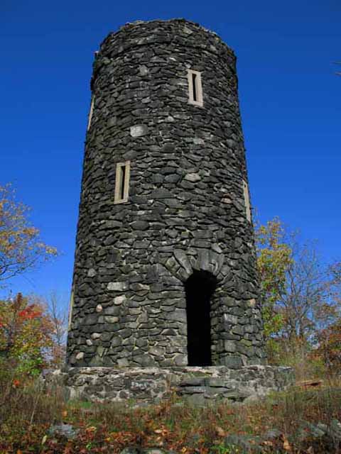
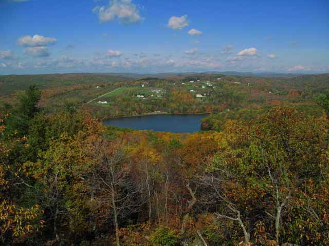
The 34 foot high stone tower at the summit of Haystack Mountain 1716 feet above sea level allows visitors to see Long Island Sound, the Berkshires, and peaks in Massachusetts and New York.
Entrance Plaque
Plaque reads
ROBBINS BATTELL
DEO
PATRIA
FAMILIAE
MUNICIPO TUO
SIMPER ESTO FIDELIS
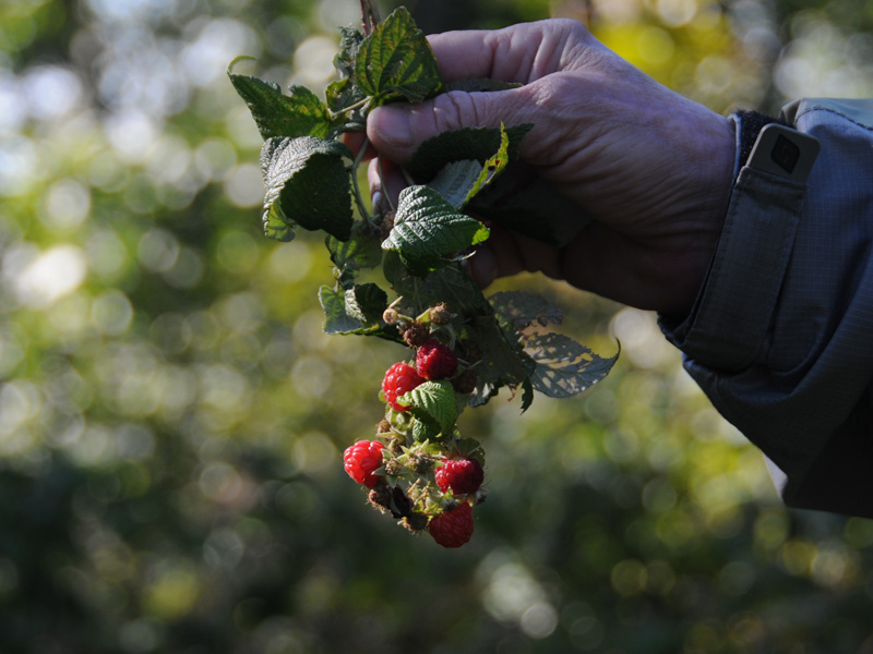
fall rasberries
This is the first time I have seen rasberries in the fall. Very sweet...
Haystack Mountain Tower
This is the 34-foot high gray stone observation tower constructed of rock quarried from the mountain as part of a Works Projects Administration project during the Great Depression. The top of the tower allows visitors to see Long Island Sound, the Berkshires, and peaks in Massachusetts and New York.
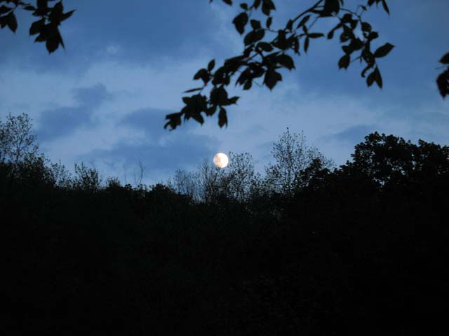
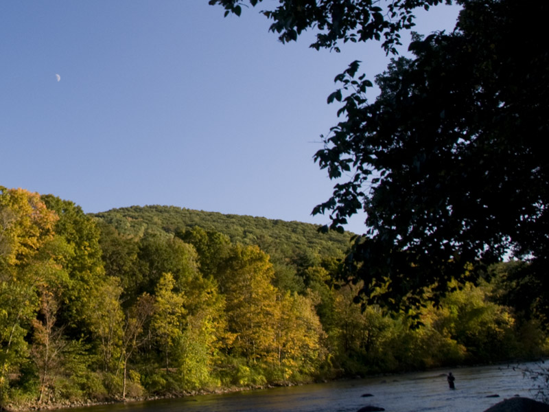
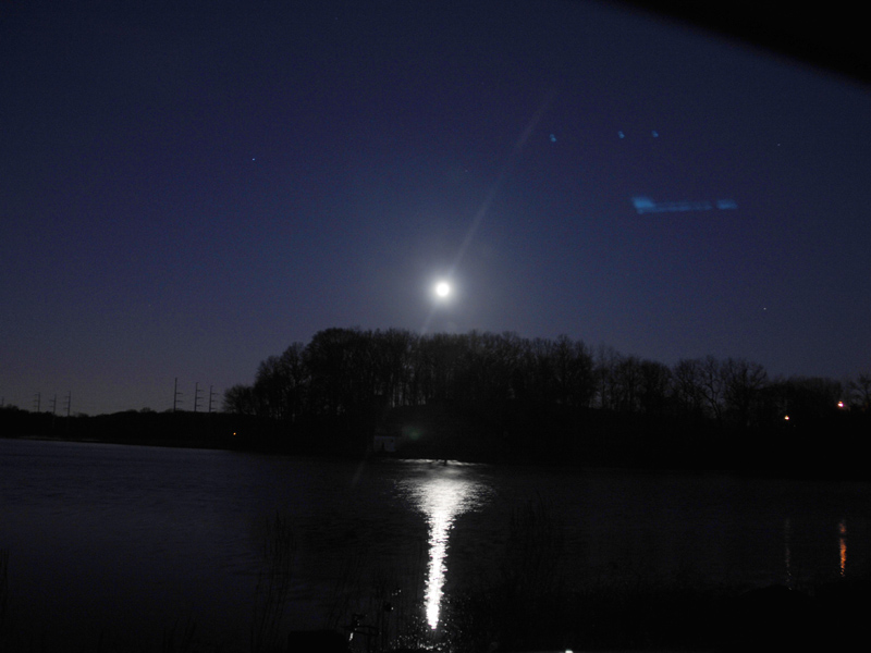
Tranquil Moon
This shot of the moon was captured looking east across the Housatonic River from the campground.
Moon Before Dusk
Notice the fly fisherman in the river.
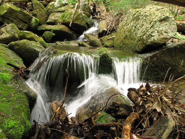
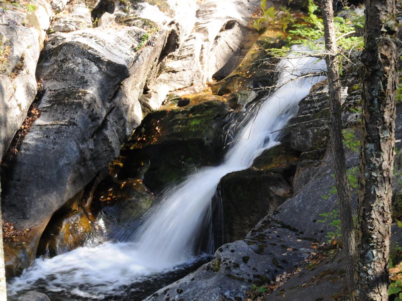
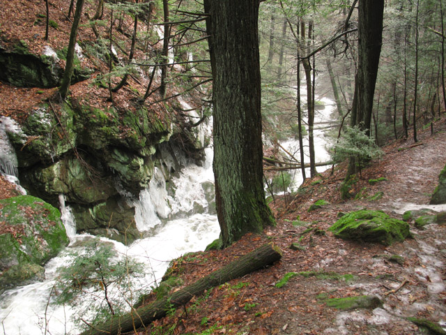
Hatch Brook Falls
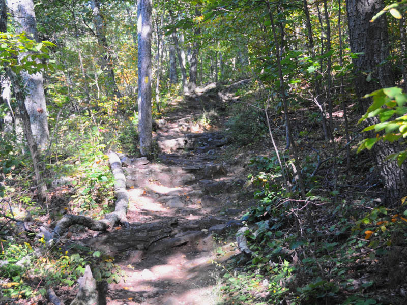
Hatch Brook Falls is short drive north of Housatonic Meadows Campground. Park and take the blue blazed trail next to the cascading brook. The Appalachian Trail intersects the Blue Trail at the top of this hike.
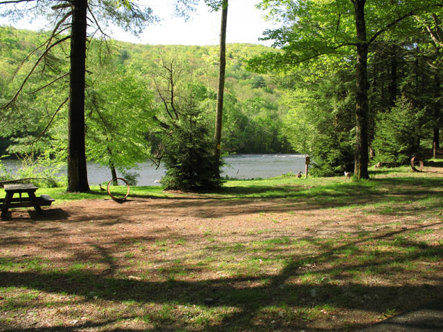
Campground
This photograph gives you an idea of how close the campground is to the Housatonic River.
Campground site 24
This site 24 is about 30' from the Housatonic River.
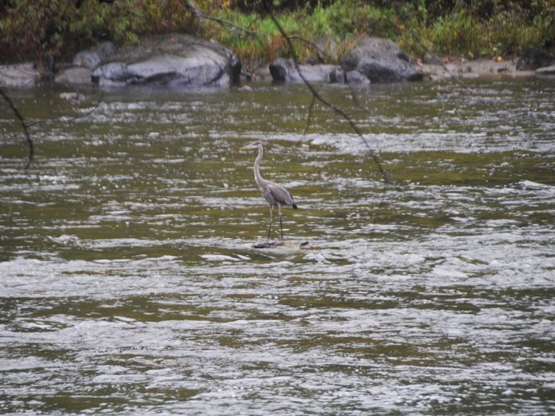
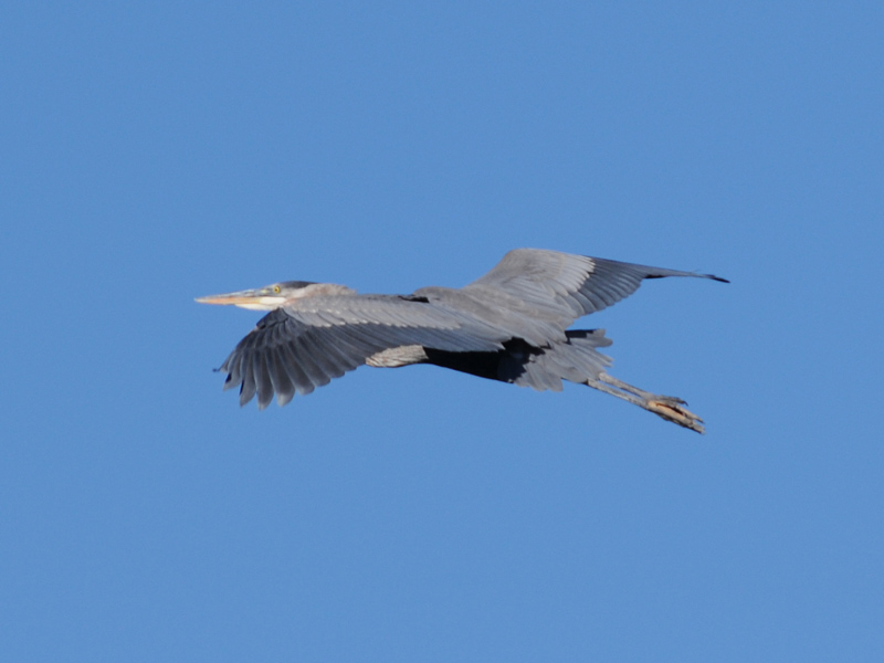
Great Blue Heron in Flight
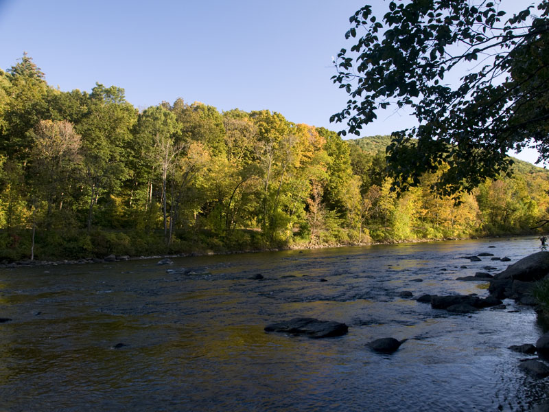
Housatonic River
This was taken at the Housatonic Meadows Campground.
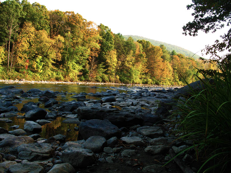
Housatonic River
Lowest water level in many years.
Housatonic River
The lowest level seen in years due to the draught in 2010 according to the local residents.
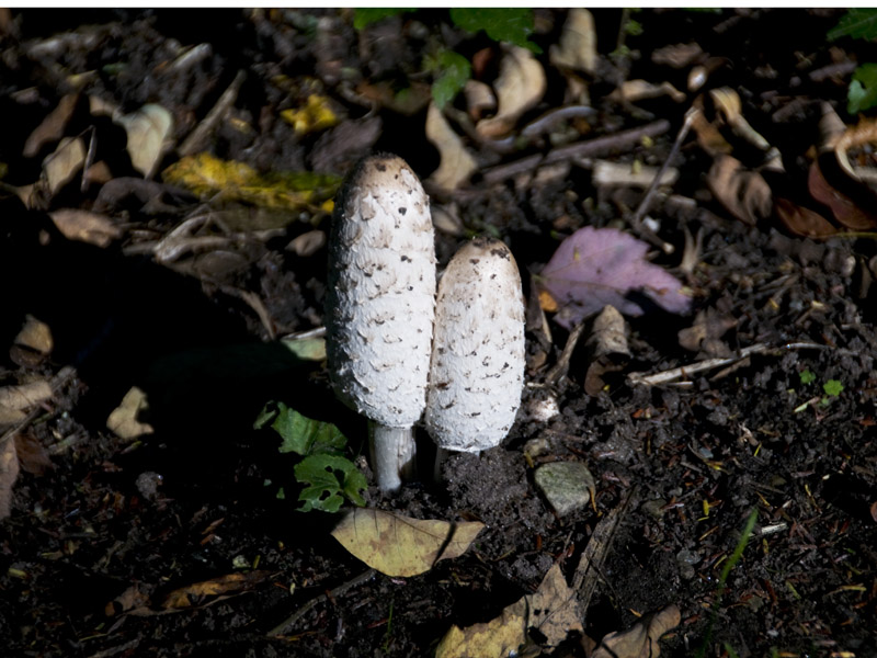
Shaggy Mane Mushrooms
A pleasant sight when we drove to our camping spot were these shaggy mane mushrooms. We harvest and eat mushrooms through the warm months and these are listed as edible choice in our bookreference Mushrooms Of North America by Orson K. Miller, sixth printing 1984.
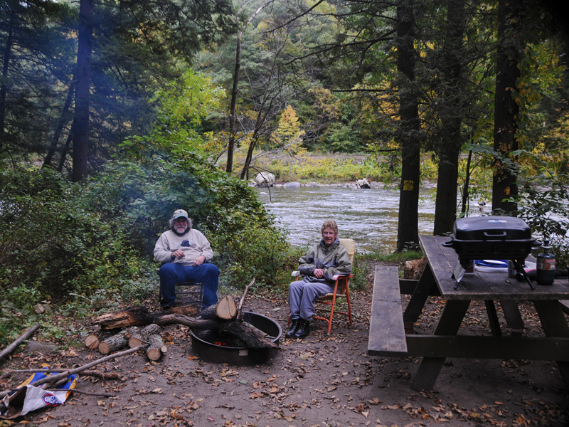
Tranquil on the River
Our camping spot was about 30 feet from rivers edge as show here.
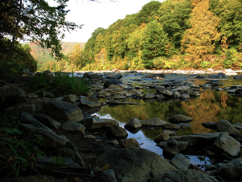
Housatonic River
The Housatonic River runs right next to this camping Park.
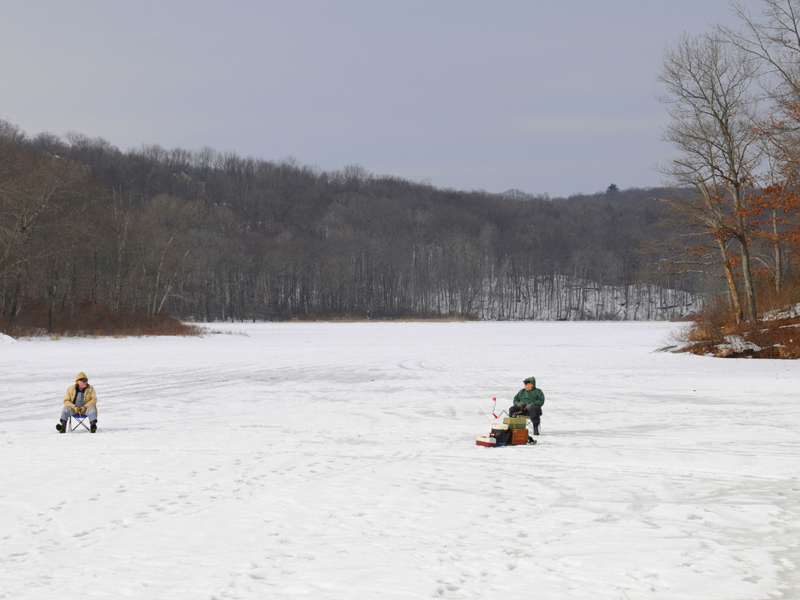
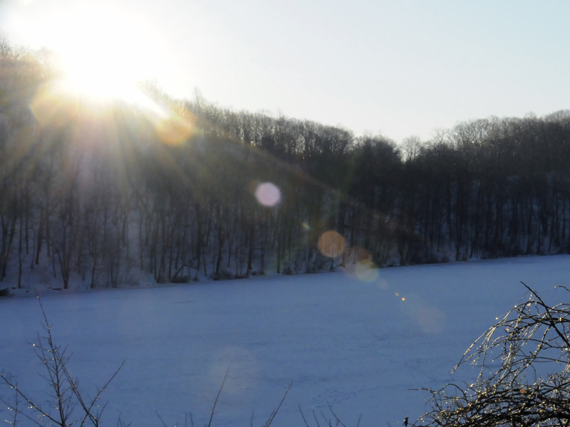
Ice Fishing
On Northfield Lake, in Humaston State Park, we found two gentlemen ice fishing.
Huntington State Park
Take a nice leisurely stroll on one of the many trails encompassing a well maintained Park. This is a beautiful place to rest and view Huntington Pond.
Perspective View
A view walking down one road in the Park.
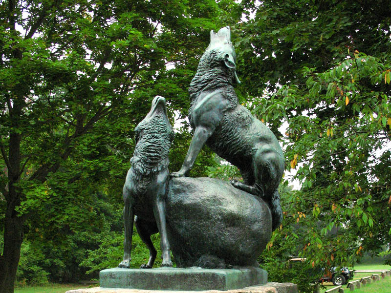
Wolves Sculpture
The Anna Hyatt Huntington sculpture of wolves welcome visitors at the park entrance.
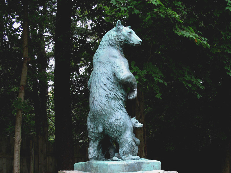
Bear Sculpture
The Anna Hyatt Huntington sculpture of bears welcome visitors at the park entrance.
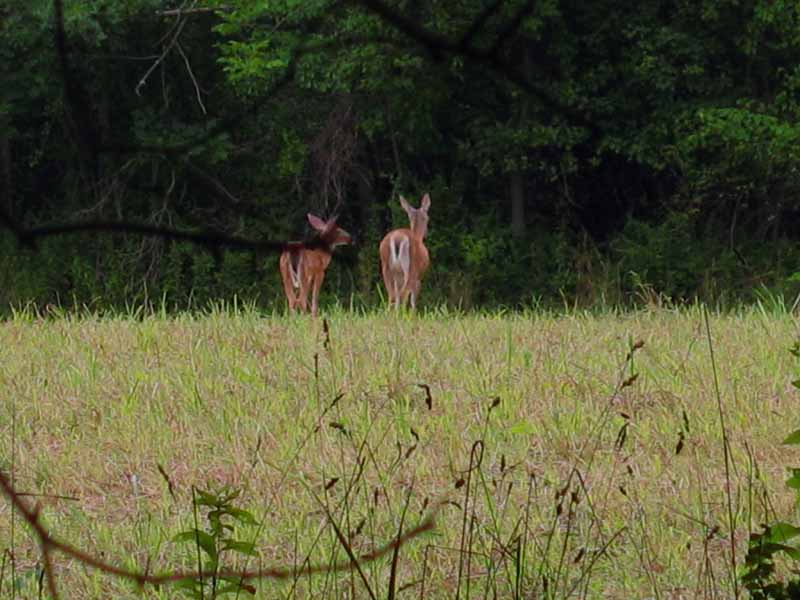
Park Friends
Two friends of the park strolling back to the woods.
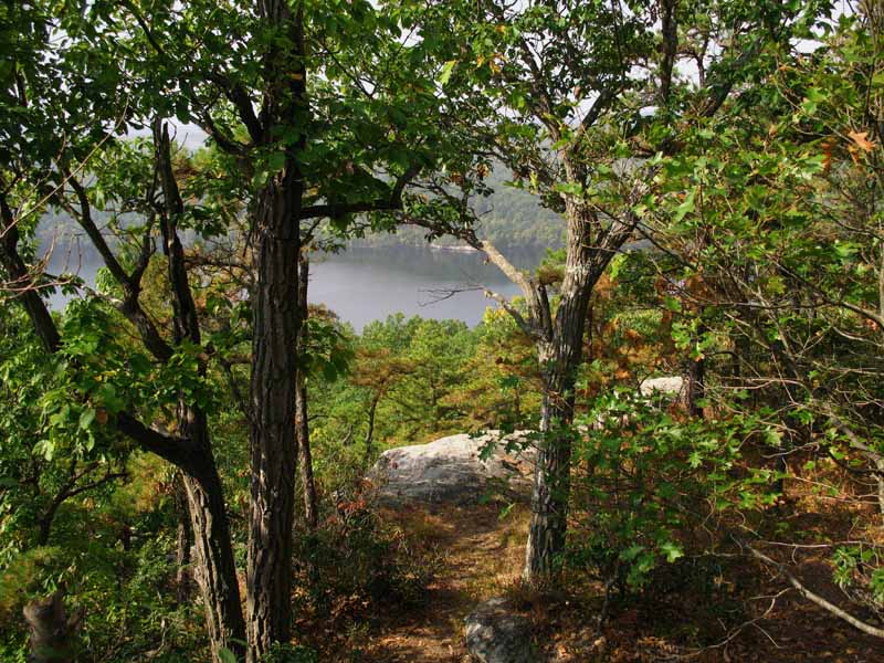
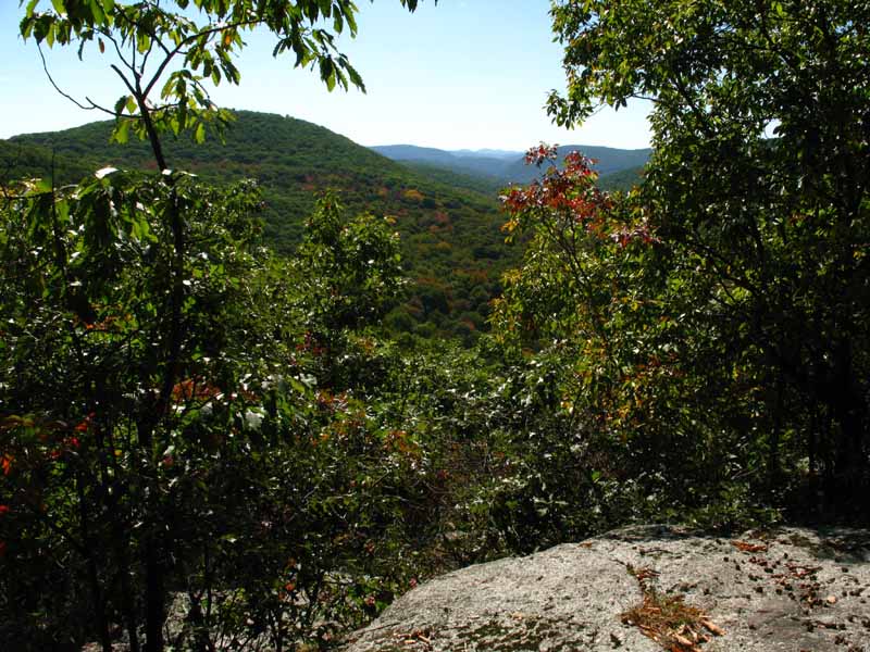
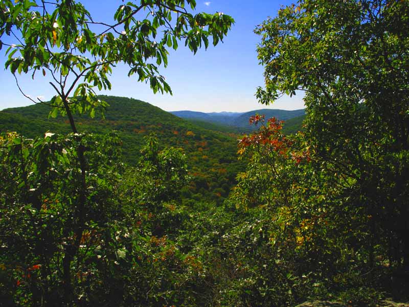
Split Rock Outlook
View from Split Rock
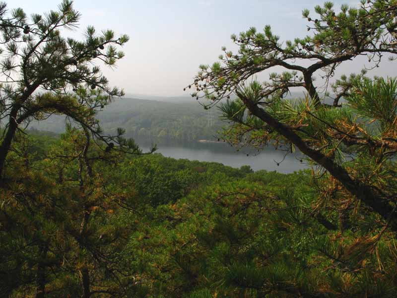
Split Rock Outlook
View from Split Rock
Split Rock Outlook
View from Split Rock
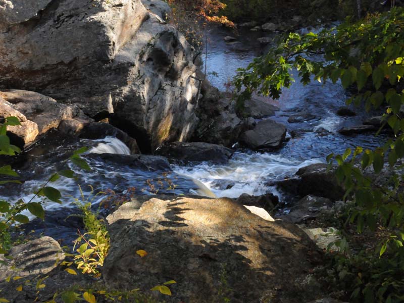
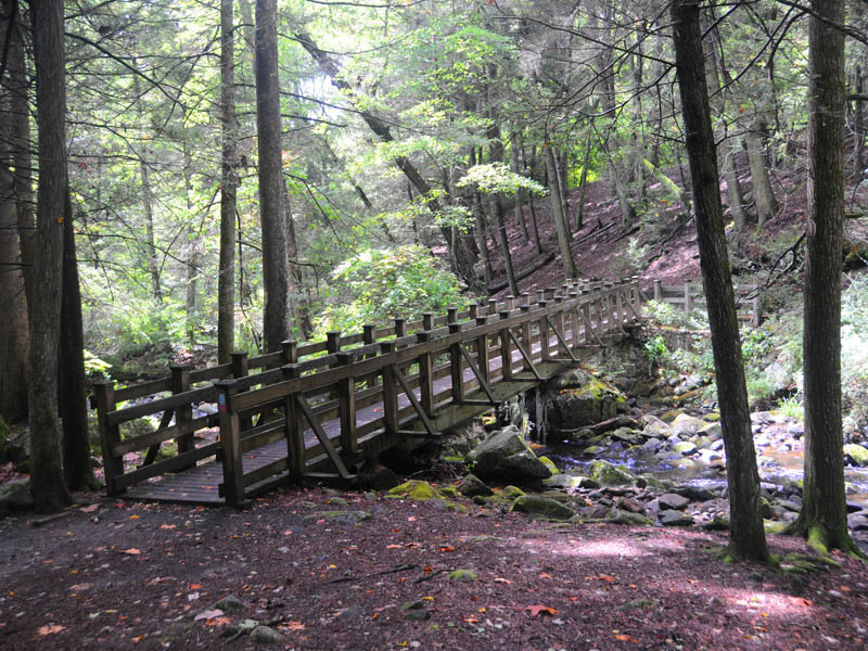
Old Rock Bridge
A rock bridge is located downstream from Indian Well Falls.
Peek of Sunlight
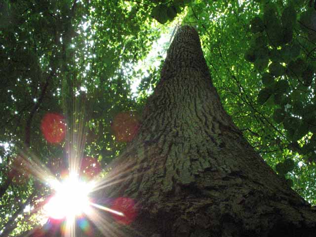
One of the many tall trees that grace this Park.
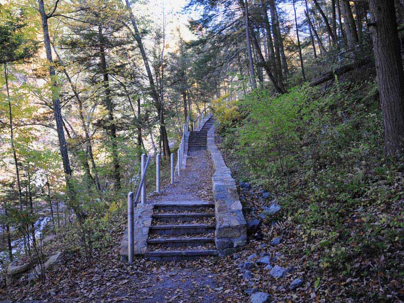
Staircase-Walkway
The park has constructed a staircase-walkway to assist in the climb to the top of the falls.
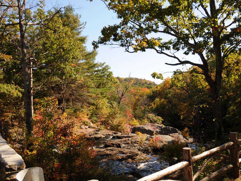
Parking Lot View
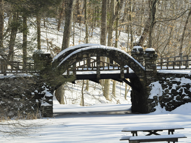
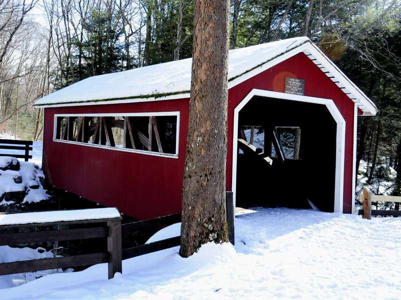
Two pedestrian bridges cross the brook that comes from the falls. The covered bridge can be seen to the far left of this photograph.
Cascades
Kent Falls is a series of cascades comming down the mountain. Pictured here are two.
Upper Cascade
This is one of the last cascades you will see as you make it to the top of the falls via a staircase-walkway.
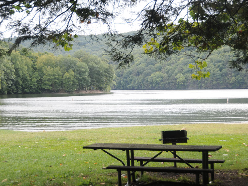
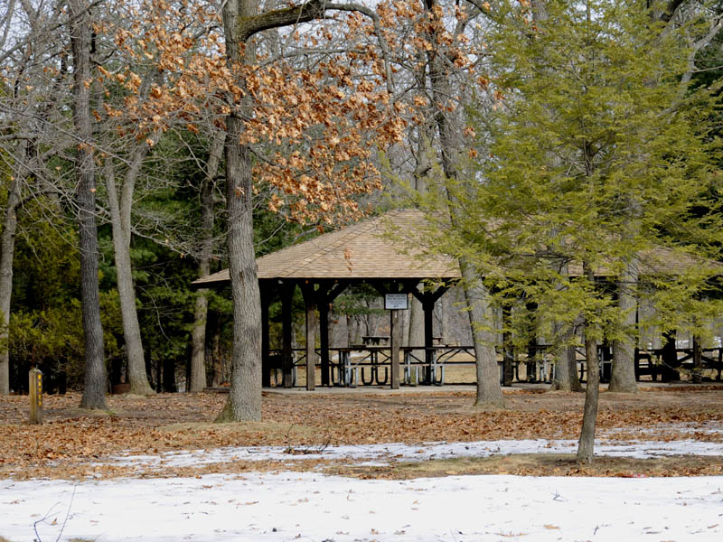
Picnic Area
There are many picnic tables and grills to use within the State Park.
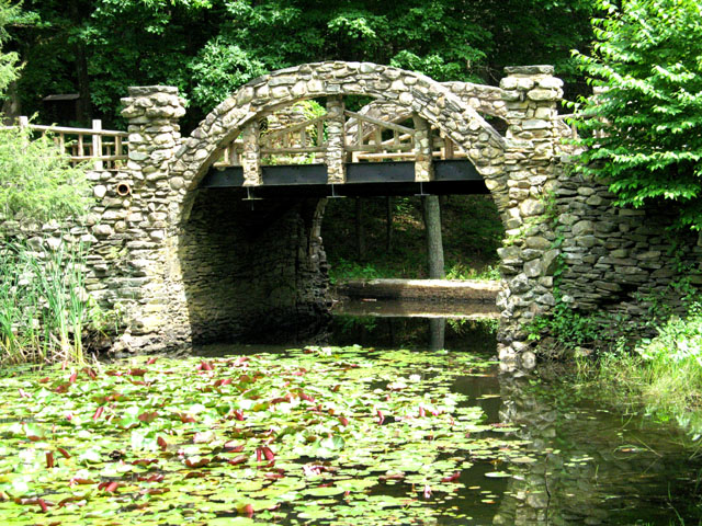
Walking Bridge
The Park hosts a boardwalk along part of the Zoar River.
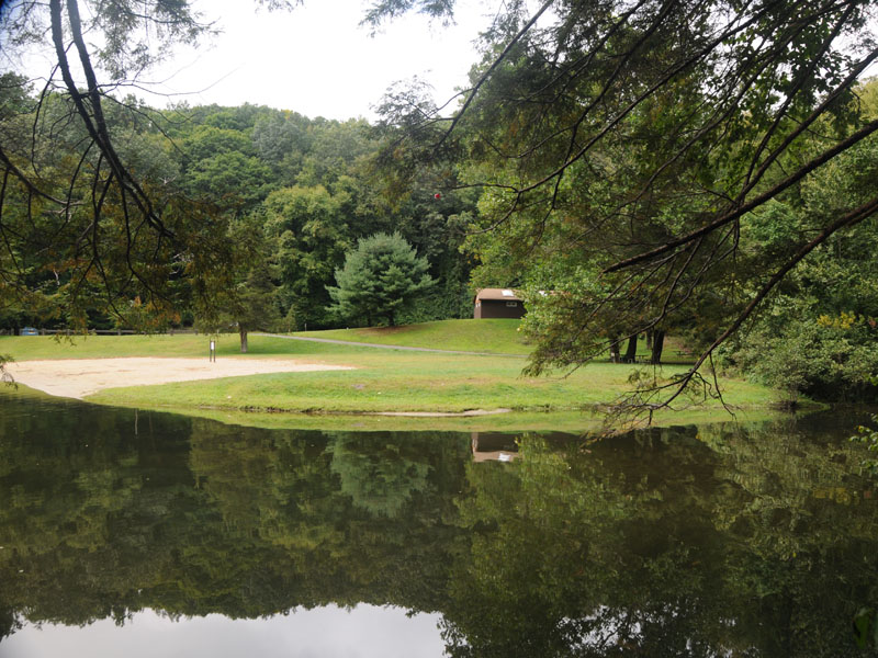
Swimming Area
This is the swimming area and facility building.
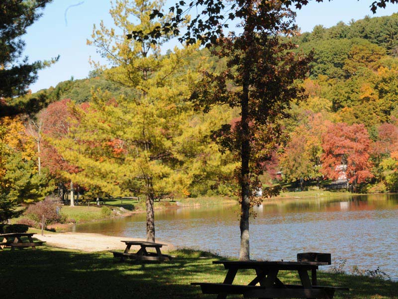
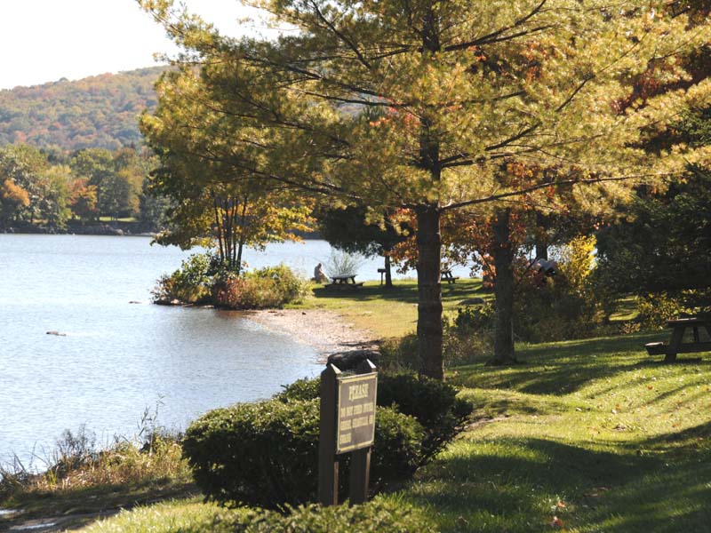
Lake Waramaug III
There are plenty of picnic tables scattered by the shore for use during the year.
Park Bridge
A walkway bridge crosses the brook and leads to Cobble Mountain.
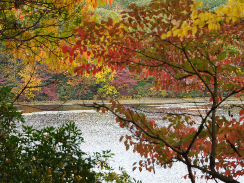
Suns Light
Autumn colors seen as the sun peaks through.
Fall Colors I
Maple trees in dynamic fall beauty.
Macedonia State Park
Lake on the North End of Park
Prespective with Colors
From a lookout point in the park
Fall Colors
Lake on the North End of Park
Campgrounds
Our campsite was 51. This is a picture taken from our campsite looking at 49 50.
Pine Hill Lookout
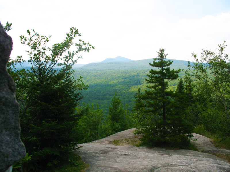
A steep climb to the peak reveals great views from this lookout point. approx. 1,400 feet
Pine Hill Lookout
A steep climb to the peak reveals great views from this lookout point. approx. 1,400 feet
Campground Brook
A small brook runs through the campgrounds.
Bridge Over Brook
This spot across the foot bridge is a great place to have a picnic.
Remains of Old Iron Works
Remains of the Kent Iron Company's second forge, a stamping works, are still visible at the southern end of the park.circa mid- 1800's
Millers Pond I
Launch your canoe and be the first to disturb the water on a quiet day.
Millers Pond II
Canoes are a method of transport used to tour the lake.
Path Leading Out
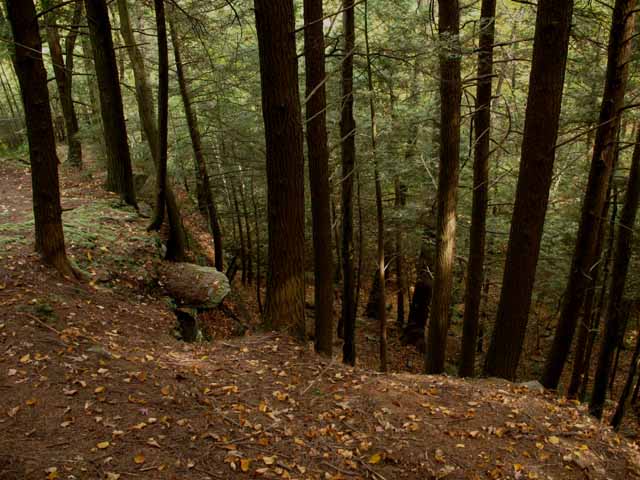
This State Park is hard to find because nothing is marked. This is probably true because there is private land that runs on one side of this path and on the other side is state land.
Path
As you see here this rock wall is man made. Much work was put into building this road, but the state has all but abandoned any maintenance efforts as of late.
Mount Bushnell State Park
The foliage is superb in the fall.
Path
The left side of the path is state land the right side is private.
Lake Waramaug View
At this point you have climbed high enough to see Lake Waramaug through the trees.
Camp Sepunkums Remains
There is a trail that loops around to the Tower and back. At one point in this loop are the remains of an old assembly hall that housed the Waterbury Boy Scouts between 1916 and 1934. All that is left is a stone fireplace and some foundations.
Looking Down
This picture is taken looking straight down from the top of the tower.
Mount Toms Tower
At the top of Mount Tom stands an old lookout tower built in 1921.
View From Mount Toms Tower
Climb to the top of Mount Tom's Tower and enjoy a 360 view. On a clear day you can see Massachusetts and Long Island Sound.
Remnants
We found what might have been the foundation of The Old Furnace. Other remnants include rock walls that are common in Connecticut.
Facilities
There is a rock wall that borders part of the lake.
Gaggle
There were many geese during our visit.
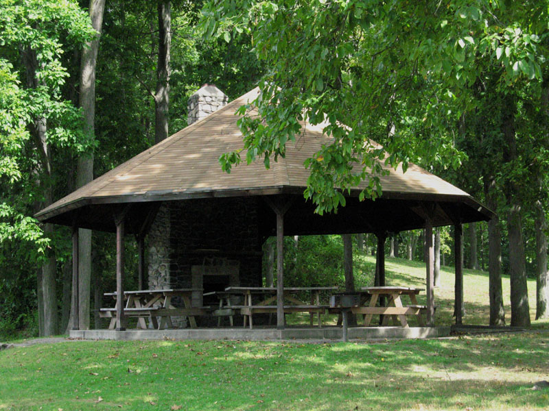
The Pavillion
This pavillion has a fireplace.
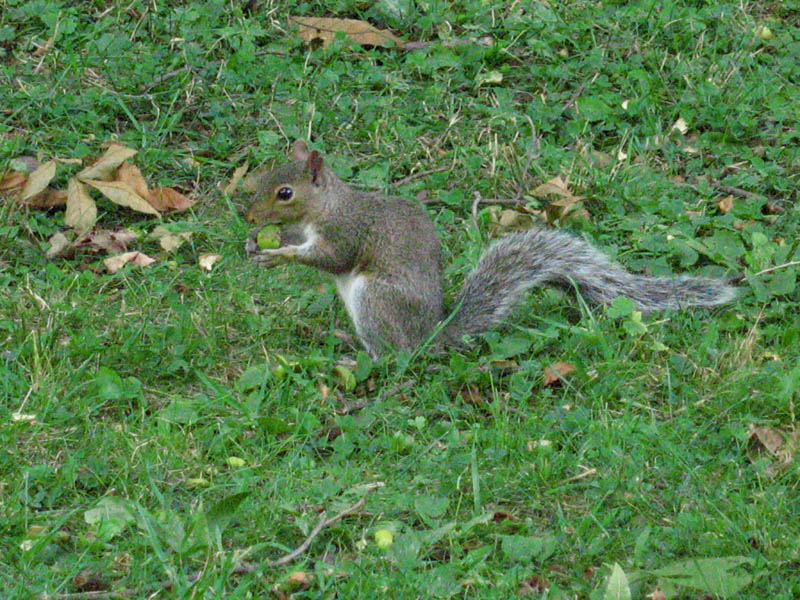
Grey Squirrel
Grey Squirrels frolic throughout the park.
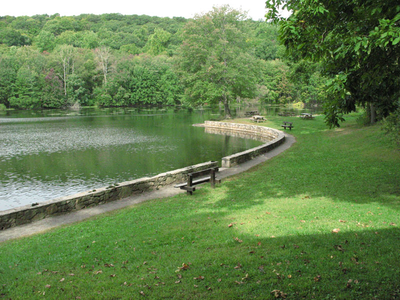
Lakeshore
There are many picnic tables and benches for visitors to use.
Interior/Officers Quarters
Museum
Fireplace inside the Museum
Museum
This Museum contains exhibits and historical material from the Redding encampment.
Guard House
Re-created Guard House.
Ghosts of Houses
Putnum's soldiers built winter houses, completed in a span of just two weeks. All that remains now are piles of stones that once served as their fireplaces.
Officers Quarters
Site of Officers Quarters. This structure was built upon an earlier foundation believed to have originated with the encampment.
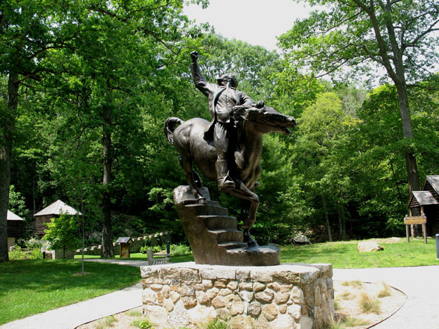
Israel Putnam
Sculpture by Anna Hyatt Huntington finished when she was 93 years old.
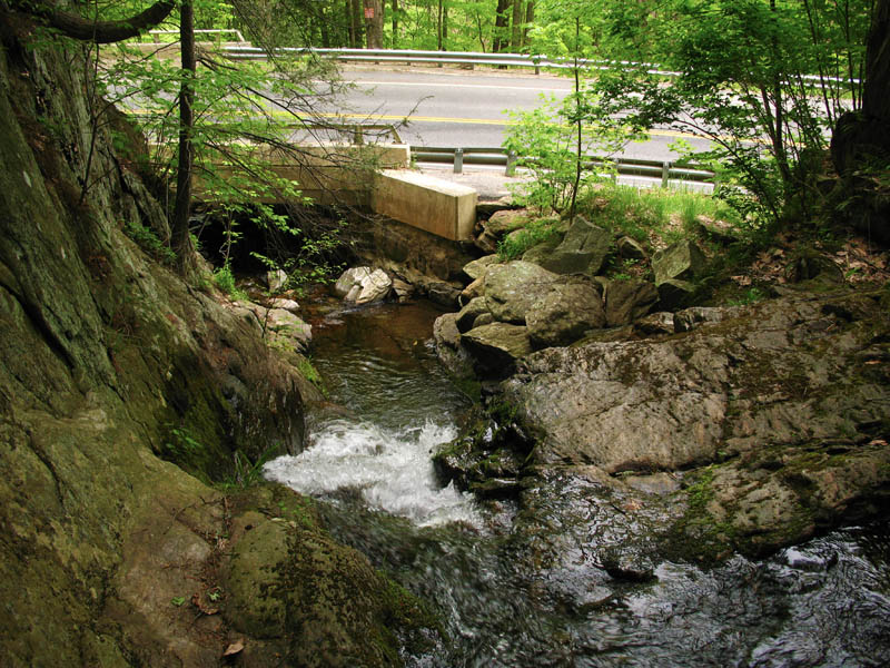
River Trail
This wide trail is probally what is left over from a railroad line that ran along-side the river.
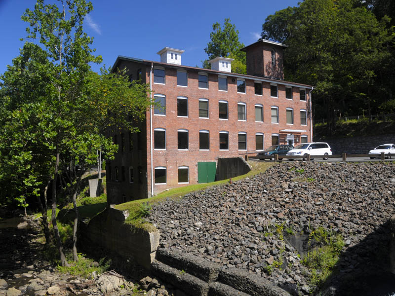
Old Rubber Factory
The history of this area is quite interesting particularly since this factory is in quite good shape. This is one of two multi-story brick buildings that remain today. The other was a mill, 2 miles from this factory.
1890 Iron Bridge
Old iron bridge runs across stream bordering park. Plaque on bridge reads
BUILT 1890 BY DEAN WESTBROOK
BRIDGE ENGINEERS N.Y.
SELECTMEN
W.H. GLOVER. J. GREEN.
C.WINTON.
CLERK M.J. HOULUHAN
The steel used is stamped
PHONIX IRON CO.
PHILAD P.A.
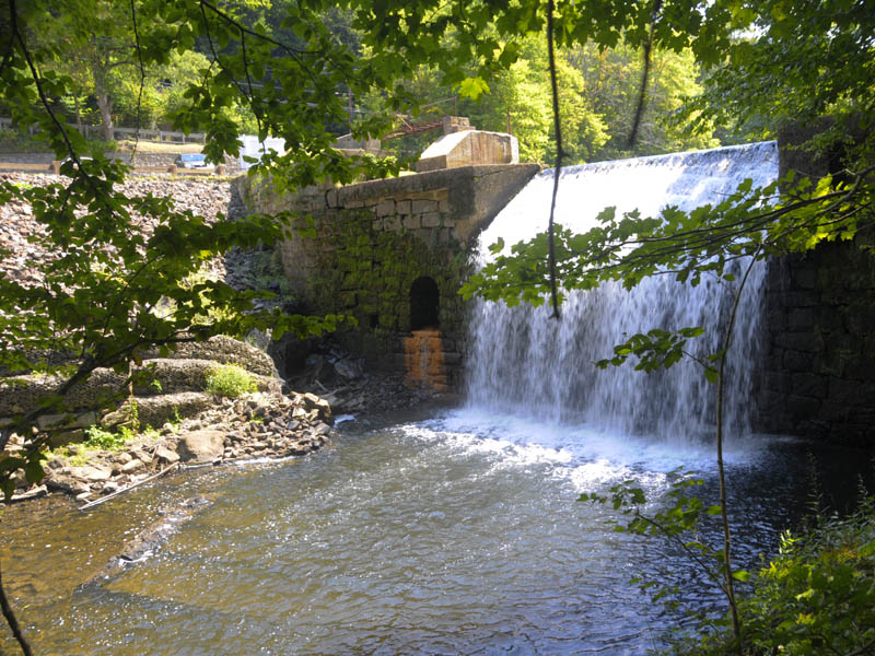
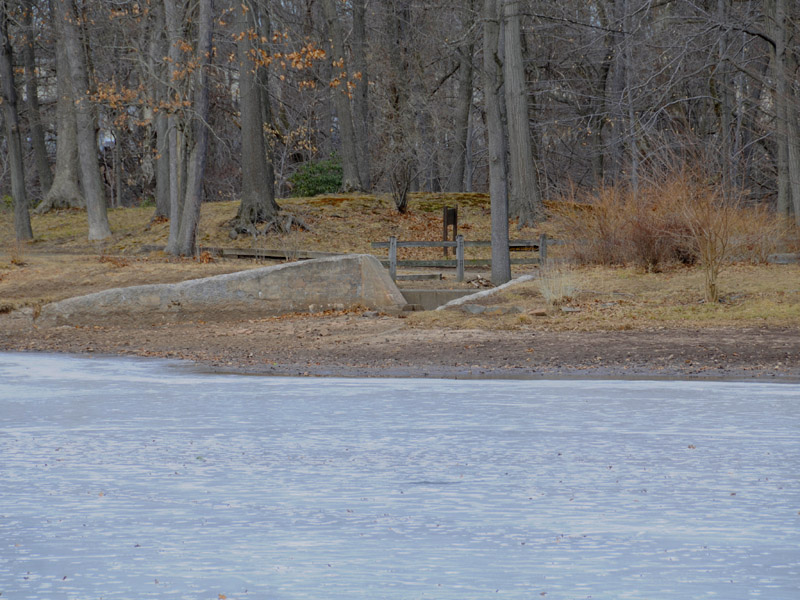
Spillway
From the path that runs by the stream can be seen an old spillway. In 1839, Charles Goodyear discovered the process for vulcanizing rubber at a shop in Sandy Hook which gave rise to the American rubber industry and lead to the establishment of a rubber factory in Rocky Glen. There was a plaque at the park that said the Irish workers lived on the side of the river that the park is on and crossed over the old iron bridge to work at the rubber factory.
Lookout Tower
This is the Lookout Tower atop Mount Carmel.
Inside Tower
This photo was taken on the first floor of the Tower. You can picnic on the table but I think use of the fireplace is prohibited.
From the Window
A view from the massive four-story stone observation lookout tower atop Mount Carmel.
Sleeping Giant State Park
A majestic cliff is seen as you hike from the main entrance towards the tower.
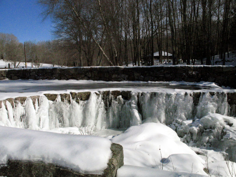
Spillway
Upper part of the falls spillway.
Covered Bridge
This is the covered bridge below the main falls.
Winter Spillway
The spillway freezes over during the winter.
Parking Dock
There is ample parking and a dock.
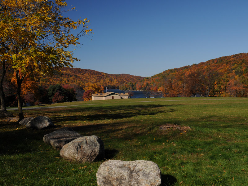
Fall Colors
This is at the south end of the lake.
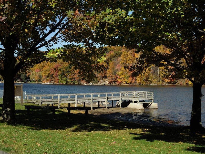
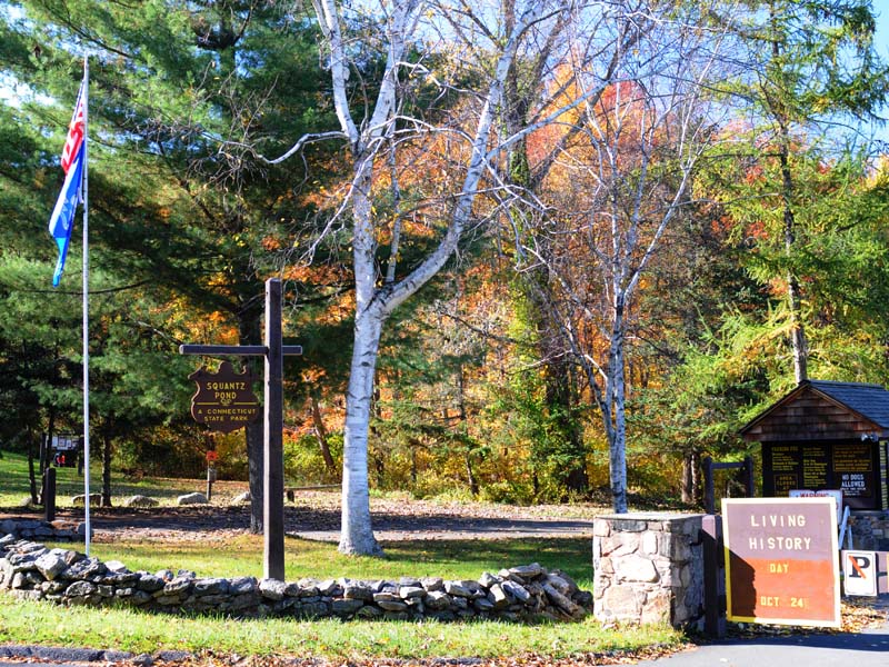
Squantz Pond State Park Dock
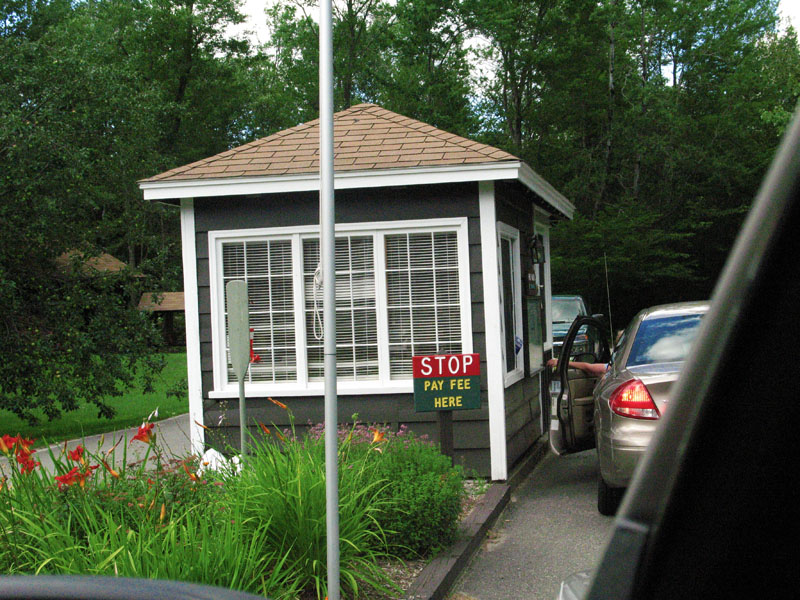
Squantz Pond State Park Pay Booth
All Dryed Up
This is what Wadsworth Upper Falls looks like with no water. It's an interesting study of Connecticut geology. These rocks statred forming about 200 million years ago.
Wadsworth Upper Falls
The Upper Falls is a bit of a hike and somewhat treacherous in the winter, but worth the venture if you enjoy viewing waterfalls in the winter.
Wadsworth Lower Falls Falls
Wadsworth Big Falls
is only a shortwalk from the main parking area.
Lookout II
A vantage point to view the surrounding area.
Lookout I
This is one of the many lookouts that can be viewed as you hike along the cliff ledge.
Pavilion
The pavillion provides shelter, grills and an area for picnics in the spring, summer and fall months.
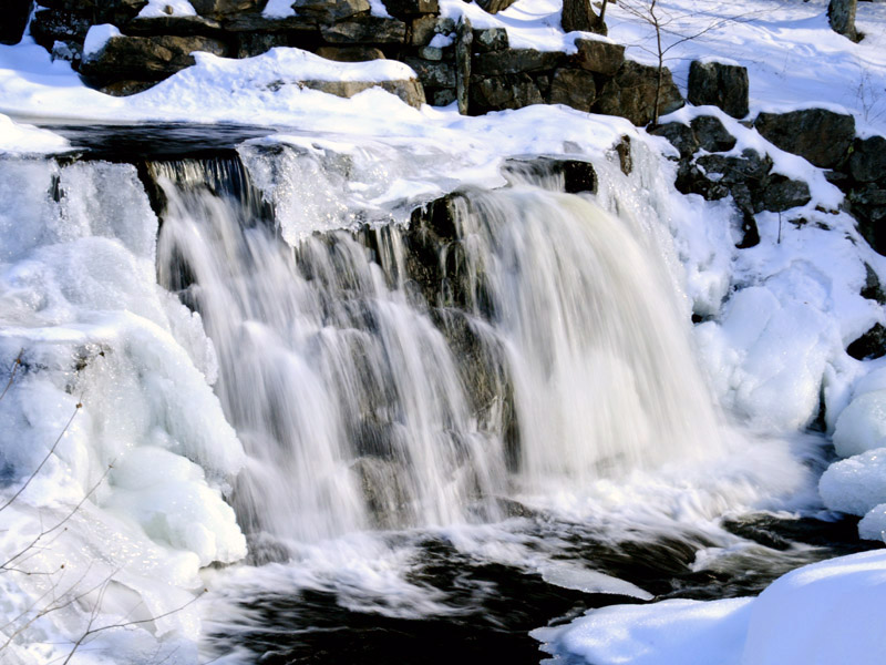
Spillway
This is the summer spillway. In the summer it provides the lake it's maxium depth.
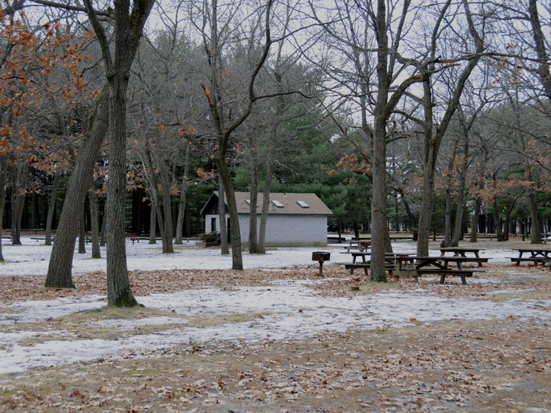
Park Facilities
Closed in the winter.
Wharton Brook fed Lake
This small lake privides a swimming area in the summer months. Wharton Brook State Park is a designated Trout Park.
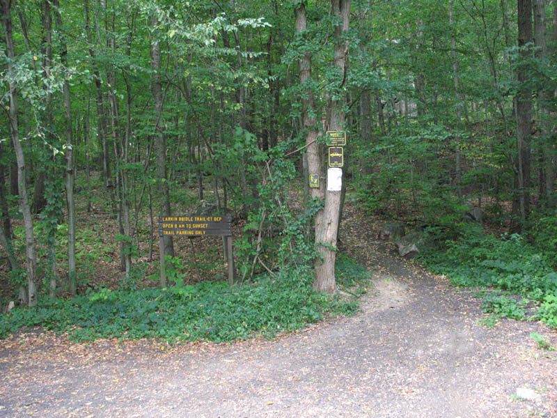
Parking Area
This is the parking area and trail-head entrance to the park. Also known as the Larkin Bridle Trail.
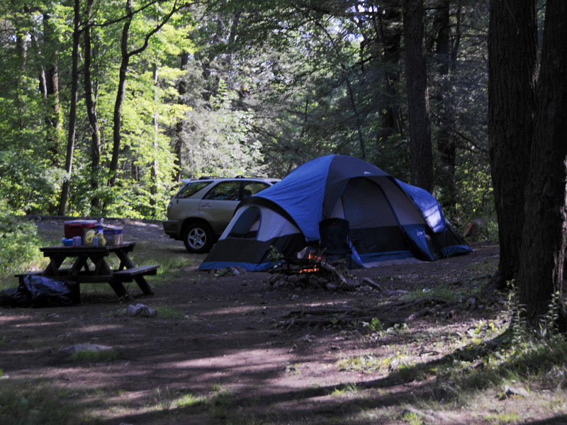
Austin F. Hawes Campground
This campgrounds is next to the Farmington River. There are plenty of trees and trails to hike right out your tent or camper door.
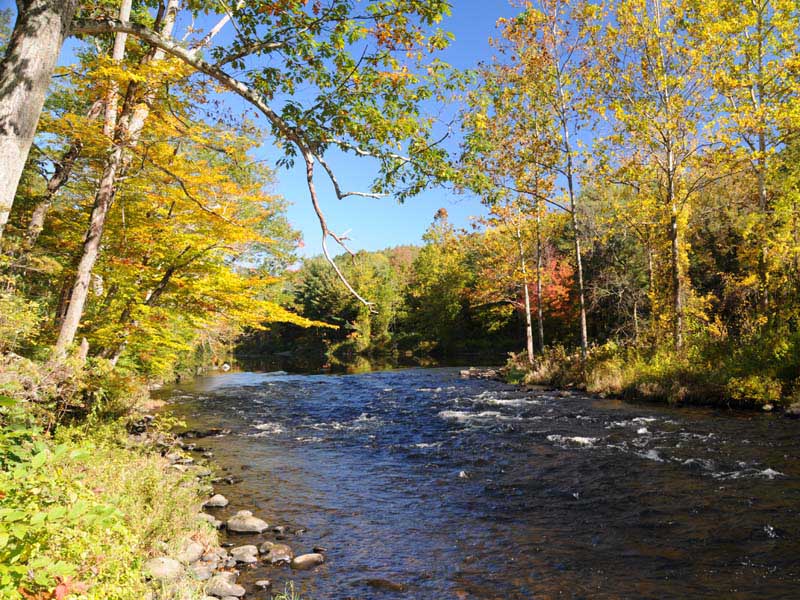
Farmington River II
Mother Nature is very well preserved along shores of the river in this area.
Farmington River I
Fishing for trout is a favored sport here.
Austin F. Hawes Campground
Bathrooms and showers make this campground a very civil place to stay.
Farmington River II
Remants of old bridge
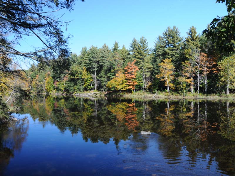
Cockaponset State Forest
A mirrored reflection when the fall colors were at their peak.
Cockaponset State Forest
Pattaconk Lake is the background drop in this picture.
Cockaponset State Forest
Cockaponset is the second largest State Forest in Connecticut. In this photograph, foreground colors againest background colors make their own fall statement.
Cockaponset State Forest
Trees actually leaning over to display their color.
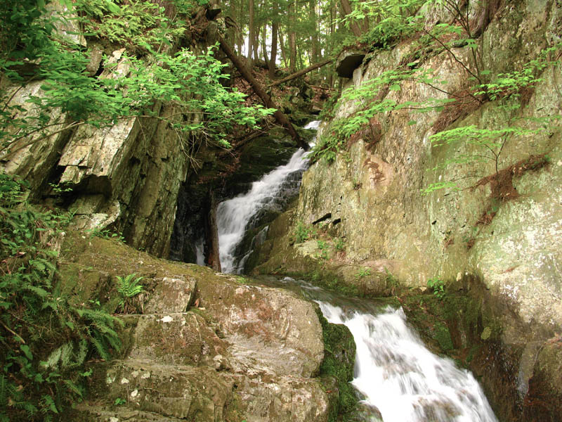
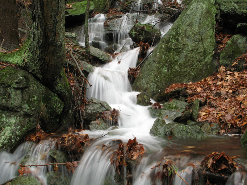
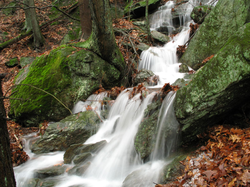
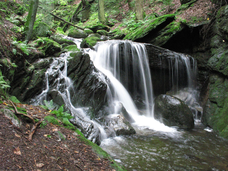
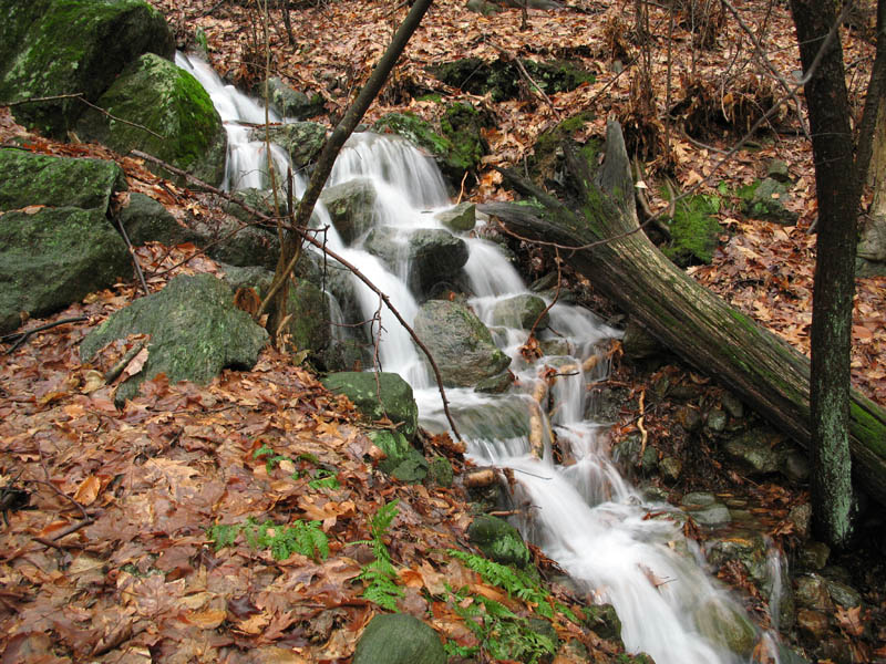
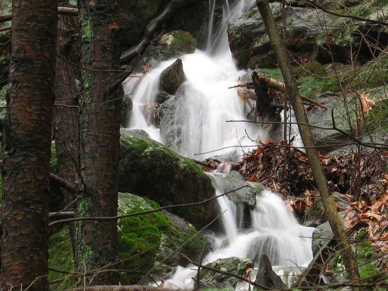
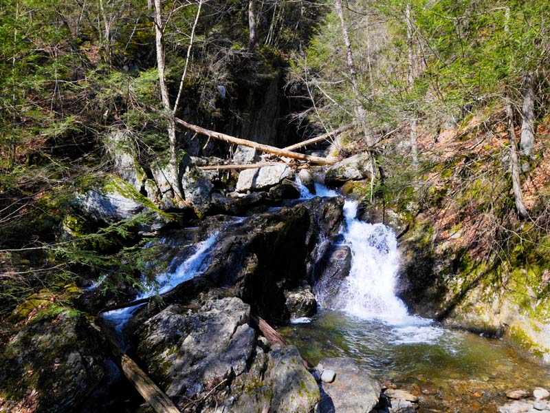
Pine Swamp Brook Waterfalls
Pine Swamp Brook Waterfalls
Pine Swamp Brook Waterfalls
Cunningham Tower
Ground level tile floor and fireplace
Cunningham Tower
This is the remains of the stairway going up to the second floor. Notice the handrail. Beams supported the original floors.
Cunningham Tower
What remains of the original stairway going up to the first story. Notice the hand rail bolted to the wall.
Cunningham Tower
Entrance doorway
Cummingham Tower
Entrance Stairway
From Lookout Tower
Climb the lookout tower at the top of Mohawk for a panoramic view. UPDATE The observation tower no longer exists.
Old Tower Remains
Visit what remains of the old Cummingham Tower.
Lookout Tower
Climb at your own risk to get an expansive view of the surrounding area.
UPDATE The Observation Tower was torn down. Nothing is left but the foundation mounts.
Majastery in Mountains
Summer photograph at one lookout in the park.
Upper Spruce Brook Falls High Rock
Chaugham Lookout
This is a splendid view overlooking the Farmington river.
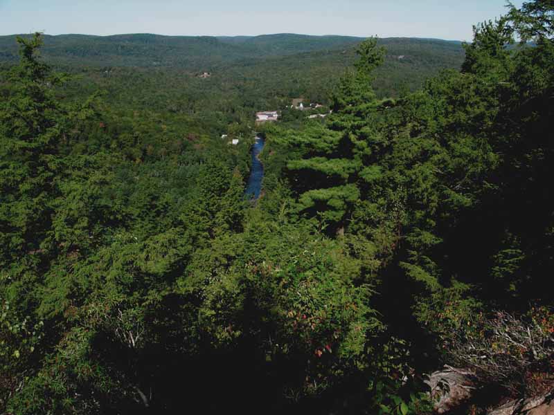
Big Springs
The park is littered with recreation areas giving everyone the chance to come and enjoy themselves, be it hiking, picnicing, or just to enjoy nature.
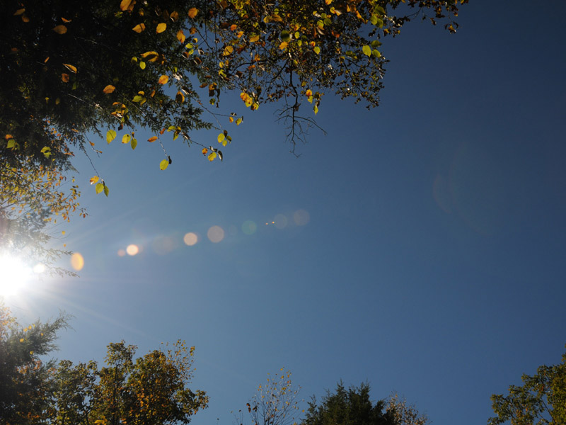
Skyward Gaze
A view looking straight upward.
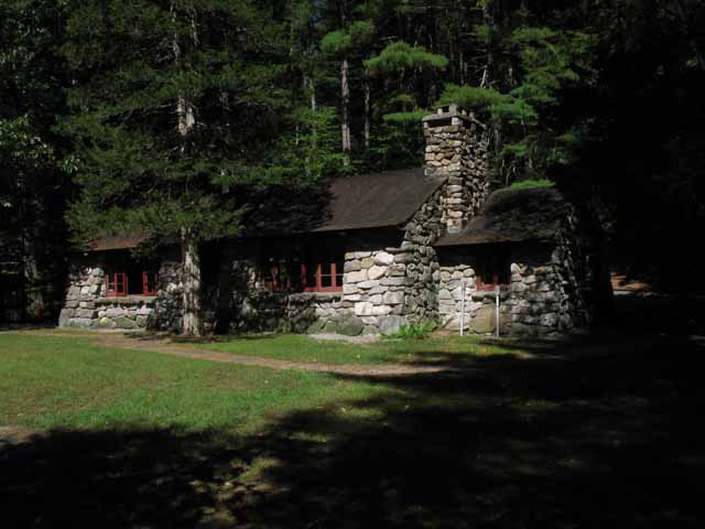
The Stone Museum
This Museum was built in 1934 by the Civilian Conservation Corps CCC. Old rock walls from the area were used in the construction of the outside walls and the fireplace. The interior woodwork is American Chestnut taken from trees killed in a local blight.
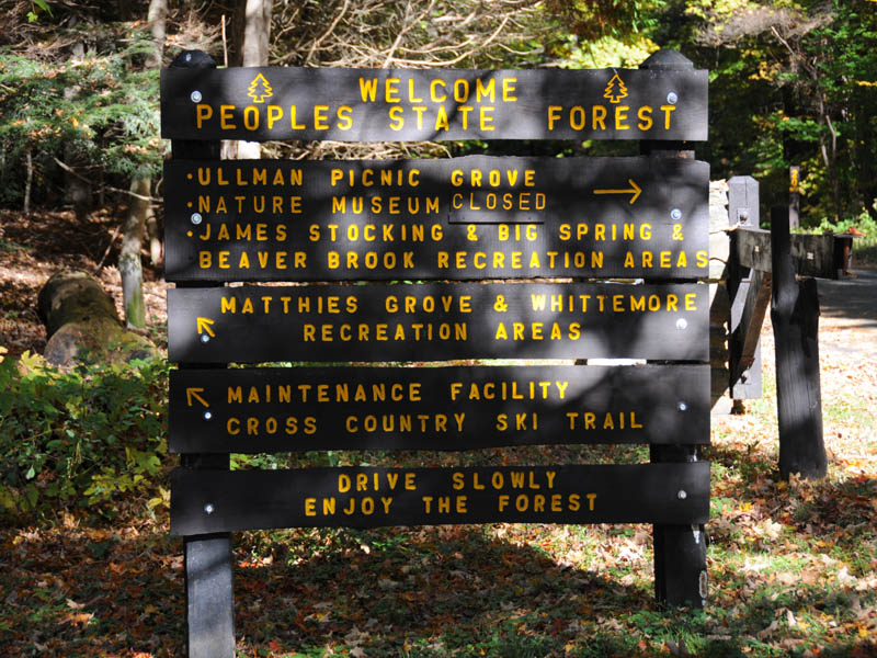
Information Sign
The sign tells of the many diverse activities available at this state park.
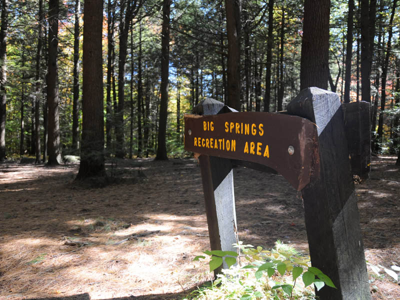
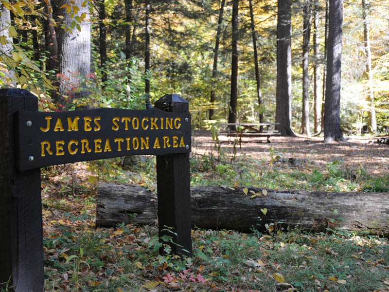
John Stocking Recreation Area
This area is desginated as a picnic area for the public
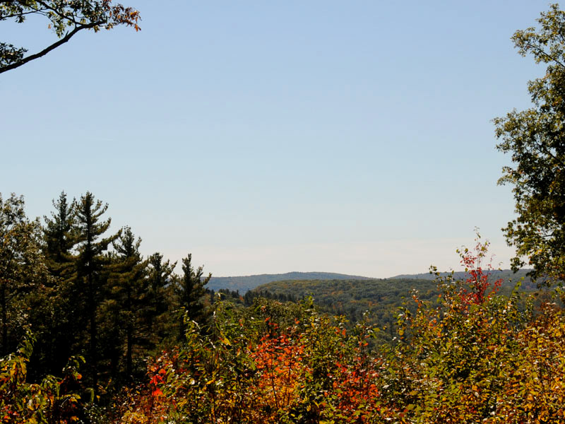
Scenic Overlook
1,000 foot climb from the Jessie Gerard Trail Yellow Starts at East River Road near the old Indian Settlement known as Barkhamsted Lighthouse.The right trail fork goes through the lighthouse site and continues northerly to the Chaugham Lookouts. The left trail fork climbs more directly to the overlooks by 299 stone steps. The views from this area are some of the best in the state. Continuing north, the trail passes between the Veeder Boulders to the picnic area on Greenwoods Road. Distance - 1.3 miles. To aviod such a climb find the trail in the middle of the park and start there. It is not well marked from the road so keep your eyes peeled.
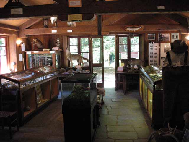
The Stone Museum inside
The museum exhibits taxidermy specimens native to the area. Other exhibits feature artifacts from Indian and colonial sites in the area. Three dioramas show events in the history of Peoples Forest.
Picnic Area
This is one of the many spots you can pull the car over and and have a picnic. It has a view of the mountains in the background.
In To Visit
Swans came over to greet us as we took their pictures.
The Grooming
Swans groom their feathers often to keep them fluffed. This allows them to stay warm and boyant.
Taking a Gander
One swan, after multiple trys, finally made it on top the ice. That however did not last too long.
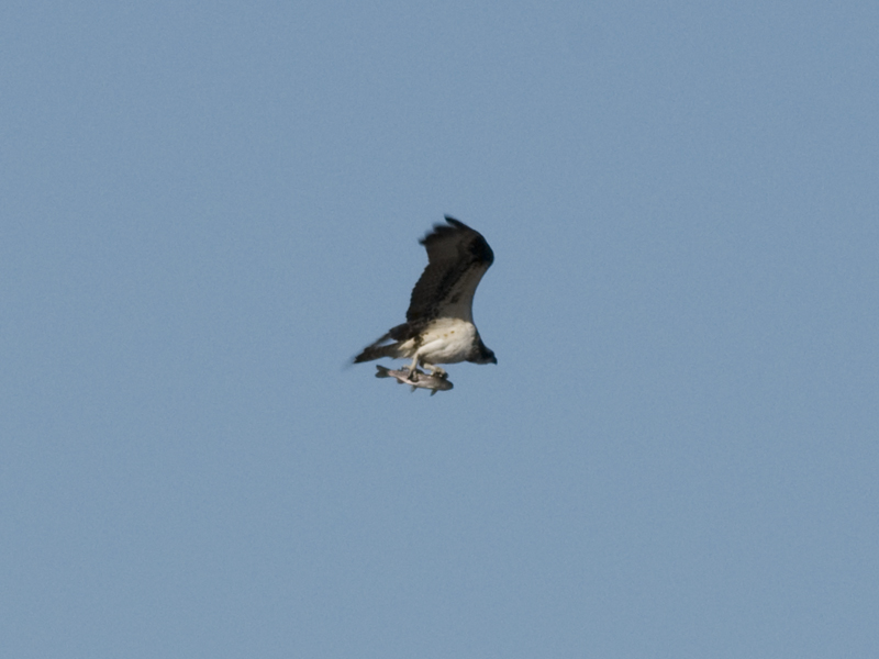
Osprey with fish
This osprey was a resident of Black Pond. In this picture he she has caught a trout to dine on.
Mute Swan geese
The mute swan is trying to chase the geese out of the area.
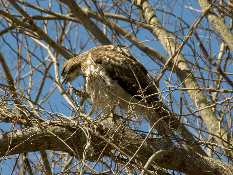
Red-tailed Hawk
This immature red-tailed hawk was pruning itself when this picture was taken. His talons show up quite well.
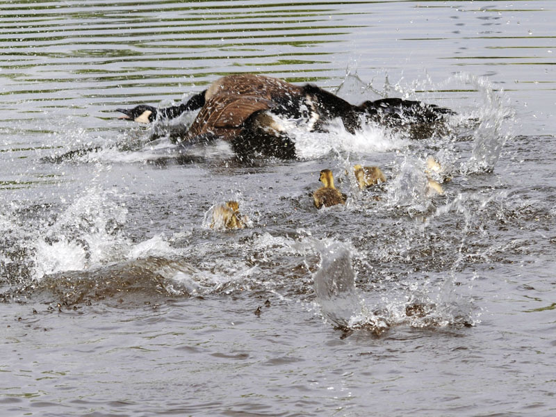
Mother Goose with siblings
This goose was showing her babies how to bathe in the pond.
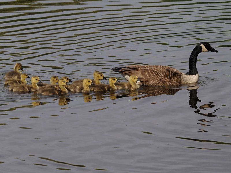
Mother Goose Brood
A parade of 11 babies follow mom in the water.
Rainy Day Fishin
There's a platform you can fish from in the parking area.
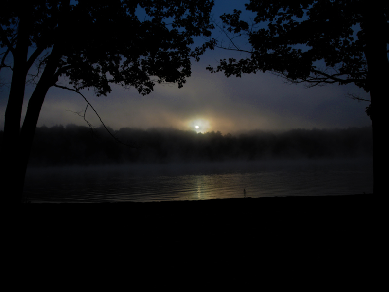
Moon Setting Over Black Pond
Sunrise Over Black Pond
Winter sunrise over Black Pond
Bald Eagle
In the spring the bald eagles usally visit for a while.
In the Treetops
View the valley below from the side of a hilltop.
View From Parking Lot
This is Black Pond and the peak behind seen from the parking area. Climbing is a good hike with scenic views along the way.
From The Ridge
Hike up one of the ridges and view the pond below. In the distance you can see the parking area and the freeway.
Traprock
This area is predominately traprock as seen in this photograph.
Parking Area
Ample parking and a boat launch
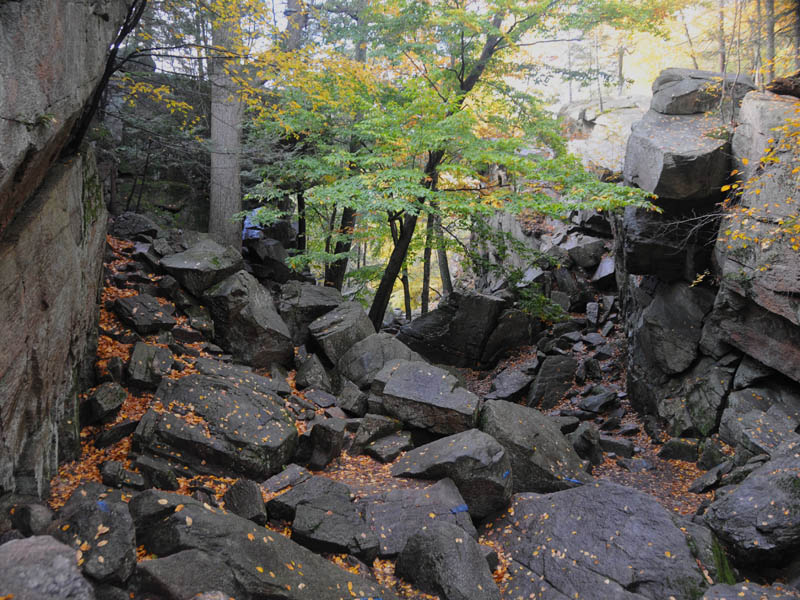
Fat Mans Misery
There's a big crack in the rock you can crawl through if you are slim enough and not frightened of confined areas.
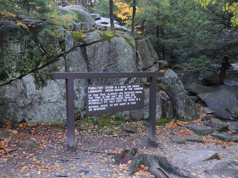
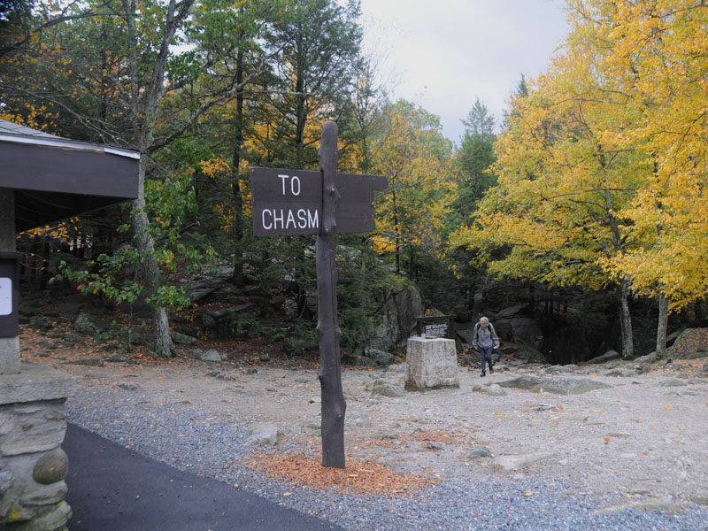
Chasm Entrance
Sign Reads
PURGATORY CHASM IS A BOLD AND UNIQUE LANDSCAPE. HIKERS BEWARE OF THE DANGERS
OF THIS TRAIL SLIPPERY AND DECEIVING ROCKS. THE TRAIL IS ONE HALF MILE LONG AND CLIMBING IS INVOLVED HIKERS SHOULD BE PHYSICALLY FIT. HELP KEEP THE CHASM IN A NATURAL STATE. DO NOT CARRY IN FOOD OR BEVERAGE.
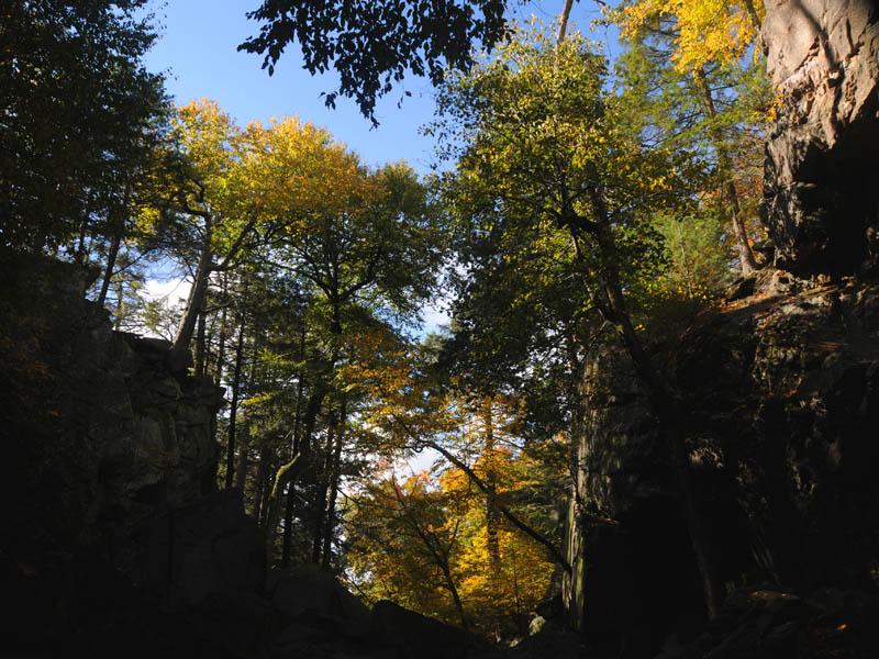
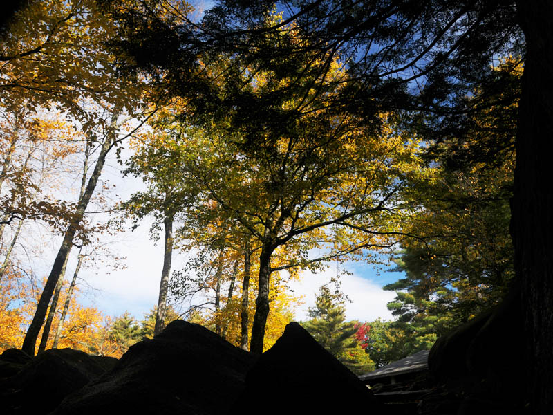
Purgatory Chasm State Park
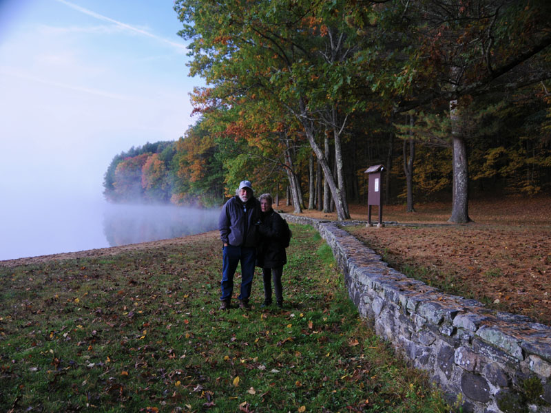
Walker Pond Shoreline
It was cold that morning.
Walker Pond Morning Fog
Fog was rolling off the pond the morning we got up to enjoy the sunrise.
Wooded Campsites
Campsites are surrounded by trees which makes camping very pleasant. There are some campsites right on the lake.
Morning Sunrise
The sun looked like this one morning as we walked along the lakeshore.
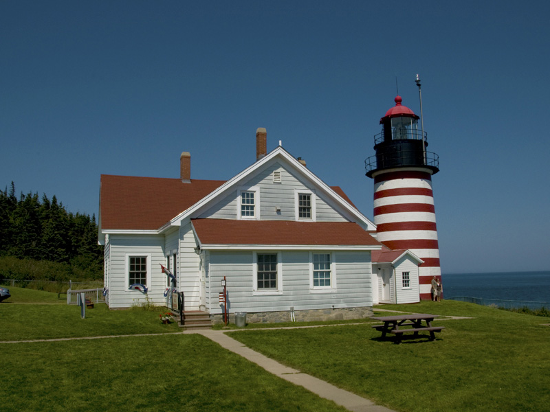
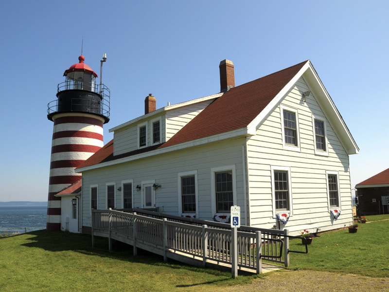
West Quoddy Head Lighthouse
West Quoddy Head Light became the easternmost lighthouse in the United States in 1808.
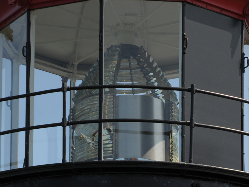
Fresnel Lens
The original third-order Fresnel lens
West Quoddy Head Lighthouse
Lighthouse Marker
Marker reads Easternmost Point in the U.S.A. West Quoddy Head Lubec, Maine 44 48 9 N 66 57 1 W.
The Ascent II
On a clear day, you can see New Hampshire, Maine, Vermont,
New York and Canada.
The Pass
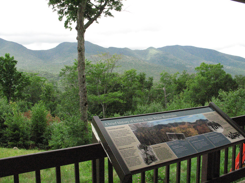
Franconia Notch is a major mountain pass through the White Mountains of New Hampshire. Pictured here is a scenic rest area just after the peak of the pass.
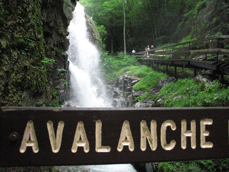
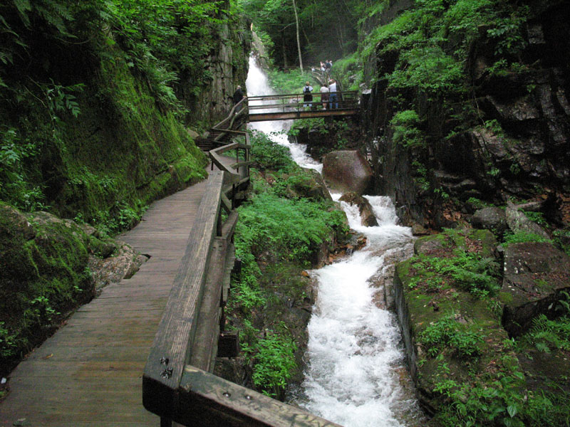
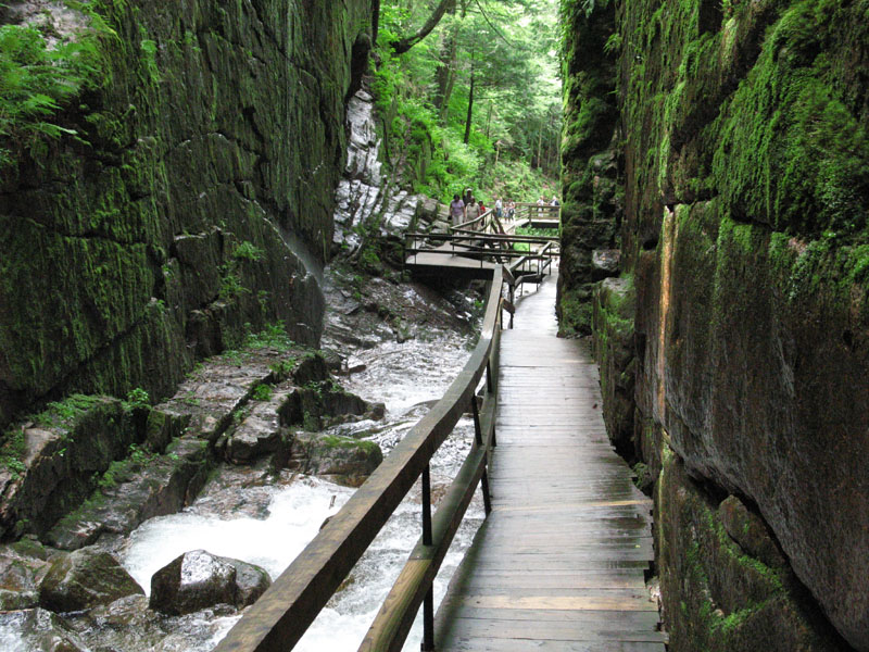
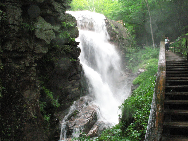
Flume Gorge
Avalanche Falls is at the top of the climb through Flume Gorge.
Flume Gorge
Built right into the steep gorge walls, this stairway is the only route.
Flume Gorge
This is the walkway that has to be taken to get through the gorge.
Flume Gorge
Flume Gorge is a narrow gorge approx 70 feet deep that extends along the flank of Mount Liberty 4,460 feet.
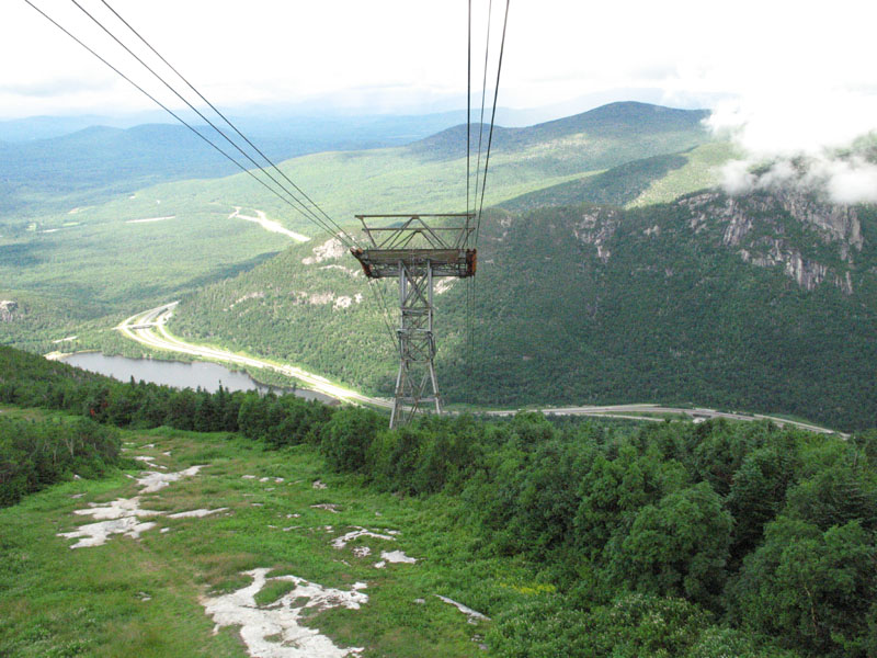
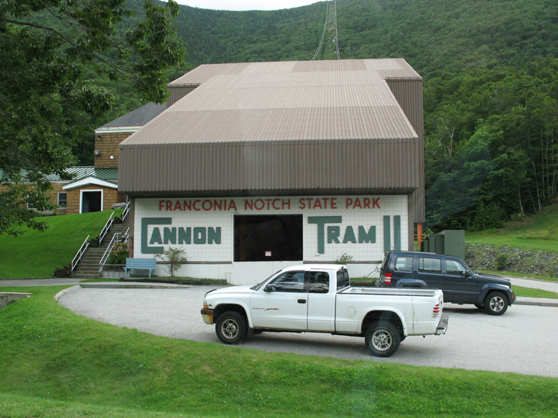
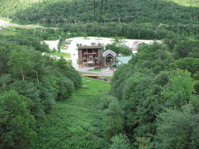
Cannon Mountain Aerial Tramway II
This location is the site of the first aerial tramway in North America. Placed in operation in 1938 and carried 6.5 million passengers until it's retirement in 1980. The present tramway was dedicated in 1980 is more then a mile in length and ascends 2022 feet to the summit.
Into the Clouds
Cannon Tram II's ascent this day took us right into the clouds.
Flume Gorge
Avalanche Falls
Flume Gorge Center
The Stagecoach is on display at the Flume Gorge Center.
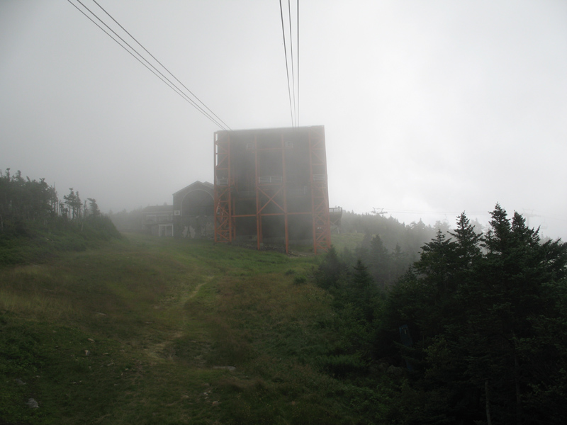
The Ascent I
An 80-passenger cable car brings visitors to the 4,180-foot summit of Cannon Mountain in under ten minutes.
Peaks of Sun
Rain was the venue most of the days we spent in the White Mountains but atop Cannon Mountain I was lucky enough to get a few pictures.
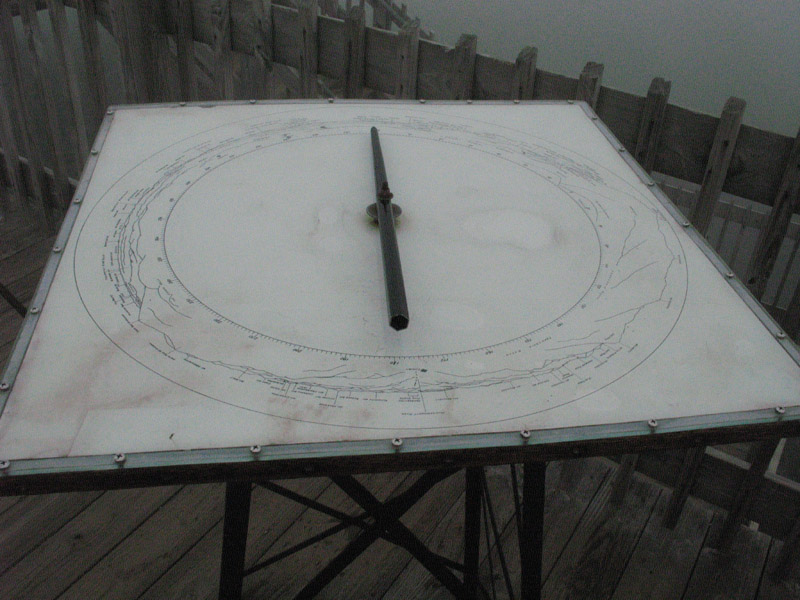
Reference Dial
At the top of the tower there is a dial that points to what you are looking at. To be seen are New Hampshire, Maine. Vermont, New York, and Canada.
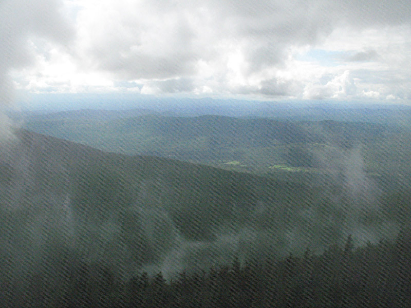
Observation Tower View
The Tram doesn't quite take you up to the top of the summit. There is a path that leads up another 500 feet where an observation tower stands. Climbing this I was literally in the clouds when I took this photo.
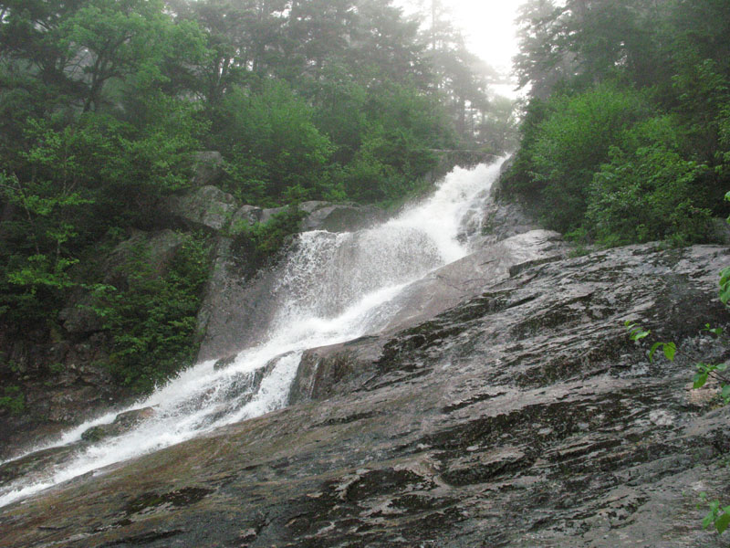
Silver Cascade Falls
This is a view from the road Highway 302. This is less then half the total drop of the falls.
The Kancamagus Highway
Lower Falls.
The Basin
The Basin area consists of a granite bowl, twenty feet in diameter, fed by a waterfall, worn smooth by the Pemigewasset River.
Silver Cascade Falls
Occassionally, throughout my hike, I reached places and crept out of the woods to peak at the falls. The climb was quite the experience between fear, exploration, and venture. I did loose my footing several times. Luckly I had positioned myself for such events.
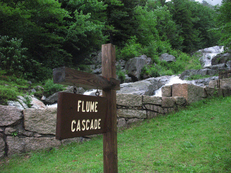
Flume Cascade
This is the view right from Highway 302 in Crawford Notch.
Flume Cascade
Flume Cascade is the sister falls of Silver Cascade. They flow down the mountain next to each other.
The Kancamagus Highway
Lower Falls.
The Kancamagus Highway
Lower Falls.
The Kancamagus Highway
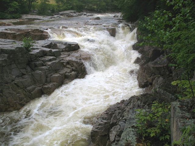
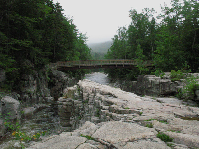
Rocky Gorge...
This is during a season of above average rains.
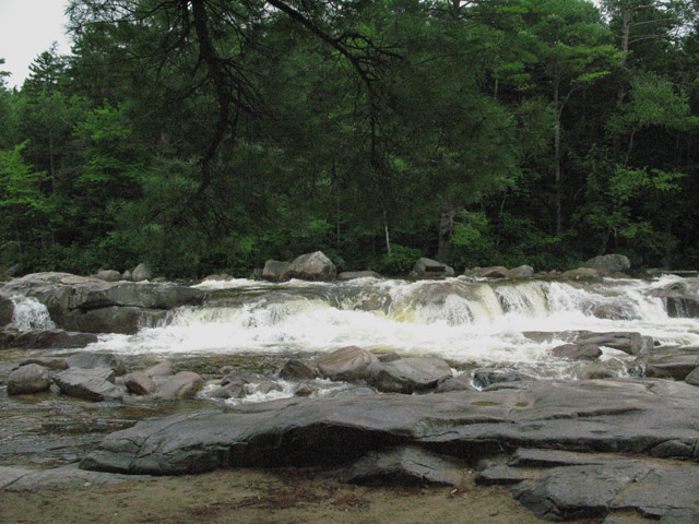
The Kancamagus Highway
Rocky Gorge
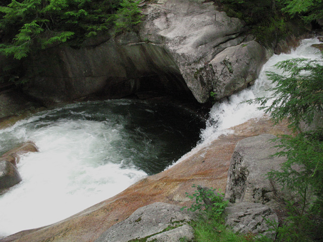
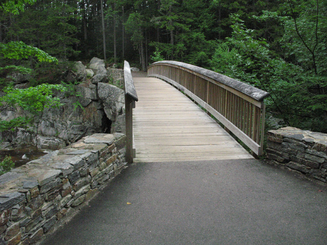
Walking Bridge
The Kancamagus Highway
Rocky Gorge
View of the walking bridge looking downstream as it spans the Gorge.
Silver Cascade Falls
Silver Cascade Falls is located in Crawford Notch and often refered to as The Gate of the Notch. This waterfall is a risky climb. I made the climb so you don't have to. These pictures were taken so you can see what it looks like without risking anything. Enjoy...
Silver Cascade Falls
This is the top of the Falls. Please take my advice and never make this climb. It is way too treacherous for anyone but those who think they are invincible. As a senior citizen, I tell you this in all ernest. But I did get my photographs......
Silver Cascade Falls
A look down gives you a visual of the long way you would fall if you were to slip. And farther down, it gets even steeper.
Silver Cascade Falls
The upper part of the falls is not visible from the road. But here is a picture of what it looks like as you approach the top.
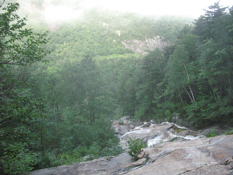
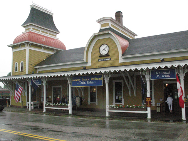
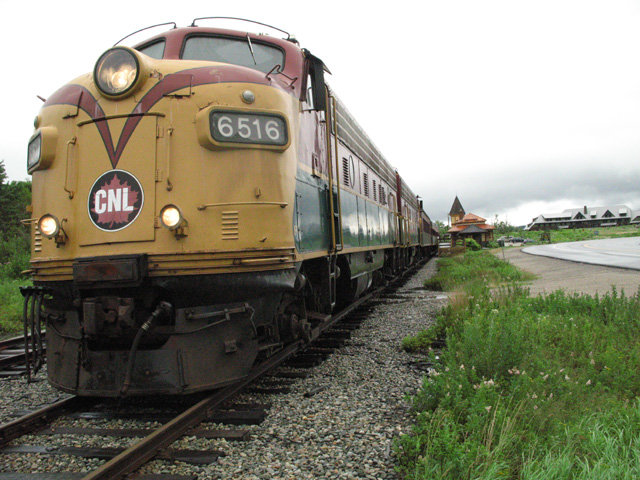
Conway Train Depot
This is where the Conway Railroad leaves and takes you past sheer bluffs, steep ravines, cascading brooks and streams, panoramic mountain vistas, and across the famed Frankenstein Trestle and Willey Brook Bridge - enroute to Crawford Depot or Fabyan Station.
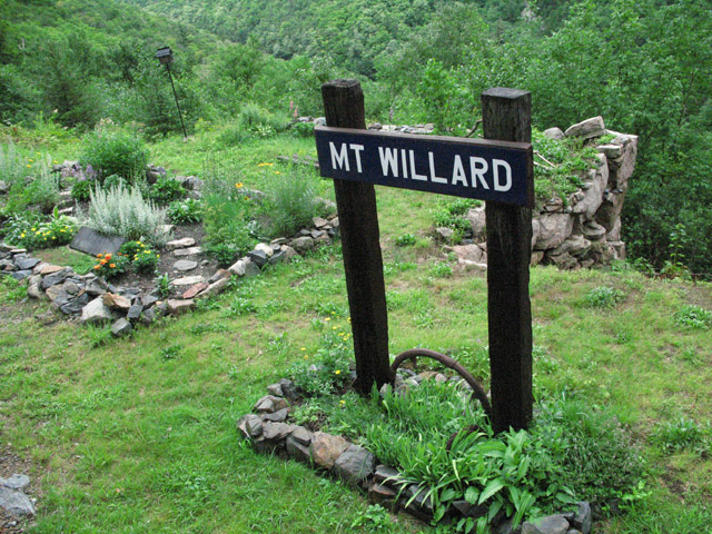
Mt. Willard
Mt Willard...
The train passes next to Mt Willard and all it's relics.
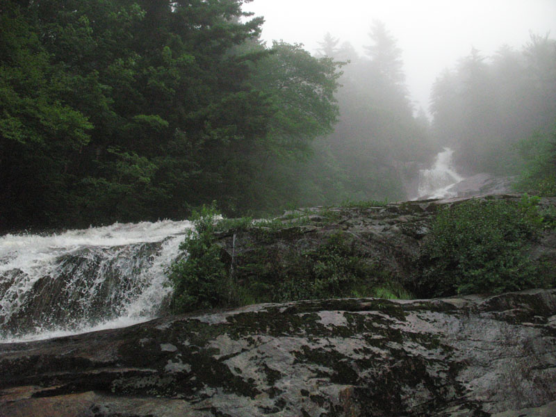
Beats Walkin
Beats Walkin...
Shear cliffs on one side and a mountains on the other.
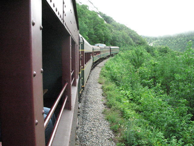
Crawford Notch
The Boss...
The Conway Train Ride is powered by a diesel electric locomotive.
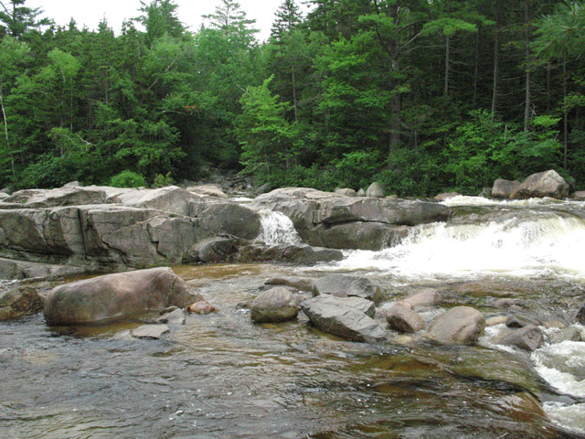
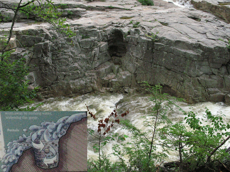
The Kancamagus Highway
Rocky Gorge...
This is a pothole in cross-section. It is scoured out by swirling sand and rocks over thousands of years. Later half the pothole was gradually worn away by rushing water, widening the gorge. The illustration in the left lower corner depicts how the pothole was made.
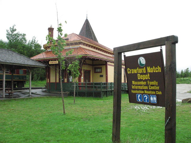
Crawford Notch
Crawford Notch Depot...
This is where the train running out of Conway turns around for the trip back down the mountain.
Norrie Momument
Momument reads This Playground was given to the People of Staatsburg in memory of Lewis Gordon Norrie and His Happy Youth
Dec. 25, 1901
Sept. 23, 1923
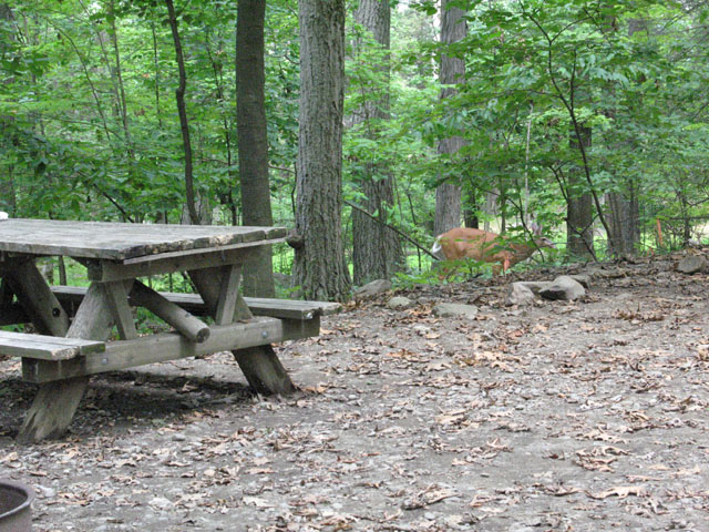
Campsite Deer
Wildlife abounds throughout the park.
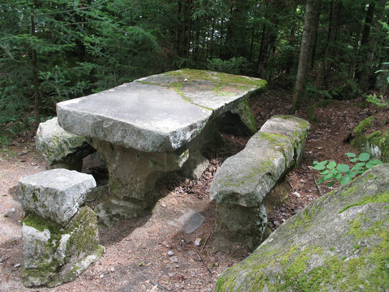
Stone Picnic Talbe
The Civilian Conservation Corp CCC quarried rock from around the area back in the 30's and 40's. This picnic table was made by them. It will not have to be replaced for many years.
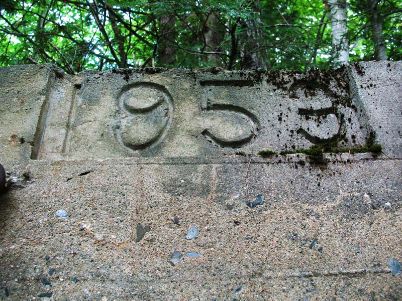
Rickers Mill Remnants
Concrete channel poured for plant operation. Circa 1953. There was once a mill here.
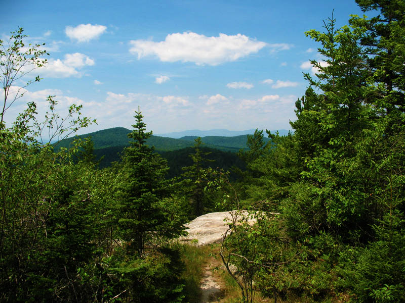
Owls Head Summit
This picture reveals why Vermont is called the Green Mountain State
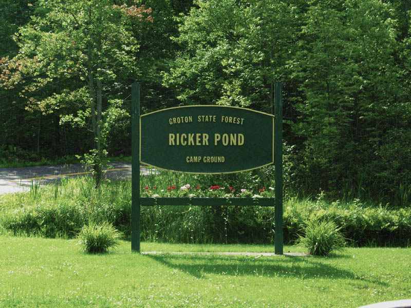
Ricker Pond Entrance
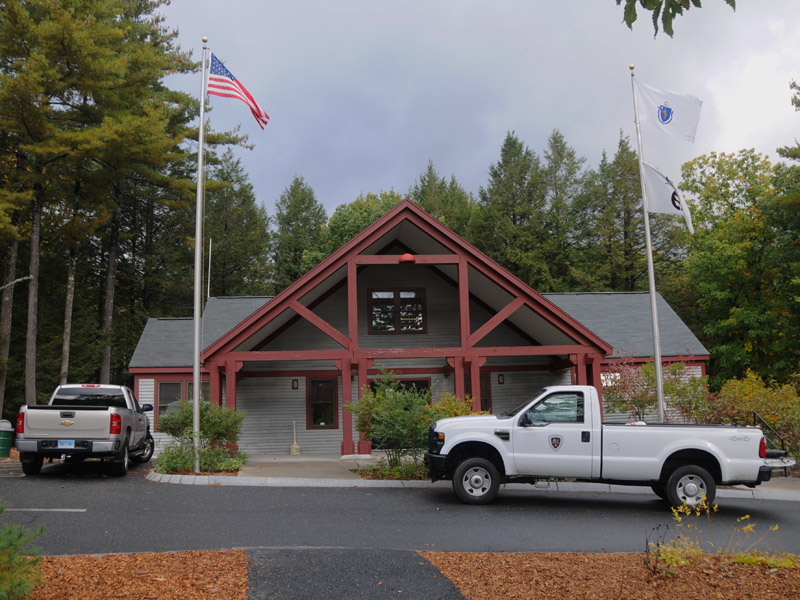
Ricker Pond Campground entrance booth
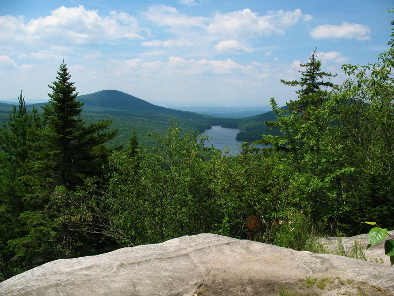
Owls Head Summit
Lake Groton is shown in the distance.
Owls Head Stone Fire Tower
Perched on the summit is this Stone Fire Tower. It was built back in 1935 by the Civilian Conservation Corp CCC. It is one highlight of the summit climb.
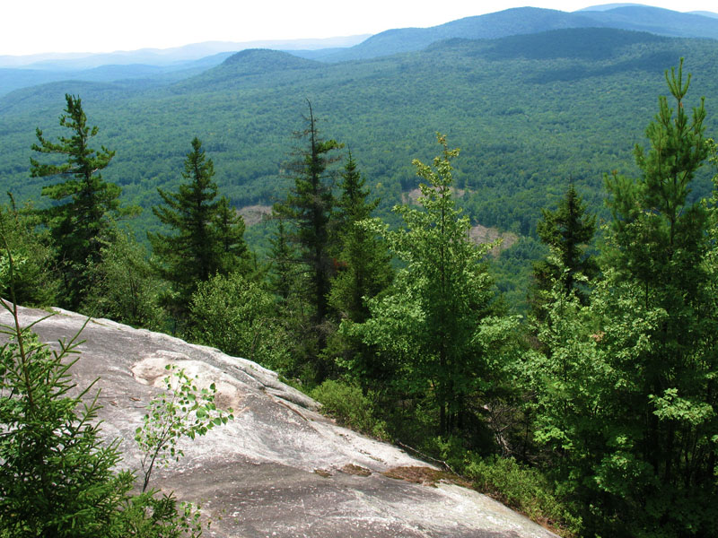
Owls Head Summit
A climb to the summit yeilded this view.
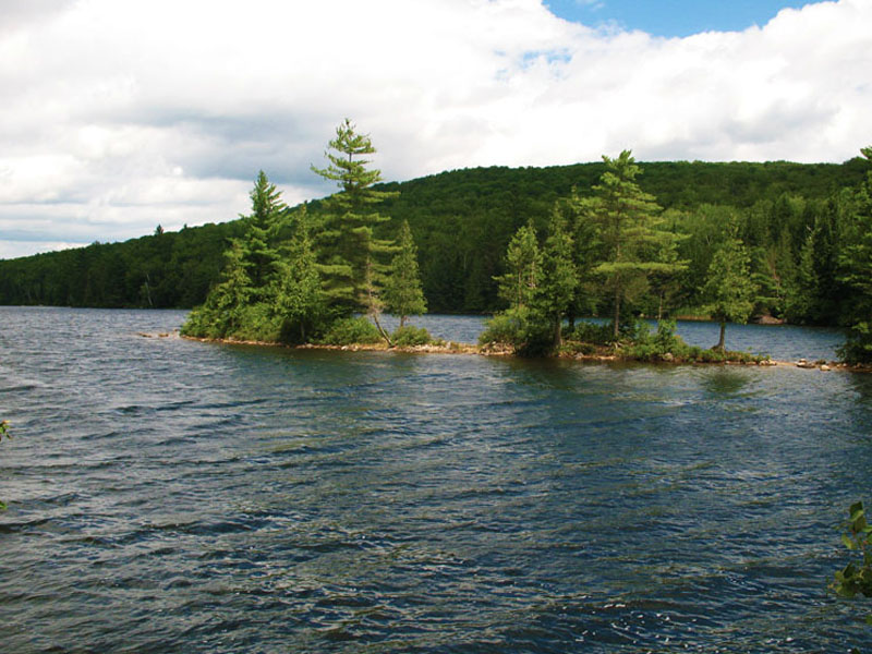
Rickers Pond
Ricker Pond Campground is across the lake over my right shoulder.
Campside Fire
A ring for fire and a grate are provided at each campsite. We stocked ours with local wood. The reason for this measure is to help prevent the spread of a beetle that is killing ash trees. No wood other then local wood is permitted.
Ricker Pond Campground
All the sites at Ricker Pond Campground are kept immaculate. The work crew that take's care of it are the very best.