POINT REYES NATIONAL SEASHORE
POINT REYES NATIONAL SEASHOREPoint Reyes National Seashore
Point Reyes, California 94956
Email:

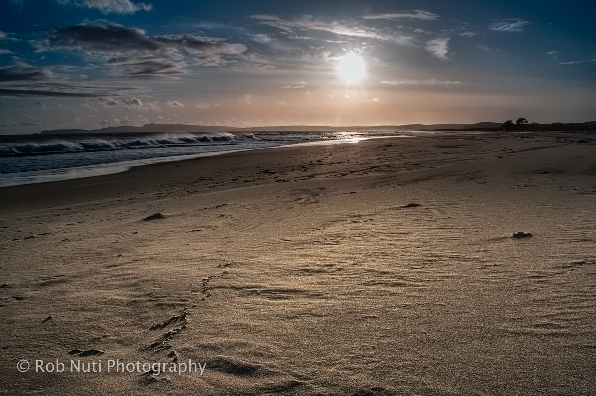
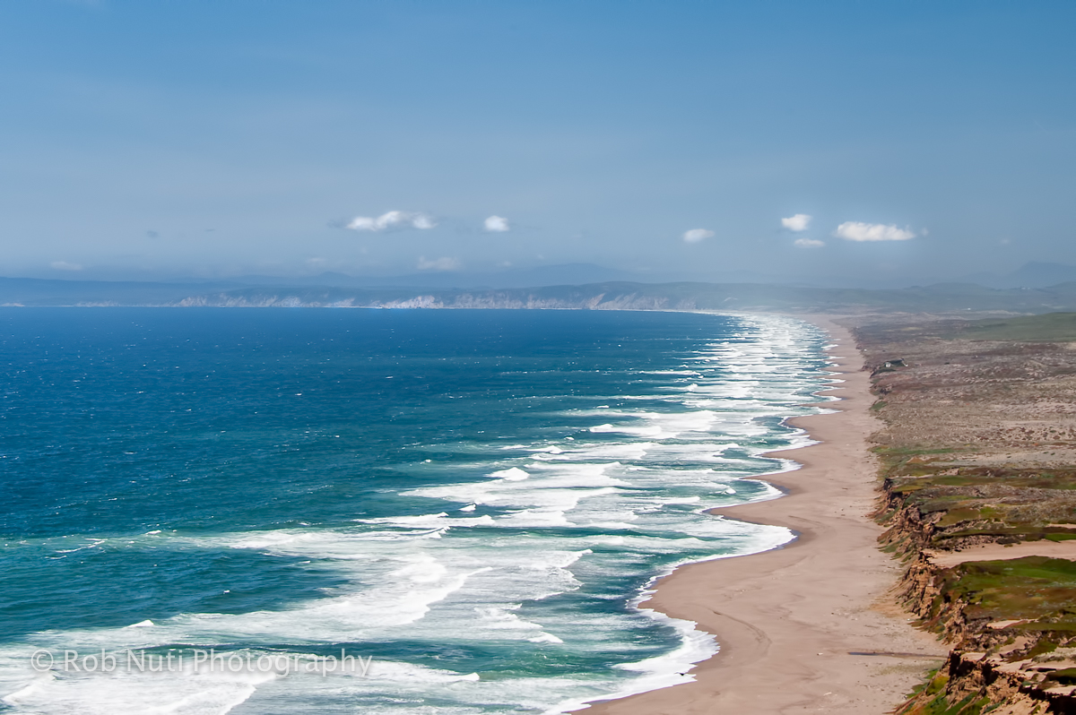
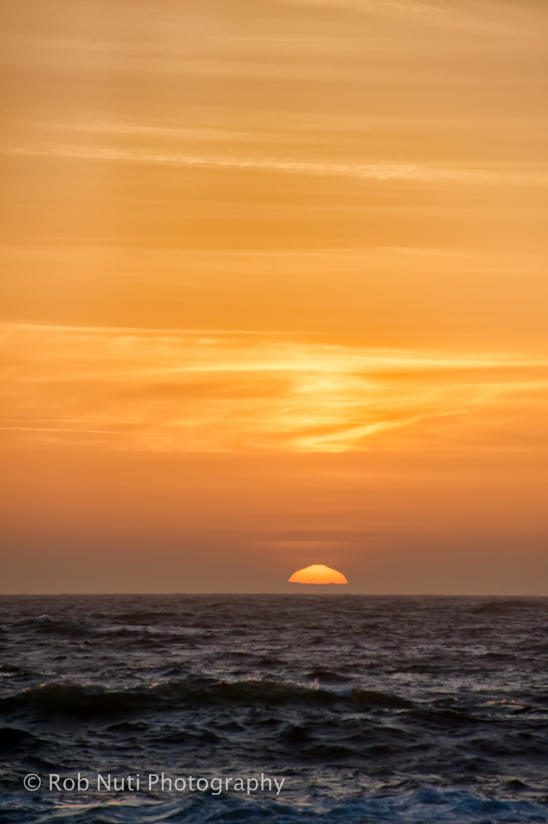
Point Reyes National Seashore contains unique elements of biological and historical interest in a spectacularly scenic panorama of thunderous ocean breakers, open grasslands, bushy hillsides and forested ridges. Native land mammals number about 37 species and marine mammals augment this total by another dozen species. The biological diversity stems from a favorable location in the middle of California and the natural occurrence of many distinct habitats. Nearly 20% of the State's flowering plant species are represented on the peninsula and over 45% of the bird species in North America have been sighted. The Point Reyes National Seashore was established by President John F. Kennedy on September 13, 1962.
As wildland habitat is lost elsewhere in California, the relevance of the Point Reyes Peninsula increases as a protected area with a notable rich biological diversity. Over 45% of North American avian species and nearly 18% of California's plant species are found in the park due to the variety habitat and uniqueness of the geology. Twenty-three threatened and endangered species exist within the Seashore.
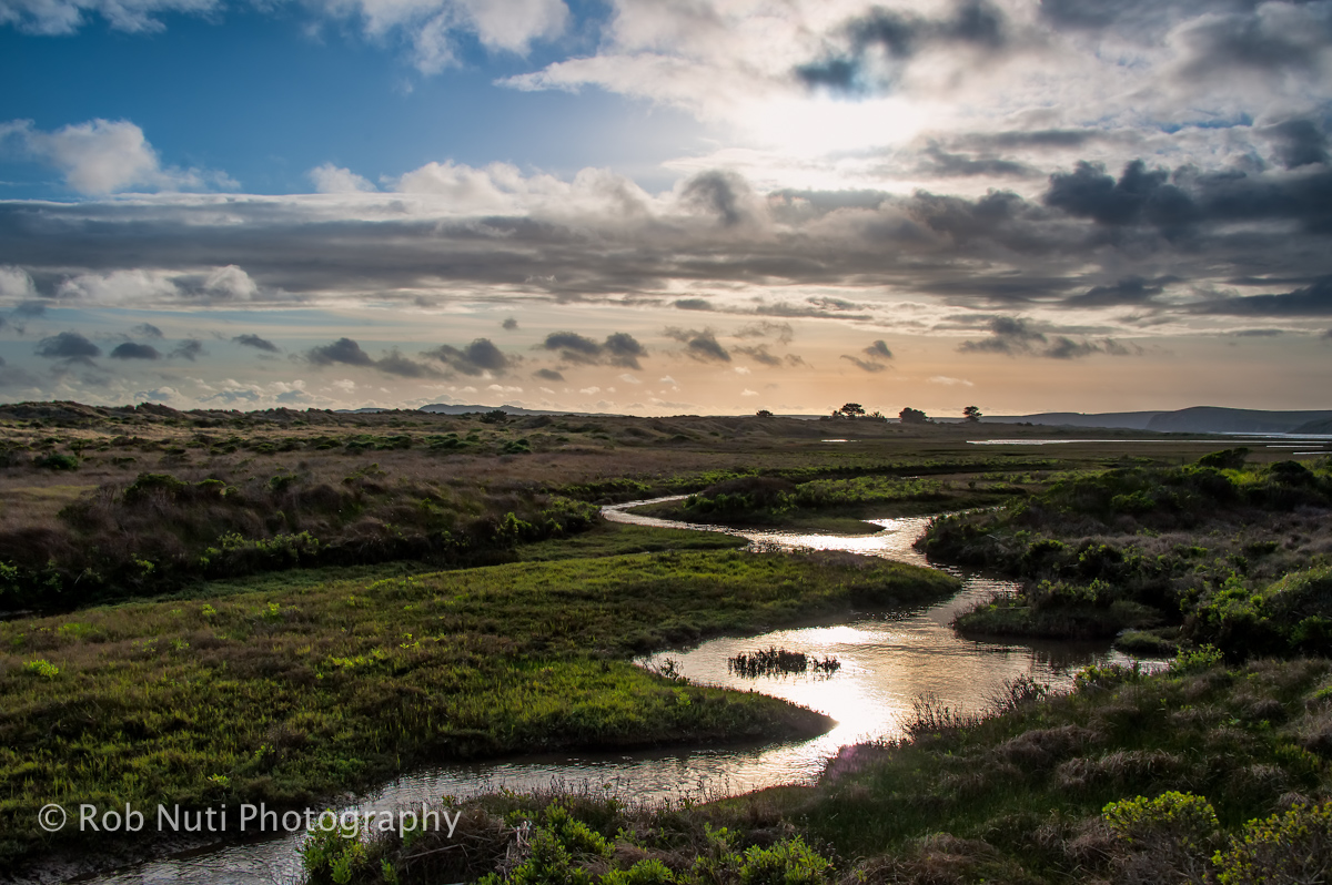
Even if you can only visit here for a day, you will begin to see what we have at Point Reyes National Seashore and how it works. As you drive through windswept Bishop pines, hike up Mt. Wittenberg under towering Douglas firs or walk along Bear Valley Trail through mixed woodlands to the exposed coastal scrub near the ocean, you will begin to see patterns. You might ask yourself why certain plants grow in certain places.
Their placement began with ancient geologic forces that created the bedrock and soils. Particular characteristics in these soils determine which types of plants can survive in different locations. Hills, valleys and exposure provide further discrimination for plants depending on their sunlight needs and tolerance to winds. Nothing is random in what you are observing -- plants grow where they can survive forming the foundations of all other life including our own.
Wildlife abounds throughout the Seashore. Along the coast you may find marine mammals such as whales, seals, and sea lions. A closer look reveals an abundance of bird life feeding near the tideline. Back in the forest, you may glimpse a bobcat, coyote, raccoon, or skunk scurrying off. We also have plenty of deer and elk to be seen.
The cultural history of Point Reyes reaches back some 5,000 years to the Coast Miwok Indians who were the first human inhabitants of the Peninsula. Over 120 known village sites exist within the park. According to many experts, Sir Francis Drake landed here in 1579, the first European to do so. In response to the many shipwrecks in the treacherous coastal waters, key lighthouse and lifesaving stations were established by the United States Government in the late 1800s and early 1900s. In the early 1800s, Mexican land grantees established ranchos. They were followed by a wave of American agricultural operations, which continue to this day in the Seashore's pastoral zone.
Day-UseHiking Trailyes
Picnickingyes
Point Reyes National Seashore offers year-round opportunities for camping along the Pacific Coast and mountains of the Phillip Burton Wilderness. Because of its location near the Metropolitan San Francisco Bay Area, the campsites at Point Reyes are in great demand. Reservations are strongly suggested.
All campsites are accessible only by hiking, biking or horseback ? these are backcountry sites. There is no car camping available in the park.
Camping is by permit only. Camping permits must be obtained from the Bear Valley Visitor Center before starting your trip. When you arrive to pick up your permit, please be prepared to provide a description (color, make, model and license plate number) of any vehicles that you will be leaving overnight in the park. There is no afterhours self-registration for camping available. You must have made a reservation in advance to camp within Point Reyes National Seashore. If you have made a reservation and are arriving after 5 p.m., a permit will be left for you in a small box on the back side of the information board outside Bear Valley Visitor Center.
Hike-in camping is allowed only in one of the four established campgrounds at the numbered site specified on the permit. Boat-in camping is allowed on national park beaches on the west side of Tomales Bay north of Indian Beach, Tomales Bay State Park. Rules & Regulations as stated below must be observed.
Campsites may be reserved up to three months (to the day) in advance. To obtain a reservation, call (415) 663-8054 between the hours of 9:00 am and 2:00 pm, Monday through Friday. Reservations by phone are not accepted at any other time. You may make reservations in person 7 days a week at the Bear Valley Visitor Center. You may also fax your reservation using our form and fax number: (415) 464-5149. Weekends and holidays fill up quickly, especially group sites, so reservations are strongly suggested.
Campground Descriptions: Each hike-in campsite has a picnic table, food storage locker and a charcoal brazier. (Only charcoal may be burned in the grill.) Each hike-in campground has pit toilets and a water faucet. Water from the faucet is potable in all camps except Wildcat Camp. Treat all water at Wildcat Camp. Do not drink water from streams without treating.
SKY CAMP: Sky Camp is located on the western side of Mt. Wittenberg at an elevation of 1025 feet. In clear weather, it has a sweeping view of Drakes Bay. Easiest approach is a 1.4-mile hike slightly uphill from Limantour Road. Twelve sites with one group site.
COAST CAMP: Coast Camp is in an open grassy meadow about 200 yards above the beach. Sites 1-7 are in a small semiprotected canyon. Easiest approach is the 1.8-mile slightly uphill hike on the Laguna Trail just past the hostel or the 2.8-mile flat bike/hike on the Coast Trail. Fourteen sites with two group sites.
GLEN CAMP: Glen Camp is in a wooded valley protected from ocean breezes. Easiest approach is the 4.6-mile hike along the Bear Valley Trail and Glen Trail. No groups, horses, or pack animals are allowed. Twelve sites.
WILDCAT CAMP: Wildcat Camp is located in an open meadow on a bluff overlooking the ocean with a short walk to the beach and a 2.0-mile round-trip walk to Alamere Falls. It is a 6.3-mile hike from Bear Valley or a 5.5-mile hike on the Coast Trail from Palomarin with access to Bass Lake. Seven sites with three group sites; three of the individual sites only hold up to four people.
TOMALES BAY: Tomales Bay boat-in camping is allowed on west side National Park beaches north of Indian Beach, Tomales Bay State Park. Pit toilets are located on Marshall Beach and Tomales Beach. No water or other facilities are available. All waste (including human) must be removed. These beaches are tidally influenced and generally are small sandy coves backed against steep cliffs. Twenty permits are available each day.
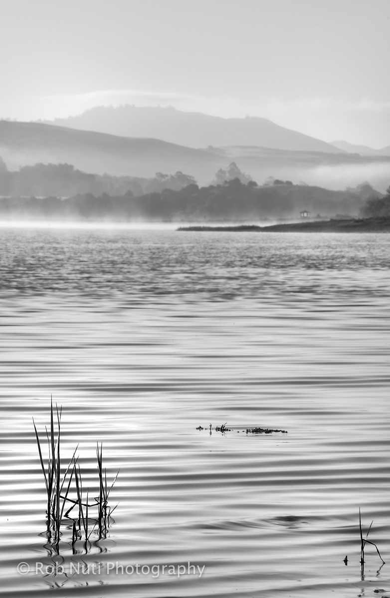
The most popular area for kayaking at Point Reyes National Seashore is on Tomales Bay. Tomales Bay is a 15-mile long, 6780-acre tidal water body located in rural west Marin County, California. It is the largest unspoiled coastal embayment on the coast of California. The bay is bounded largely on the west by the Point Reyes National Seashore. Adjacent communities include Pt. Reyes Station, Inverness, Tomales, Marshall, and Dillon Beach in the north where Tomales Bay meets Bodega Bay.
Kayaking is also permitted on Drakes Estero and Limantour Estero from July 1 through February 28. To protect harbor seals from disturbance during the most crucial part of the pupping season, from March 1 through June 30 the National Park Service closes Drakes Estero and Limantour Estero to boating.
Recreational use of Tomales Bay has grown in recent years especially for camping, boating, and wildlife watching. The National Park Service at Point Reyes is concerned about the effects of the growth in recreational use.
The Seashore faces the challenge of not only preserving the pristine shorelines of Tomales Bay and assisting in protecting clean water, but also providing recreational opportunities for the public. Visitor use of national parklands must always be weighed against the responsibility to maintain natural and cultural resources for succeeding generations. As such, personal water craft (PWC) such as a Jetski or Waverunner are not permitted on Tomales Bay. (Note: please read A Guide to Low-Impact Boat Camping if you intend to participate in kayaking in and around Pt. Reyes National Seashore).
There are four areas for launching on Tomales Bay:
MILLER COUNTY PARK (415) 499-6387Also known as Nick's Cove. It is located on the east side of Tomales Bay off Highway 1, north of the town of Marshall. This Marin County park has a public boat launch with cement grade into the water, restrooms, and a pier. There is a day use fee and overnight use fee. Overnight parking is in the upper lot, to the right as you pull in.
TOMALES BAY STATE PARK - (415) 669-1140The state park provides two access areas to Tomales Bay, Millerton Point and Hearts Desire Beach.
Millerton Point is on the east side of Tomales Bay, three miles north of Point Reyes Station. No overnight parking is permitted. There is a pit toilet and you must carry your boat along a short trail approximately 100 yards to the water. It is very shallow and is best used at high tides.
Hearts Desire Beach is on the west side of Tomales Bay off Pierce Point Road. It is a day-use area (no overnight parking) and there is a day-use fee. You must carry your boat approximately 100 yards across a sandy beach. Water and restrooms are available at the beach. Orange floats are placed in the water in summer to indicate the swimming area. Boaters may land to the south of the orange floats. Motorized vessels are prohibited within 100' of the swim area markers.
GOLDEN HINDE INN AND MARINA - (415) 669-1389The inn and marina are located on the west side of the bay. It is off Sir Francis Drake Boulevard three miles north of Inverness. There is a boat launch fee and if you pay the launch fee, you may leave your car overnight. No dump station.
LAWSON'S LANDING - (707) 878-2443The campground and boat launch are located in Dillon Beach with direct access to Tomales Bay. There is gas, dump station, and boat rentals. Restrooms and water available. There is a day-use and overnight fee charged.
If you plan to have a beach fire on national seashore beaches, stop by national park visitor centers for a free required permit. No beach fires are permitted on state park beaches.


 Share Your Point Reyes National Seashore Photos (click here)