Save
You must be signed in to save park lists.
Your Park Lists
add New List
Add Photo
You must be signed in to add photos.
state route ranger badge
Oregon
26

Oregon State Parks

responsive menu icon
USA Parks
Oregon
Central & Eastern Region
Fort Rock State Park
start slideshow
Fort Rock State Park © Michael Skourtes
Fort Rock State Park © fritzcat / CC BY 2.0, via Wikimedia Commons
IMG_7659.jpg
Fort Rock State Park © brx0 from Portland, USA / CC BY-SA 2.0, via Wikimedia Commons
Fort Rock, Eastern Oregon
Fort Rock State Park © Kingofthedead / CC BY-SA 4.0, via Wikimedia Commons
Fort Rock is an unincorporated community in Lake County, Oregon, United States, southeast of Fort Rock State Natural Area.The landmark of Fort Rock is a volcanic landmark called a tuff ring, located on an ice age lake bed in north Lake County, Oregon, United States.
Fort Rock State Park © DKRKaynor / CC BY-SA 4.0, via Wikimedia Commons
After the maar eruption formed Fort Rock, waves on the lake it formed in eroded away one side.
Search
Availability
Calendars
Availability Search
FORT ROCK STATE PARK
Fort Rock Road
Fort Rock, Oregon   97735
(lat:43.3728 lon:-121.0662) map location

Phone: 800-551-6949
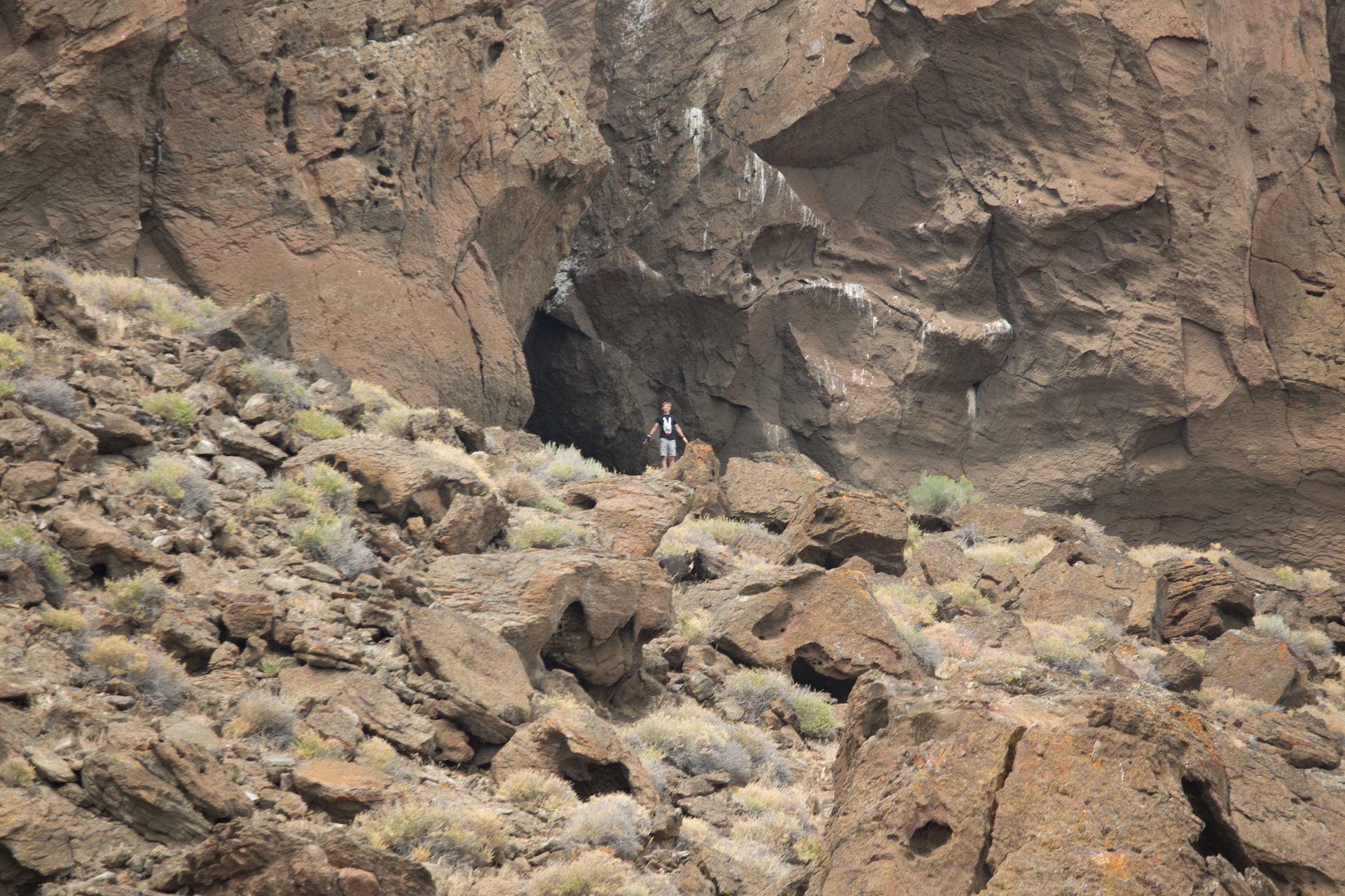
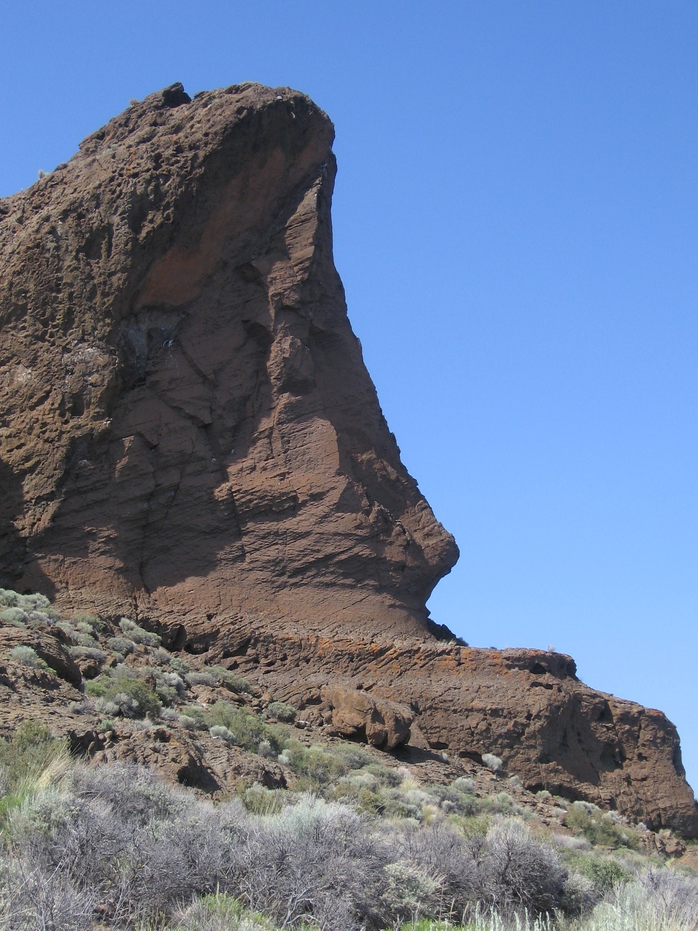
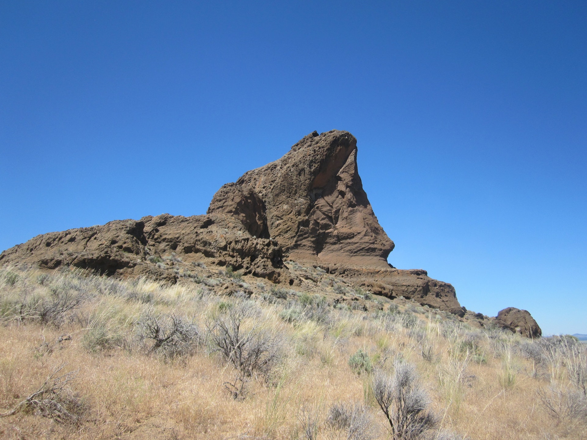
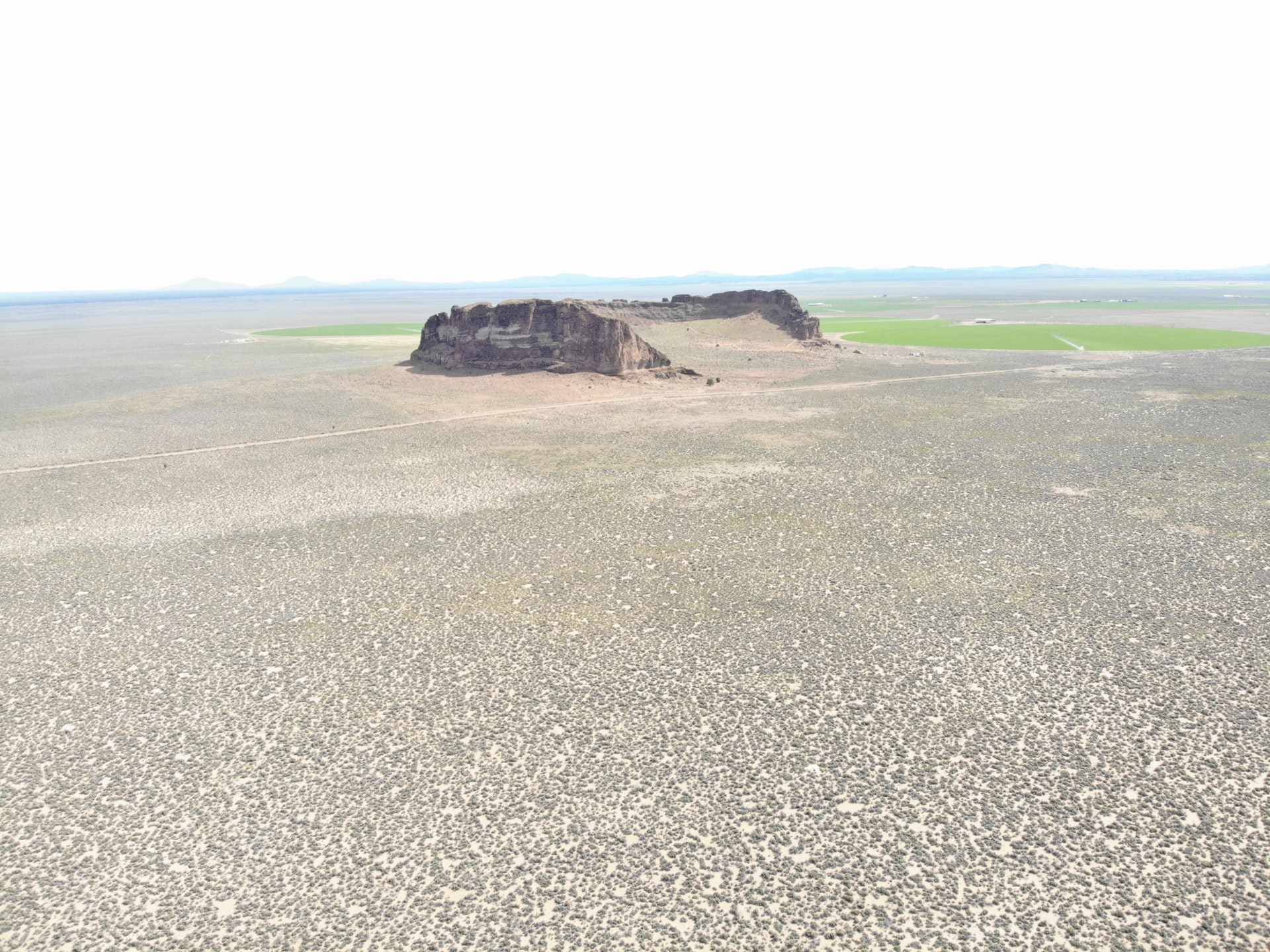
Like a desert mirage, this monolith rises huge out of the barren, immense flatness of Oregon's high desert. An enormous near-circle of towering jagged rock walls make it seem like a fort. Hike around and you'll soon realize it's even bigger than it looks It's an old shield volcano set in what was a shallow sea in prehistoric times. As you walk around inside, imagine the early American Indians who canoed to and from what was then an island. Sandals found in a nearby cave are the oldest ever discovered in Oregon, dating back around 9,000 years.
History of the Area
Located in Lake County, Oregon, this natural wonder was formed by a volcanic eruption around 50,000 to 100,000 years ago. The explosion created an impressive ring-shaped formation that resembles a fort and hence its name.

The area has been inhabited for thousands of years with the earliest evidence dating back nearly 13,500 years when Native American tribes lived there. In fact it is one of North America's oldest known archaeological sites where sagebrush sandals were discovered inside caves near the site which are believed to be among the world's most ancient footwear.

In early twentieth century (1900s), settlers arrived at Fort Rock Valley hoping to establish farms but due harsh environmental conditions many left within decades leaving behind ghost towns like Silver Lake and Christmas Valley nearby.

It wasn't until June 29th ,1928 that Governor I.L Patterson designated it as state park after recognizing its historical significance along with unique geological features making it popular tourist destination today offering hiking trails through high desert landscape providing panoramic views from top while also preserving important cultural heritage.

Over time additional land acquisitions have expanded boundaries including acquisition of 'Fort Rock Cave' in late sixties adding more depth into understanding prehistoric life here based on artifacts found during excavations conducted over several decades since then till now under guidance from University Of Oregon Museum Natural History researchers who continue studying these findings further enhancing our knowledge about past civilizations inhabiting region long before us.


Location
Fort Rock State Park is

Picnicking
Fort Rock State Park offers picnic tables and grills, perfect for a family outing. No covered shelters are available.
Bicycling
Biking enthusiasts should be aware that the park offers no designated cycling trails. Exercise caution when biking on hiking paths.

While there are not specific bike routes, cyclists can enjoy riding along the park's roads and parking areas.

Remember to yield to pedestrians while bicycling in this location as shared-use is common throughout most of its grounds.

The terrain here varies greatly; from flat surfaces near picnic spots, it becomes rocky and uneven closer towards geological formations.

Cyclists must always wear helmets for safety due to unpredictable terrains within these premises.

Be prepared with a puncture repair kit since some parts have sharp volcanic rocks which could potentially damage tires.

Keep an eye out for wildlife crossing your path unexpectedly - stay alert at all times during your ride!

Night-time biking isn't recommended because lighting conditions aren't optimal after sunset across much of this area's expanse.

Note: There are no facilities available specifically catering toward bicycle maintenance or rentals onsite so come well-prepared!
Trails
1. Cave Loop Trail: This 0.8-mile trail is easy and flat, perfect for beginners or families with children. It takes hikers around the base of Fort Rock formation.

2. Rim View Trail: A moderate difficulty level hike that stretches about a mile long, this path offers stunning views from atop the rim of Fort Rock's volcanic tuff ring.

3. Hot Springs Campground Trails: These trails are located near Christmas Valley and offer various lengths ranging between one to three miles through desert terrain featuring hot springs along some routes.

4. Hole-in-the-Ground Hiking Trail: An approximately five-mile loop trail offering scenic views into an enormous maar (a type of volcanic crater). The route can be challenging due to loose rocks but provides unique geological insights on Oregon's landscape history.

5. Crack in Ground Hike Route:This two-mile round trip hiking experience leads you down into a deep fissure formed by cooling lava thousands years ago; it remains cool even during summer months making it ideal for warm weather hikes.

6. Fort Rock Museum Village Pathway: Though not strictly within park boundaries, this short walkable pathway winds its way through historic buildings relocated here from surrounding homesteads providing insight into early pioneer life in Central Oregon region.

7. Lost Forest Research Natural Area: Located north:eastern part of Park boundary,this area has several unmarked paths leading visitors across ancient Ponderosa Pine forest isolated amidst high-desert scrubland.
Birding
Birdwatchers can enjoy spotting a variety of species, including hawks, eagles and owls. Migratory birds are also common during certain seasons. The park's diverse habitats attract different bird types throughout the year.

Visitor Comments, Memories and Reviews
write a review
Share On

Nearby Hotels
Booking.com

Directions
Fort Rock State Park is located in central Oregon, approximately 70 miles southeast of Bend. To reach the park from Bend, follow US-97 South for about 50 miles until you reach La Pine. In La Pine, take a left onto OR-31 and continue driving south for another 20 miles.

If you are coming from Klamath Falls or Lakeview to the south, head north on US-97 until reaching Chemult. From there, turn right onto OR-138 East and drive for about 30 miles before turning left onto Fort Rock Road/County Rd 5A.

Once you have reached Fort Rock Road/County Rd 5A (from either direction), continue traveling eastward towards Fort Rock itself. The road will lead directly into the state park entrance after around five more minutes of driving.

Upon arrival at Fort Rock State Park's parking area near its visitor center, visitors can explore various hiking trails that wind through this unique volcanic formation known as "The Rim." Additionally, make sure to check out other attractions within the park such as camping areas and picnic spots where one can relax while enjoying stunning views of Central Oregon's high desert landscape.

state route ranger badge
Oregon
26

Oregon State Parks

X