FORBES STATE FOREST
The Forbes State Forest was named in honor of General John Forbes who, 1757 ordered the construction of a road from Bedford to Fort Pitt for the movement of an expeditionary Army. The Forbes State Forest contains over 20 separate tracts of State Forest Land in Fayette, Somerset, and Westmoreland Counties. The total acreage is over 50,000 acres.
Most of the Forbes State Forest lays along Laurel Ridge. This area is a favorite of people from the greater Pittsburgh area and is heavily used for all types of outdoor recreation. To play host to the millions of visitors to this area, six State Parks and three State Forest Picnic Areas have been developed.
In addition to these developed facilities, there are a number of undeveloped points of interest which appeal to those with an adventurous spirit. For administrative purposes the Forbes State Forest is divided into five Divisions.
Roaring Run Natural Area:
Roaring Run is a 3,070 acre tract of second and third growth mixed mesophytic forest in southeastern Westmoreland County, located south of PA Route 31, east of PA Route 711 and 381, and north of L.R. 64070. It occupies the major portion of the watershed of Roaring Run on the west slope of Laurel Ridge. Roaring Run is a tributary of Indian Creek, which empties into the Youghiogheny River. Two high points of the ridge, known as Painter Rock Hill and Birch Rock Hill are within the natural area.
The Roaring Run Natural Area was acquired by the Commonwealth in 1975. Prior to acquisition numerous roads had been constructed and much of the timber removed. Nature with some help from man as done much to restore the area.
Although the entire area is closed to all vehicles, it is open to hiking, cross-country skiing, and in the appropriate seasons, to access on foot by hunters and fishermen.
As the decades pass, the Roaring Run Natural Area will afford an opportunity to witness nature's healing as the disturbed land progresses through natural succession toward the unmanaged mixed mesophytic climax forest type.
Mt. Davis Natural Area:
The Mt. Davis Natural Area comprises of 581 acres in Elk Lick Township, Somerset County surrounding the rock know as Mt. Davis on the summit of Negro Mountain. The top of this rock is 3,213 feet above sea level, and is the highest point in Pennsylvania. The elevation of the lowest point in the natural area is 2,823 feet. Drainage is to the southeast into Tub Mill Run, a tributary of the Casselman River, a part of the Mississippi River watershed.
An interesting geologic feature of the area is the scattering of small concentric stone rings caused my localized frost heaving. Each ring surrounds a spot in the soil which is a little softer and looser than the adjacent ground. Under the action of frost, these soft spots rise up as slight humps. Surface rocks on the humps tend to slide off, and over thousands of years, the sliding progresses enough to deposit the rocks in ringlike formations at the bases of the humps.
The Natural Area is bounded by L.R. 55008 on the north, by the Shelter Rock Road on the east, and the South Wolf Rock Road from L.R. 55008. The Shelter Rock Road is closed to vehicles. A picnic area is located about 1 mile from Mt. Davis along L.R. 55008. Hiking trails connect the picnic area with the high point, and from Mt. Davis lead into the lower elevations of the natural area. Motorized vehicles are not permitted in the area except on the road to the High Point.
Spruce Flats Wildlife Management Area:
The Spruce Flats Wildlife Management Area is a tract of 305 acres located behind the Laurel Summit Picnic Area. The dominant feature of the area is the 28-acre Spruce Flats Bog, which contains large cranberry, pitcher plant, sundew, cotton grass, and other plants more typical of plant communities farther north.
The origin of the original bog is obscure. Past geologic activity which may or may not have included glaciation, left a depression on top of Laurel Ridge. This depression passed through natural succession from open water to marsh or swamp, to bog, to meadow and finally to forest. Early in the 20th century, lumbermen found a forest of virgin hemlock which they misnamed, "spruce", growing on the flats. They clear-cut the forest, and without realizing it caused the water table to rise. Evapotraspiration from the tree leaves had been the major method by which water was removed from the undrained basin. Devastating fires at about the same time burned away the upper layers of organic matter which comprised the forest floor above the water table. These events set back the successional clock, probably to the last swamp or early bog stage. Once more Spruce Flats Bog is making its slow trek through time toward a mature forest.
Cottages and Cabins
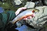
For those who like to fish for wild trout...this is the place to be Savage River Outfitters is a full line Orvis Dealer and Fly Shop with vacation rentals located on the Savage River in Western Maryland. Call ahead to book a half or full day wade trip or fly fishing instructions.
16.9 miles from park*


 Share Your Forbes State Forest Photos (click here)