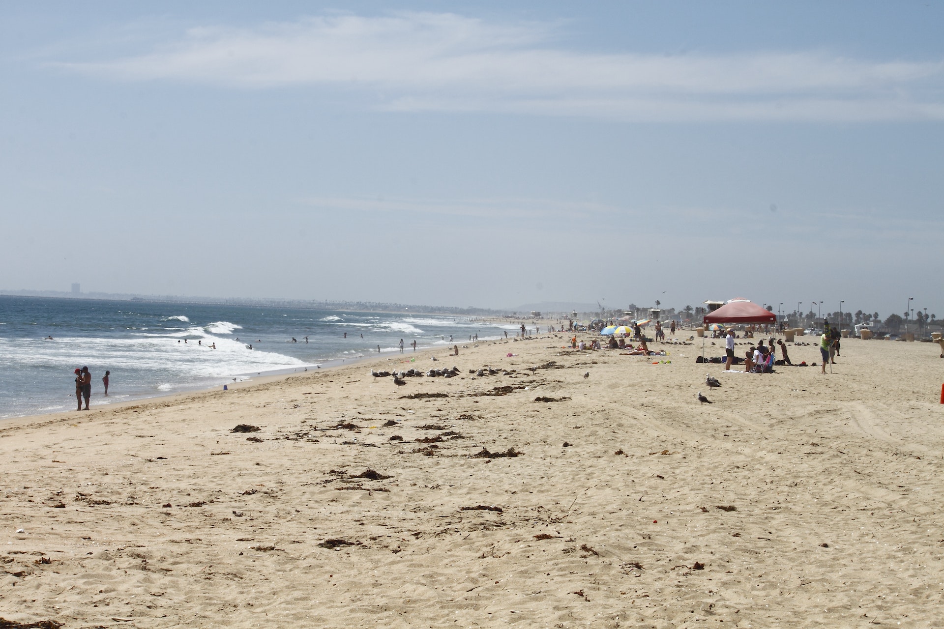
BOLSA CHICA STATE BEACH
Bolsa Chica State Beach is a popular place for surf fishing for perch, corbina, croaker, cabezon and sand shark. Also popular is in the summer is bare-handed fishing for California grunion, a species that only spawns on sandy southern California beaches. The beach extends three miles from Seal Beach to Huntington Beach City Pier. A bikeway connects it with Huntington State Beach, seven miles south. Wildlife and bird watching are popular. Across the road from the beach is the 1,000-acre Bolsa Chica Ecological Reserve, operated by the California Department of Fish and Game.
The area was originally part of a Mexican land grant from 1834. It became popular for hunting and fishing during the late 19th century.
In early years it served as an oil extraction site until its purchase by Signal Oil Company in 1941. The company drilled wells but also preserved parts of wetlands which later formed Bolsa Chica Ecological Reserve.
The State acquired this beachfront property in1960 to provide public recreational opportunities while preserving coastal resources.
It officially opened as a state park on July 25,1972 offering various activities like surfing or bird watching.
Today it is managed by California Department of Parks and Recreation attracting over two million visitors annually with diverse wildlife habitats making it significant ecological reserve along Southern Californian coast.
Day-UseFishingyes
Hiking Trailyes
Bolsa Chica State Beach offers ocean swimming with lifeguard services during daylight hours, typically from sunrise to sunset. The beach has mild waves suitable for beginner swimmers but can have rip currents; caution is advised. Swimming areas are clearly marked and visitors should swim near staffed lifeguard towers for safety. Water quality varies, so check local reports before going in the water.
Anglers can enjoy surf fishing along the coastline, targeting species such as perch, corbina, croaker, and bass. Fishing from public docks is also an option for catching halibut or stingrays. No license required on piers; elsewhere a valid California fishing license is necessary.
Bolsa Chica State Beach is located near Aliso Viejo, Anaheim and Artesia
Bolsa Chica State Beach offers picnic areas with tables and grills, perfect for family gatherings or beachside barbecues.
- Bolsa Chica Ecological Reserve Trail: A 4.5-mile loop trail, suitable for all skill levels and primarily used for walking, bird watching.
- Harriett M Wieder Regional Park Loop: This is a lightly trafficked loop trail of approximately 1 mile that features beautiful wild flowers.
- Huntington Beach Bike Path - North to South Route: An easy level path stretching about 8.5 miles along the Pacific coastline offering scenic views of beaches and ocean waves.
- Warner Avenue Paved Pathway at Bolsa Chica State Beach: Approximately half-a-mile long paved pathway ideal for biking or leisurely walks with beachside view points
-Bolsa Bay & Mesa Trails - These are two separate trails both measuring around one mile each; they offer great opportunities to observe wildlife in their natural habitats.
-Pocket Loop Trail - At just under three-quarters of a mile this short hike provides stunning panoramic vistas over the wetlands area below it.
-Inner Bay Loop Trail - It's an easy-to-moderate difficulty hiking route spanning roughly four miles round trip through diverse ecosystems including marshes and coastal dunes.
-Warner Pond Overlook Spur- Just shy of quarter-of-a-mile long but offers excellent viewing spots overlooking Warner pond where many species can be observed from its elevated position.
-Mesa Point Outlook Hike- Short yet steep climb up onto mesa point providing breathtaking overlooks across entire reserve which spans less than half a mile total distance covered on foot
Cyclists should be mindful when riding along the paved beachside trail, known as the "Bike Path," that runs parallel to Pacific Coast Highway. It's important to watch for pedestrians and other cyclists since this path can become crowded, especially on weekends and holidays.
Be aware of sand drifts which may occasionally encroach onto the pathway; these can create hazardous conditions if not approached with caution. Riders are advised to wear helmets at all times and ensure their bicycles are in good working order before setting out.
There aren't designated bike lanes on nearby roads, so extra vigilance is required when cycling outside of dedicated paths. Always adhere strictly to traffic laws and signals for safety reasons.
It's also wise to lock up bikes securely at provided racks or posts while enjoying areas off-path due its popularity among visitors which could increase theft risks.
The area offers diverse birdwatching opportunities, especially for waterfowl and shorebirds. Species include terns, egrets, sandpipers, and plovers. The wetlands attract migratory birds along the Pacific Flyway. Bird enthusiasts can spot rare species like the endangered California least tern during summer months. Raptors such as ospreys and peregrine falcons are also sighted here.
Visitors may use designated trails to observe avian life without disturbing habitats-ideal for photography or quiet observation.
The beach extends from Pacific Coast Highway at Golden West to Pacific Coast Highway at Warner Ave. Latitude/Longitude: 33.6603 / -117.9983.


 Share Your Bolsa Chica State Beach Photos (click here)
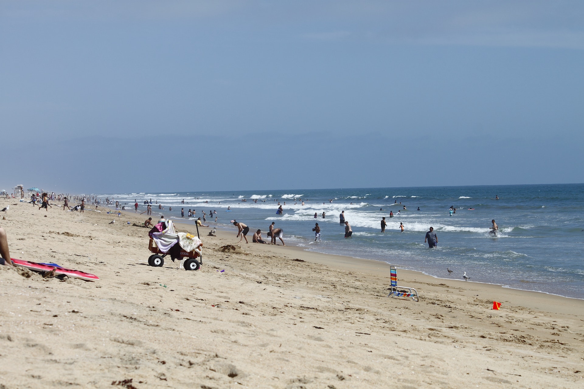